Chest opened
+${chestReward.xp} XP
Explorer
NOUVEAU ×${chestReward.collectible.quantity}
tapez pour fermer
Chest locked

Open chests in the app

Around Us is built for your phone — chests unlock when you walk, explore and capture nearby places.

Enable Location

We need your location to show you interesting places around you

Discover nearby places

Find interesting locations and hidden gems around you

Precise directions

Get accurate directions and distances to places

Your location is never shared with other users. It's only used when you tap the location button.

Log in to your account

Start exploring — it's free

Trusted by 72,894 travelers worldwide

Continue with Google
Continue with Apple
or

We will send you a code to connect

By continuing, you accept our Terms and Conditions and our Privacy Policy

Check your inbox

We've sent a pincode in your inbox. Please enter the code below.

Fields Point
Discussion Reviews Photo
2.1k Popularity

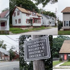
Fields Point, Peninsula in Providence, United States

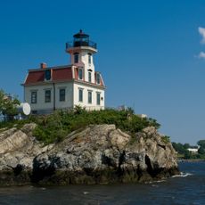
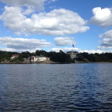
Fields Point is a peninsula in Providence that juts into Narragansett Bay at the convergence of the Providence and Seekonk Rivers. The location forms a natural deep-water harbor with clear shipping channels suitable for commercial vessels.

The area served as a strategic military position during World War II with gun emplacements and fortifications protecting Providence Harbor. These defensive structures were part of broader coastal defenses that guarded against potential naval threats during the war.

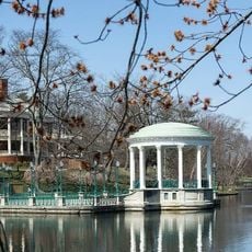
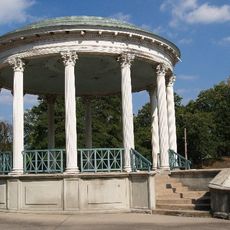
Fields Point attracts numerous visitors who explore the walking paths along the waterfront and observe maritime activities in Providence Harbor.

The location offers direct access to boat launches, fishing spots, and multiple walking trails that connect different waterfront sections. Visitors should note that the area can be windy and trail accessibility varies depending on weather conditions.

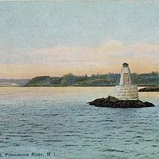
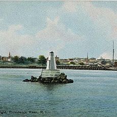
The point contains specialized navigational markers that guide vessels through the shipping channel toward Providence's commercial terminals. These markers are essential for maintaining safety in this busy harbor.

The community of curious travelers

AroundUs brings together thousands of curated places, local tips, and hidden gems, enriched daily by 60,000 contributors worldwide.

Start exploring
GPS coordinates
41.78785,-71.38293
Latest update
December 13, 2025 17:02
Around this place
Roger Williams Park Zoo
United States of America

Roger Williams Park Zoo

2.8 km
Roger Williams Park
United States of America

Roger Williams Park

2.4 km
Pawtuxet Village
United States of America

Pawtuxet Village

2.8 km
Pomham Rocks Light
United States of America

Pomham Rocks Light

1.6 km
Roger Williams Park Museum of Natural History and Planetarium
United States of America

Roger Williams Park Museum of Natural History and Planetarium

2.5 km
Edgewood Yacht Club
United States of America

Edgewood Yacht Club

1.5 km
The Zoo In Forest Park
United States of America

The Zoo In Forest Park

2.8 km
Squantum Association
United States of America

Squantum Association

809 m
Roger Williams Park Botanical Center
United States of America

Roger Williams Park Botanical Center

2.1 km
Rhodes-on-the Pawtuxet
United States of America

Rhodes-on-the Pawtuxet

2.4 km
James Dennis House
United States of America

James Dennis House

1.5 km
Rosedale Apartments
United States of America

Rosedale Apartments

1 km
Return Sludge Pumping Station, Fields Point Sewage Treatment Plant
United States of America

Return Sludge Pumping Station, Fields Point Sewage Treatment Plant

860 m
Roger Williams Botanical Center
United States of America

Roger Williams Botanical Center

2.1 km
Bicknell-Armington Lightning Splitter House
United States of America

Bicknell-Armington Lightning Splitter House

2.1 km
Phillipsdale Historic District
United States of America

Phillipsdale Historic District

2.8 km
Edgewood Historic District-Shaw Plat
United States of America

Edgewood Historic District-Shaw Plat

1.7 km
Fuller Rock Light
United States of America

Fuller Rock Light

745 m
Sassafras Point Light
United States of America

Sassafras Point Light

1.6 km
Chemical Building, Fields Point Sewage Treatment Plant
United States of America

Chemical Building, Fields Point Sewage Treatment Plant

969 m
Washington Park Sewage Pumping Station
United States of America

Washington Park Sewage Pumping Station

707 m
Whitcomb Farm
United States of America

Whitcomb Farm

2.1 km
Edgewood Historic District-Sally Greene Homestead Plats
United States of America

Edgewood Historic District-Sally Greene Homestead Plats

1.9 km
Edgewood Historic District–Anstis Greene Estate Plats
United States of America

Edgewood Historic District–Anstis Greene Estate Plats

1.8 km
Edgewood Historic District-Arnold Farm Plat
United States of America

Edgewood Historic District-Arnold Farm Plat

1.6 km
Ernest Street Sewage Pumping Station
United States of America

Ernest Street Sewage Pumping Station

1.5 km
Plymouth Congregational Church
United States of America

Plymouth Congregational Church

2.7 km
Edgewood Historic District-Aberdeen Plat
United States of America

Edgewood Historic District-Aberdeen Plat

2.1 km
Show the full map
Reviews
Share your experience

No review yet

Discussions
Start a discussion...

No discussion yet

« Fields Point - Peninsula in Providence, United States » is provided by Around Us (aroundus.com). Images and texts are derived from Wikimedia project under a Creative Commons license. You are allowed to copy, distribute, and modify copies of this page, under the conditions set by the license, as long as this note is clearly visible.

Discover hidden gems everywhere you go!

From secret cafés to breathtaking viewpoints, skip the crowded tourist spots and find places that match your style. Our app makes it easy with voice search, smart filtering, route optimization, and insider tips from travelers worldwide. Download now for the complete mobile experience.

Around Us App Screenshot

A unique approach to discovering new places

Le Figaro

All the places worth exploring

France Info

A tailor-made excursion in just a few clicks

20 Minutes

Around Us
Travel Guide & Maps
Download

Send to your phone

QR Code
1

Open the camera app on your mobile.

2

Point at the QR code with your camera. A notification will appear.

3

Tap the notification to open the link.