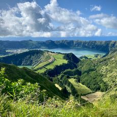
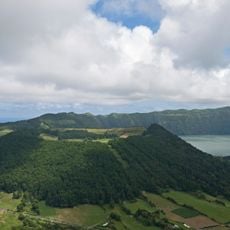
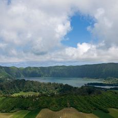
Santiago Lake, Volcanic crater lake in São Miguel Island, Portugal.
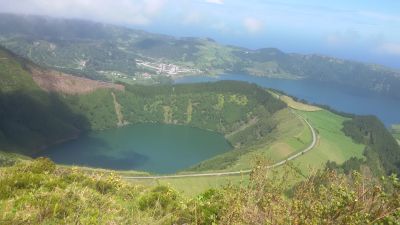
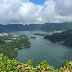
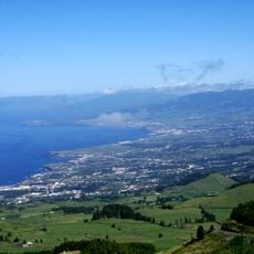
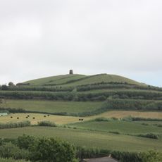
Santiago Lake is a volcanic crater lake on São Miguel Island that fills an oval basin roughly 3 kilometers long and 2.5 kilometers wide at an elevation of 334 meters. Steep crater walls surround the water, creating a natural boundary that gives the lake its distinctive shape.
The lake formed through volcanic eruptions roughly 15,000 years ago, fundamentally shaping the current landscape of São Miguel. This geological history explains why the island contains multiple craters and water basins.
The lake holds meaning for local people, who have passed down stories about its waters across generations. This connection to tradition makes it an important part of how residents understand their island.
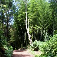
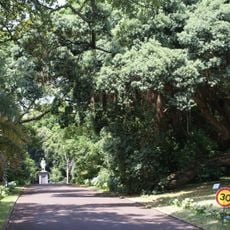
The lake is reachable via marked hiking trails that lead to multiple viewing spots with different perspectives on the water. Morning visits tend to offer clearer weather and less crowded pathways than later in the day.
The lake shore supports rare plant species like Azores juniper and buckthorn that grow only in this region. This vegetation makes the spot important for preserving local plant life, especially since southern slopes also supply water to nearby settlements.
Location: Azores
Elevation above the sea: 334 m
Address: Santiago Lake, 9555, Portugal
GPS coordinates: 37.84833,-25.77361
Latest update: December 6, 2025 17:45
The Azores archipelago stretches about 1500 kilometers off the coast of Portugal in the Atlantic Ocean. The nine islands were born through volcanic activity, creating a land of unusual sights: craters turned into lakes, hot springs bubbling from the ground, caves formed naturally in the rocks, and...
Miradouro da Vista do Rei
2.1 km
Ponta da Ferraria
7 km
Boca do Inferno Viewpoint
1.1 km
Church of the Jesuit College
14.8 km
Conceição Palace
15 km
Santo António
6.3 km
Recreational Forest Reserve of Pinhal da Paz
13.6 km
Jardim José do Canto
14.4 km
Zona de Paisagem Protegida das Sete Cidades
1.1 km
Ponta da Ferraria Lighthouse
6.8 km
Santa Clara Lighthouse
14.9 km
Jewish cemetery of Ponta Delgada
14.8 km
Church of Nossa Senhora da Conceição
15 km
Monumento Natural Regional do Pico das Camarinhas e Ponta da Ferraria
6.8 km
Church of Santo António
6.3 km
Miradouro do Pico do Paul
3.4 km
Hotel Monte Palace
2.1 km
Batalha Golf Course
13.4 km
Caldeira do Alferes
3.1 km
Caldeira Seca
2.3 km
Solar dos Condes de Albuquerque, Rua do Contador, 2-10
14.9 km
Solar de São Joaquim, Rua São Joaquim, 12
14.4 km
Solar de Santa Catarina, Rua Direita de Santa Catarina
14.5 km
Moinho de vento do Pico do Cavalo
6.1 km
Prédio anexo à Igreja do Colégio, Largo do Colégio
14.8 km
Igreja e convento de Santo André
15 km
Solar Scholtze/Berquós, Rua José do Canto, 9
14.3 km
Prédio na Rua Dr. Guilherme Poças, 14
14.9 kmVisited this place? Tap the stars to rate it and share your experience / photos with the community! Try now! You can cancel it anytime.
Discover hidden gems everywhere you go!
From secret cafés to breathtaking viewpoints, skip the crowded tourist spots and find places that match your style. Our app makes it easy with voice search, smart filtering, route optimization, and insider tips from travelers worldwide. Download now for the complete mobile experience.
A unique approach to discovering new places❞
— Le Figaro
All the places worth exploring❞
— France Info
A tailor-made excursion in just a few clicks❞
— 20 Minutes