See the monuments around you in AROpen chests in the app
Around Us is built for your phone — point your camera at the streets and discover the monuments and places around you in augmented reality.Around Us is built for your phone — chests unlock when you walk, explore and capture nearby places.
Visiting Montana: National Parks, Historic Towns, and Glaciers
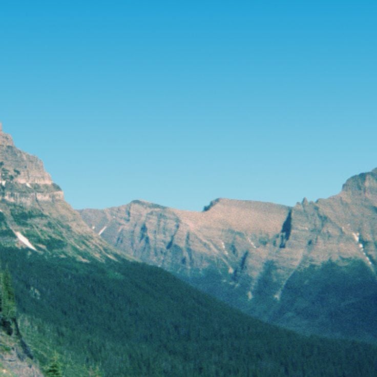
Montana offers a range of landscapes from the peaks of Glacier National Park to the central plains. The state has several mountain routes including the Going-to-the-Sun Road and the Beartooth Highway, both exceeding 3,000 meters in elevation. Glacial lakes such as Flathead Lake and Lake McDonald stretch over miles, with geological formations revealing millions of years of natural history. The Museum of the Rockies in Bozeman holds significant dinosaur fossil collections.
Montana's mining history is evident in the streets of Virginia City, a former territorial capital founded in 1863, where over 200 buildings from the 19th century are preserved. The Little Bighorn Battlefield commemorates the 1876 conflicts between the U.S. Army and Native American nations. To observe local wildlife, the Grizzly and Wolf Discovery Center houses bears and wolves in protected habitats. Hikers can take the 18-kilometer Highline Trail along the continental divide or walk to the Grinnell Glacier through alpine lakes in Glacier National Park.
Visiting Montana: National Parks, Historic Towns, and Glaciers
Montana offers a range of landscapes from the peaks of Glacier National Park to the central plains. The state has several mountain routes including the Going-to-the-Sun Road and the Beartooth Highway, both exceeding 3,000 meters in elevation. Glacial lakes such as Flathead Lake and Lake McDonald stretch over miles, with geological formations revealing millions of years of natural history. The Museum of the Rockies in Bozeman holds significant dinosaur fossil collections.
Montana's mining history is evident in the streets of Virginia City, a former territorial capital founded in 1863, where over 200 buildings from the 19th century are preserved. The Little Bighorn Battlefield commemorates the 1876 conflicts between the U.S. Army and Native American nations. To observe local wildlife, the Grizzly and Wolf Discovery Center houses bears and wolves in protected habitats. Hikers can take the 18-kilometer Highline Trail along the continental divide or walk to the Grinnell Glacier through alpine lakes in Glacier National Park.
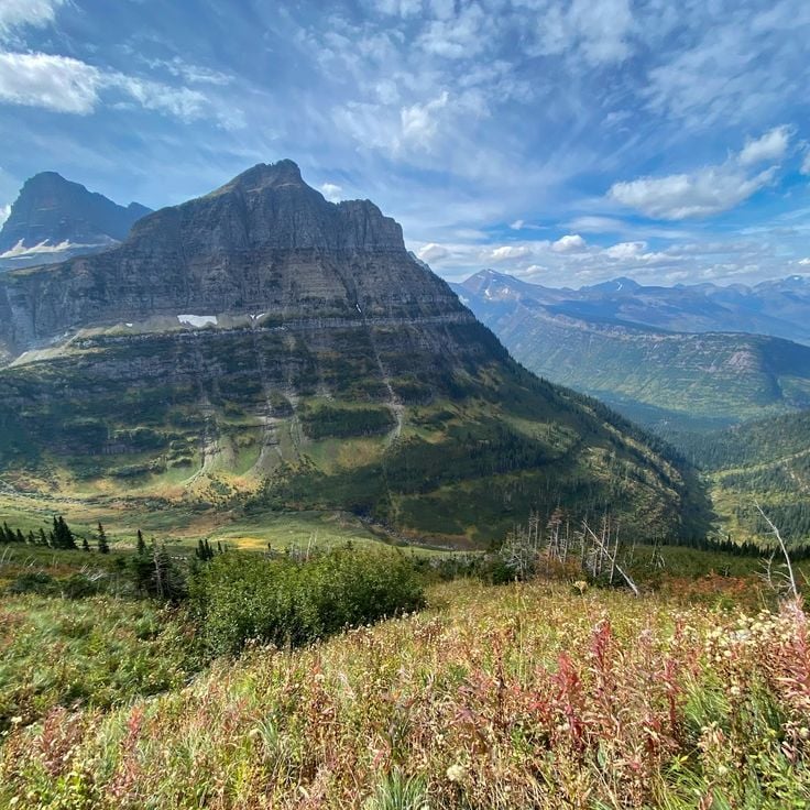
The Highline Trail extends for 18 kilometers along the Continental Divide in Glacier National Park. This hiking route begins at Logan Pass at 2,025 meters elevation and traverses alpine meadows to Granite Park Chalet. The path runs partly along steep rock walls and provides views of the surrounding mountain peaks and glaciers of the park.
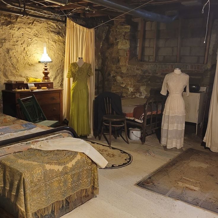
Virginia City served as the capital of the Montana Territory and was founded in 1863 during the gold rush. This historic town preserves more than 200 buildings from the 19th century in their original condition, documenting the era of gold mining in the American West.
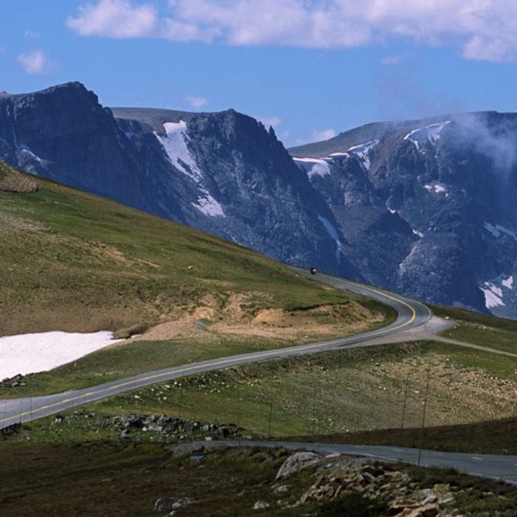
The Beartooth Highway is a 110-kilometer high-altitude road that climbs to 3,337 meters, connecting Red Lodge in Montana to the entrance of Yellowstone National Park in Wyoming. This road crosses the Beartooth Mountains and provides access to alpine landscapes with mountain lakes and high plateaus. The route is open from late May to mid-October, depending on snow conditions.
Little Bighorn Battlefield is a national battlefield that preserves the site of the 1876 battle between the U.S. Army under General George Custer and the Lakota, Cheyenne, and Arapaho tribes. The site features several monuments honoring fallen soldiers and warriors, along with a military cemetery. The visitor center provides exhibits about the history of the conflict and the perspectives of the tribes involved.
The Grizzly and Wolf Discovery Center provides refuge for grizzly bears and wolves that cannot return to the wild due to injury, orphaning, or conflicts with humans. The facility allows visitors to observe these animals in natural enclosures and operates educational programs focused on wildlife conservation and understanding bear and wolf behavior.
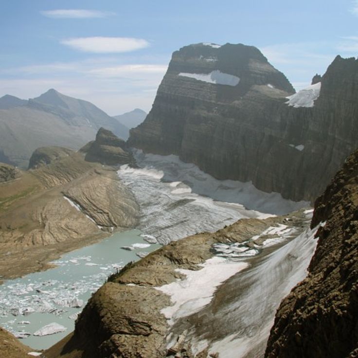
Grinnell Glacier is located in Glacier National Park and can be reached after an 11-kilometer hike. The trail passes three mountain lakes and provides access to this ice formation, which has retreated significantly over recent decades.
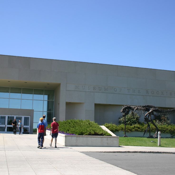
The Museum of the Rockies holds the largest collection of dinosaur fossils in North America and presents exhibitions on Montana regional history. The facility is affiliated with Montana State University and documents paleontological research and the development of the Rocky Mountains. The collection includes Tyrannosaurus Rex and Triceratops skeletons, along with geological and archaeological findings from the northwestern United States.
The Going-to-the-Sun Road is an 80-kilometer mountain highway that crosses Glacier National Park from west to east. This road traverses alpine landscapes and crosses the Continental Divide at Logan Pass at an elevation of 2,026 meters. Along the route, numerous mountain peaks, waterfalls, and valleys can be observed. The road is typically open from June to October.
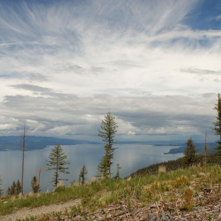
Flathead Lake covers 510 square kilometers and was formed by glacial activity during the last ice age. Located in northwestern Montana, the lake reaches a maximum depth of 113 meters. Its waters support various fish species and allow activities such as fishing, boating, and swimming during summer months.
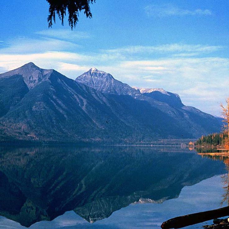
Lake McDonald is the largest lake in Glacier National Park, extending over 16 kilometers in length. This lake sits nestled between mountains and is surrounded by extensive conifer forests that line its shores.
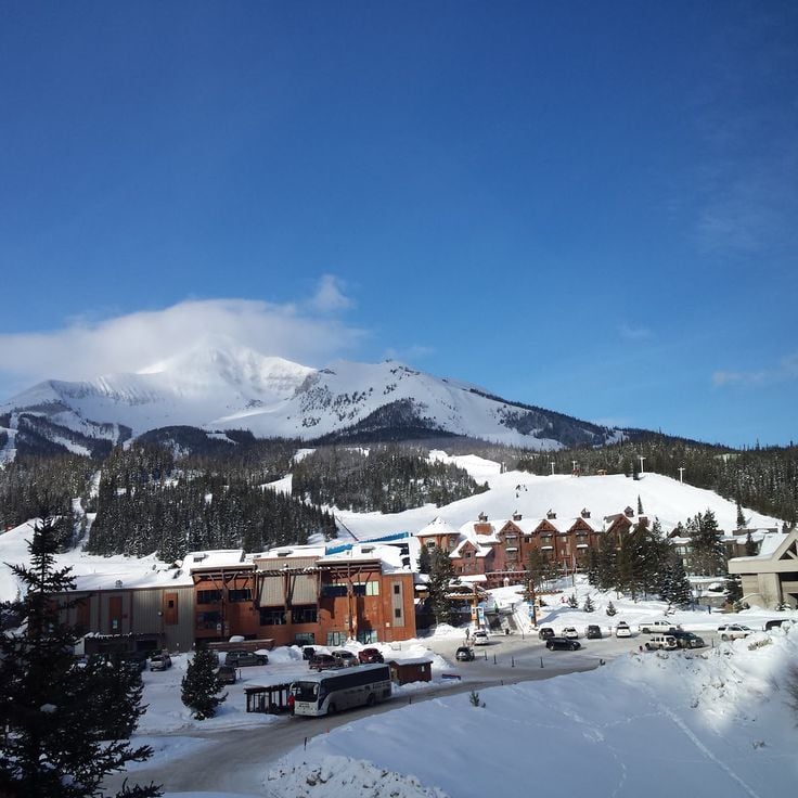
Big Sky Resort is a winter sports center that features 39 ski lifts and 250 trails. The ski area extends over 2300 hectares and reaches an elevation of 3400 meters at Lone Peak.
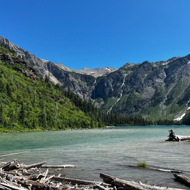
Avalanche Lake sits within Glacier National Park, surrounded by 600-meter high cliff walls. This mountain lake is located at the end of a 4.5-kilometer hiking trail through dense forest and offers views of several waterfalls fed by surrounding glaciers.
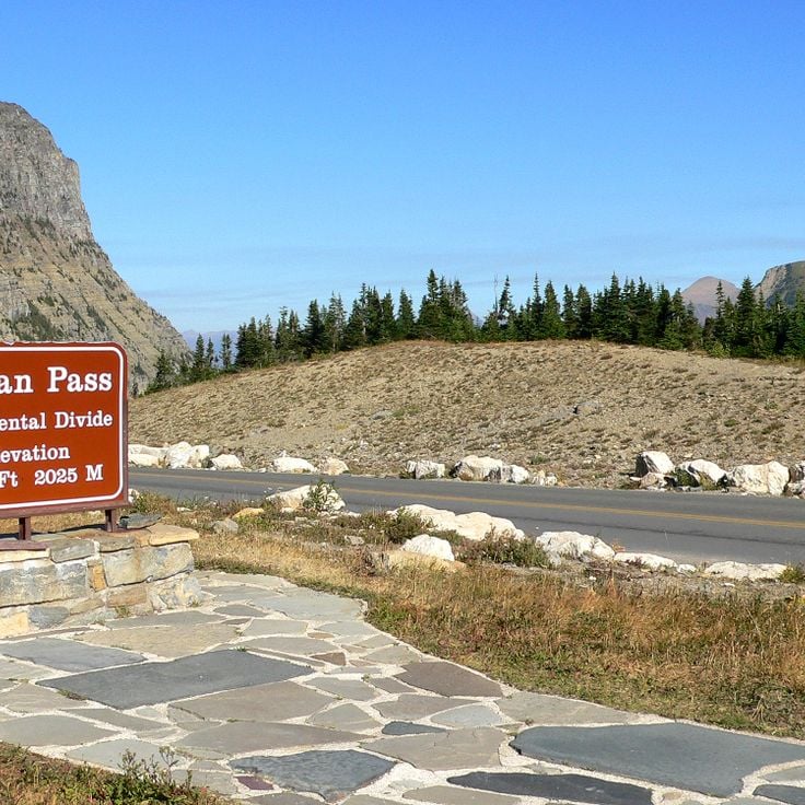
Logan Pass marks the highest point of the Going-to-the-Sun Road at 2026 meters in altitude. This pass features a visitor center and serves as the starting point for trails leading to Hidden Lake and Granite Park.
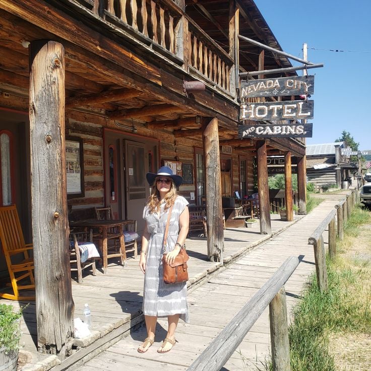
Nevada City is a restored village from the gold rush era, comprising over 100 historical buildings and structures from the 19th century. The open-air museum displays original buildings gathered from abandoned mining settlements across the region, along with a collection of tools, furniture, and everyday objects from this period. Visitors can walk through the authentic streetscapes and participate in historical demonstrations that recreate the lives of gold seekers and pioneers.
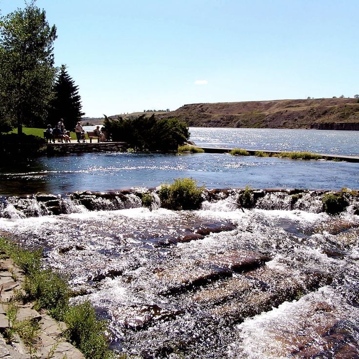
Giant Springs State Park protects one of the largest freshwater springs in the United States, releasing 570 million liters of consistently cool water daily. This spring was documented by the Lewis and Clark expedition in 1805 and today forms the centerpiece of a park offering visitors trails along the Missouri River and a fish hatchery visitor center.
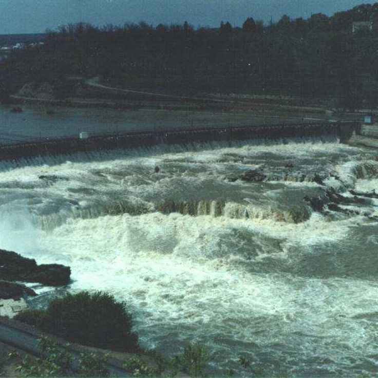
These waterfalls on the Missouri River reach a height of 30 meters and form a significant point along the river's course. Great Falls includes a hydroelectric dam used for power generation, as well as several hiking trails that run along the riverbanks and provide access to various viewpoints. The area documents the historical importance of hydropower in Montana.
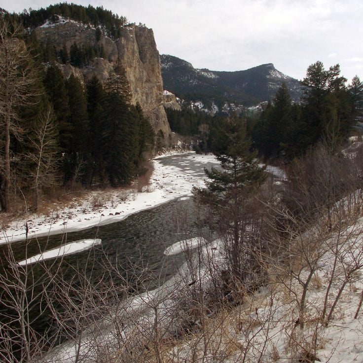
The Gallatin River is a mountain river 125 kilometers long, tributary of the Missouri River. This river flows through southwestern Montana and provides opportunities for trout fishing as well as whitewater activities including rafting and kayaking.
The Butte Historic District contains approximately 4000 buildings from the 19th century shaped by mining activity. This district documents the history of copper extraction in Montana and ranks among the largest contiguous historic mining areas in the United States. The architecture reflects the industrial development of the region.
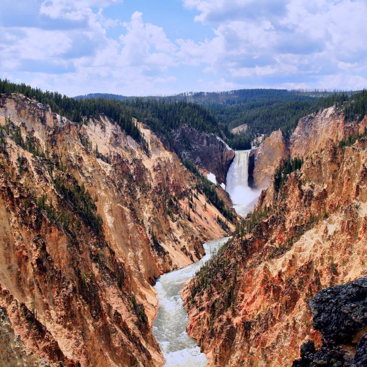
Yellowstone National Park was established in 1872 as the first national park in the United States. The area spans three states and contains over 500 active geysers, including the famous Old Faithful. Besides geothermal features, the park hosts numerous hot springs, mud pots, and several natural waterfalls, including the Lower Falls of the Yellowstone River.
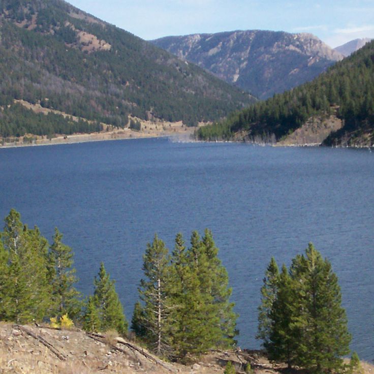
Quake Lake is a 10-kilometer body of water formed by a landslide during the earthquake of August 17, 1959. The seismic event triggered a massive rockslide that blocked the Madison River, creating this new lake. Numerous tree trunks that were submerged during the disaster still protrude from the surface, bearing witness to the force of the event.
Ringing Rocks consists of granite boulders that produce metallic sounds when struck with a hammer. This formation features densely packed rocks of various sizes spread across approximately 5 hectares in southern Montana.
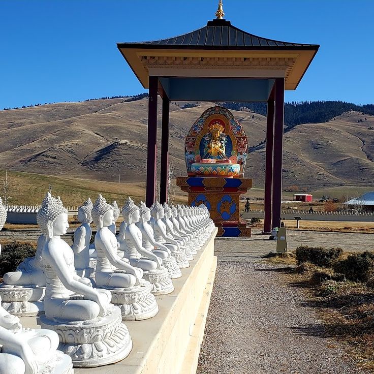
The Garden of One Thousand Buddhas is a Buddhist center covering 4 hectares, established in 2000. This site displays one thousand white Buddha statues arranged in the geometric pattern of the dharma wheel, creating a space dedicated to meditation and spiritual practice.
Castle Ghost Town is an abandoned mining settlement established in 1887 in the Castle Mountains. The remains of this silver mining town include stone foundations and walls of former stores, miner residences, and public buildings that document the late 19th-century mining boom in the region.
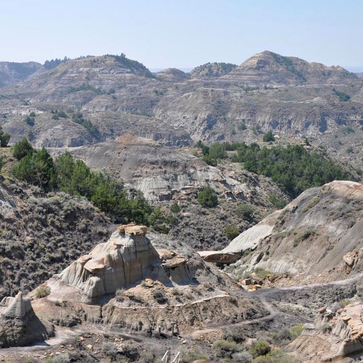
Makoshika State Park covers 4700 hectares of eroded landscapes with sandstone formations in various shades of red. The area contains numerous fossils from the Cretaceous period, including remains of Tyrannosaurus Rex and Triceratops. Several hiking trails cross the park and allow exploration of the geological formations and excavation sites.
Havre Underground consists of a network of tunnels and underground rooms created in 1904 beneath the city. These passageways served as shops and establishments, including barber shops, pharmacies, and smoking parlors. The tunnels allowed residents to move between buildings during winter without using the streets.
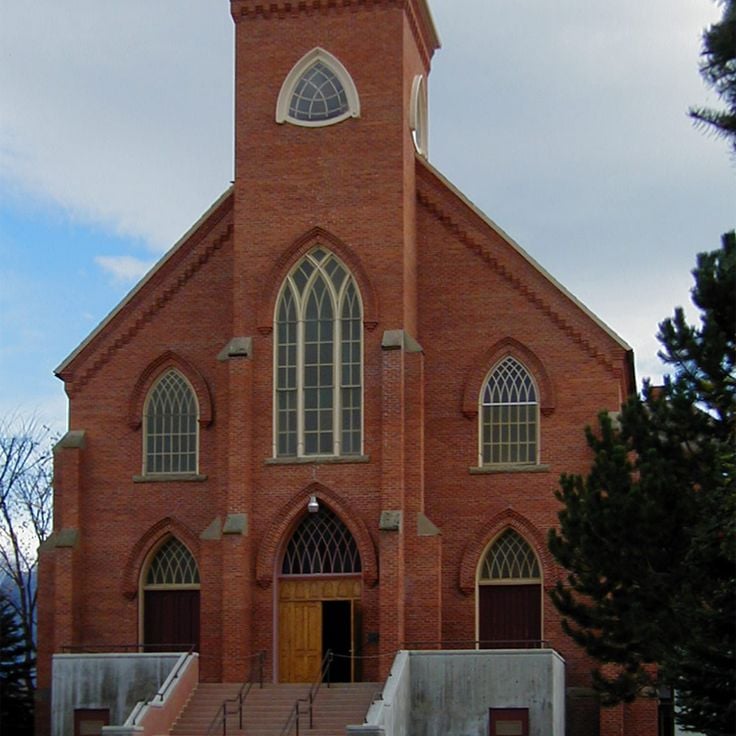
Mission St. Ignatius is a Catholic church built in 1891 by Jesuits working alongside the Salish people. The interior walls of this church display 58 religious paintings created by a Jesuit brother, depicting biblical scenes and Christian themes throughout the sanctuary.
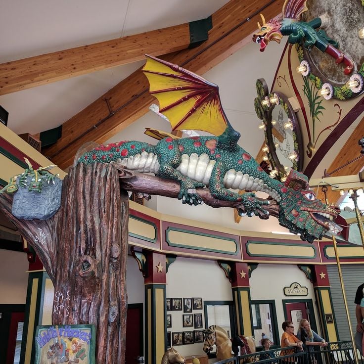
The Carousel for Missoula was handcrafted in 1995 by the town's residents and features 38 carved wooden horses in various colors. Each horse was designed by local artists and volunteers, displaying detailed carving work. The carousel is located in Caras Park along the Clark Fork River and operates as a functioning historic ride for visitors of all ages.
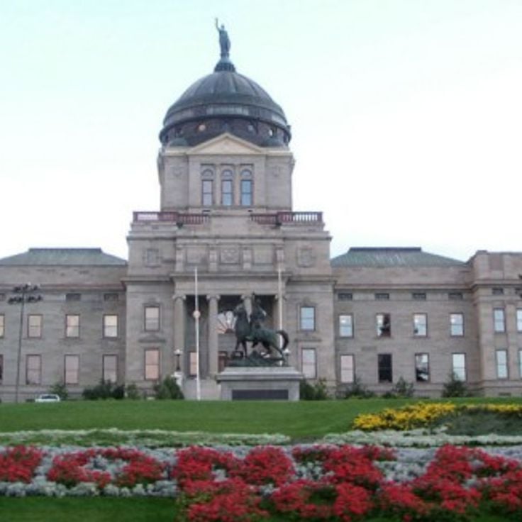
The Montana State Capitol serves as the seat of government for the state of Montana and was completed in 1902. The building features a copper dome and houses historical frescoes inside that depict scenes from Montana's history.
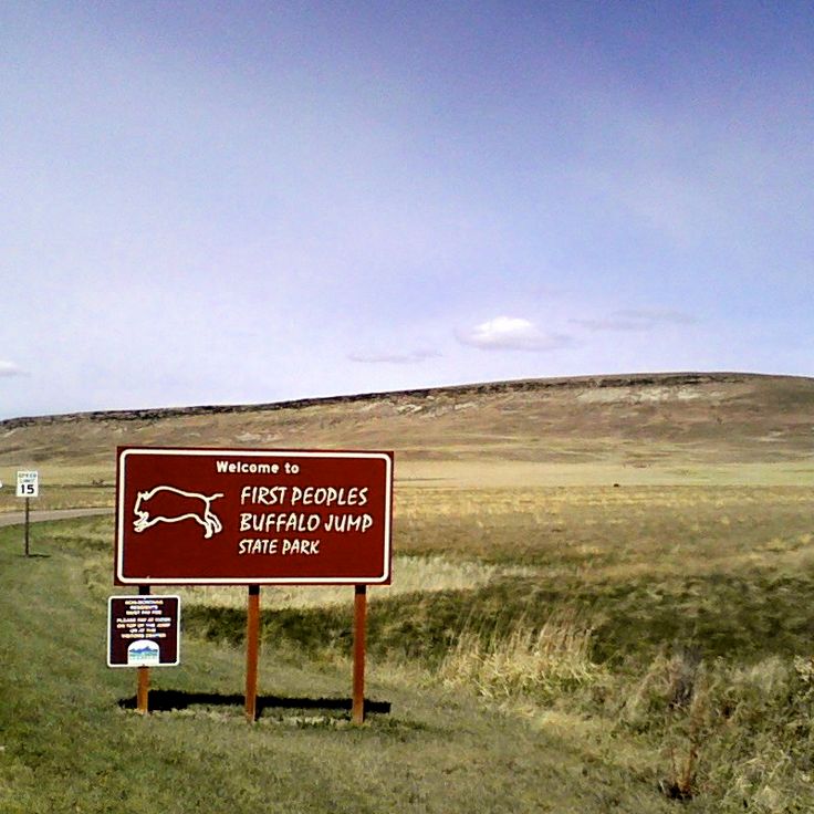
The First Peoples Buffalo Jump State Park preserves a cliff used by indigenous peoples of the Great Plains for over a thousand years to hunt bison. This technique involved driving bison herds toward the cliff edge, where they would fall. The site includes an interpretive center that documents the hunting methods, tribal life, and archaeological discoveries made at this historic location.
Lewis & Clark Caverns State Park protects an extensive underground network of limestone caves featuring numerous stalactites, stalagmites, and other mineral formations. These caverns were discovered by settlers in 1892 and named in honor of the famous 1805 expedition. Guided tours allow visitors to explore the various chambers and geological formations that developed over thousands of years.
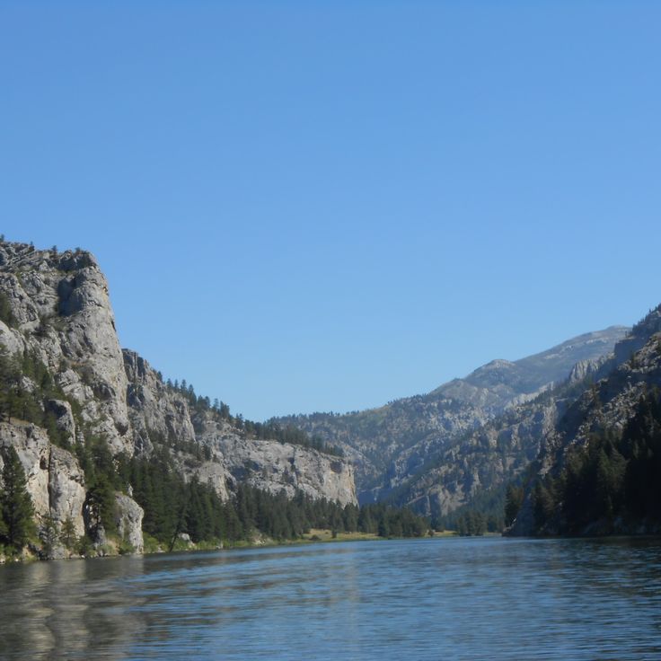
Gates of the Mountains is a natural gorge on the Missouri River, where limestone walls rise up to 360 meters high. Meriwether Lewis named this formation in 1805 during the expedition with William Clark, as the group navigated through the narrow passage. The gorge extends for several kilometers and displays geological layers that are several hundred million years old.
The World Museum of Mining occupies the former Orphan Girl Mine site and features over 50 historical buildings that recreate life and work in an early 20th-century mining town. Visitors can tour underground mine shafts, examine original mining machinery and tools, and walk through residential homes, shops, and public buildings from Butte's copper mining heyday.
The Highline Trail extends for 18 kilometers along the Continental Divide in Glacier National Park. This hiking route begins at Logan Pass at 2,025 meters elevation and traverses alpine meadows to Granite Park Chalet. The path runs partly along steep rock walls and provides views of the surrounding mountain peaks and glaciers of the park.
Virginia City served as the capital of the Montana Territory and was founded in 1863 during the gold rush. This historic town preserves more than 200 buildings from the 19th century in their original condition, documenting the era of gold mining in the American West.
The Beartooth Highway is a 110-kilometer high-altitude road that climbs to 3,337 meters, connecting Red Lodge in Montana to the entrance of Yellowstone National Park in Wyoming. This road crosses the Beartooth Mountains and provides access to alpine landscapes with mountain lakes and high plateaus. The route is open from late May to mid-October, depending on snow conditions.
Little Bighorn Battlefield is a national battlefield that preserves the site of the 1876 battle between the U.S. Army under General George Custer and the Lakota, Cheyenne, and Arapaho tribes. The site features several monuments honoring fallen soldiers and warriors, along with a military cemetery. The visitor center provides exhibits about the history of the conflict and the perspectives of the tribes involved.
The Grizzly and Wolf Discovery Center provides refuge for grizzly bears and wolves that cannot return to the wild due to injury, orphaning, or conflicts with humans. The facility allows visitors to observe these animals in natural enclosures and operates educational programs focused on wildlife conservation and understanding bear and wolf behavior.
Grinnell Glacier is located in Glacier National Park and can be reached after an 11-kilometer hike. The trail passes three mountain lakes and provides access to this ice formation, which has retreated significantly over recent decades.
The Museum of the Rockies holds the largest collection of dinosaur fossils in North America and presents exhibitions on Montana regional history. The facility is affiliated with Montana State University and documents paleontological research and the development of the Rocky Mountains. The collection includes Tyrannosaurus Rex and Triceratops skeletons, along with geological and archaeological findings from the northwestern United States.
The Going-to-the-Sun Road is an 80-kilometer mountain highway that crosses Glacier National Park from west to east. This road traverses alpine landscapes and crosses the Continental Divide at Logan Pass at an elevation of 2,026 meters. Along the route, numerous mountain peaks, waterfalls, and valleys can be observed. The road is typically open from June to October.
Flathead Lake covers 510 square kilometers and was formed by glacial activity during the last ice age. Located in northwestern Montana, the lake reaches a maximum depth of 113 meters. Its waters support various fish species and allow activities such as fishing, boating, and swimming during summer months.
Lake McDonald is the largest lake in Glacier National Park, extending over 16 kilometers in length. This lake sits nestled between mountains and is surrounded by extensive conifer forests that line its shores.
Big Sky Resort is a winter sports center that features 39 ski lifts and 250 trails. The ski area extends over 2300 hectares and reaches an elevation of 3400 meters at Lone Peak.
Avalanche Lake sits within Glacier National Park, surrounded by 600-meter high cliff walls. This mountain lake is located at the end of a 4.5-kilometer hiking trail through dense forest and offers views of several waterfalls fed by surrounding glaciers.
Logan Pass marks the highest point of the Going-to-the-Sun Road at 2026 meters in altitude. This pass features a visitor center and serves as the starting point for trails leading to Hidden Lake and Granite Park.
Nevada City is a restored village from the gold rush era, comprising over 100 historical buildings and structures from the 19th century. The open-air museum displays original buildings gathered from abandoned mining settlements across the region, along with a collection of tools, furniture, and everyday objects from this period. Visitors can walk through the authentic streetscapes and participate in historical demonstrations that recreate the lives of gold seekers and pioneers.
Giant Springs State Park protects one of the largest freshwater springs in the United States, releasing 570 million liters of consistently cool water daily. This spring was documented by the Lewis and Clark expedition in 1805 and today forms the centerpiece of a park offering visitors trails along the Missouri River and a fish hatchery visitor center.
These waterfalls on the Missouri River reach a height of 30 meters and form a significant point along the river's course. Great Falls includes a hydroelectric dam used for power generation, as well as several hiking trails that run along the riverbanks and provide access to various viewpoints. The area documents the historical importance of hydropower in Montana.
The Gallatin River is a mountain river 125 kilometers long, tributary of the Missouri River. This river flows through southwestern Montana and provides opportunities for trout fishing as well as whitewater activities including rafting and kayaking.
The Butte Historic District contains approximately 4000 buildings from the 19th century shaped by mining activity. This district documents the history of copper extraction in Montana and ranks among the largest contiguous historic mining areas in the United States. The architecture reflects the industrial development of the region.
Yellowstone National Park was established in 1872 as the first national park in the United States. The area spans three states and contains over 500 active geysers, including the famous Old Faithful. Besides geothermal features, the park hosts numerous hot springs, mud pots, and several natural waterfalls, including the Lower Falls of the Yellowstone River.
Quake Lake is a 10-kilometer body of water formed by a landslide during the earthquake of August 17, 1959. The seismic event triggered a massive rockslide that blocked the Madison River, creating this new lake. Numerous tree trunks that were submerged during the disaster still protrude from the surface, bearing witness to the force of the event.
Ringing Rocks consists of granite boulders that produce metallic sounds when struck with a hammer. This formation features densely packed rocks of various sizes spread across approximately 5 hectares in southern Montana.
The Garden of One Thousand Buddhas is a Buddhist center covering 4 hectares, established in 2000. This site displays one thousand white Buddha statues arranged in the geometric pattern of the dharma wheel, creating a space dedicated to meditation and spiritual practice.
Castle Ghost Town is an abandoned mining settlement established in 1887 in the Castle Mountains. The remains of this silver mining town include stone foundations and walls of former stores, miner residences, and public buildings that document the late 19th-century mining boom in the region.
Makoshika State Park covers 4700 hectares of eroded landscapes with sandstone formations in various shades of red. The area contains numerous fossils from the Cretaceous period, including remains of Tyrannosaurus Rex and Triceratops. Several hiking trails cross the park and allow exploration of the geological formations and excavation sites.
Havre Underground consists of a network of tunnels and underground rooms created in 1904 beneath the city. These passageways served as shops and establishments, including barber shops, pharmacies, and smoking parlors. The tunnels allowed residents to move between buildings during winter without using the streets.
Mission St. Ignatius is a Catholic church built in 1891 by Jesuits working alongside the Salish people. The interior walls of this church display 58 religious paintings created by a Jesuit brother, depicting biblical scenes and Christian themes throughout the sanctuary.
The Carousel for Missoula was handcrafted in 1995 by the town's residents and features 38 carved wooden horses in various colors. Each horse was designed by local artists and volunteers, displaying detailed carving work. The carousel is located in Caras Park along the Clark Fork River and operates as a functioning historic ride for visitors of all ages.
The Montana State Capitol serves as the seat of government for the state of Montana and was completed in 1902. The building features a copper dome and houses historical frescoes inside that depict scenes from Montana's history.
The First Peoples Buffalo Jump State Park preserves a cliff used by indigenous peoples of the Great Plains for over a thousand years to hunt bison. This technique involved driving bison herds toward the cliff edge, where they would fall. The site includes an interpretive center that documents the hunting methods, tribal life, and archaeological discoveries made at this historic location.
Lewis & Clark Caverns State Park protects an extensive underground network of limestone caves featuring numerous stalactites, stalagmites, and other mineral formations. These caverns were discovered by settlers in 1892 and named in honor of the famous 1805 expedition. Guided tours allow visitors to explore the various chambers and geological formations that developed over thousands of years.
Gates of the Mountains is a natural gorge on the Missouri River, where limestone walls rise up to 360 meters high. Meriwether Lewis named this formation in 1805 during the expedition with William Clark, as the group navigated through the narrow passage. The gorge extends for several kilometers and displays geological layers that are several hundred million years old.
The World Museum of Mining occupies the former Orphan Girl Mine site and features over 50 historical buildings that recreate life and work in an early 20th-century mining town. Visitors can tour underground mine shafts, examine original mining machinery and tools, and walk through residential homes, shops, and public buildings from Butte's copper mining heyday.