Ringing Rocks

Log in to your account

AroundUs is a community-driven map of interesting places, built by curious explorers like you. It grows with every review, story, and photo you share.
Connect to save your favorite spots, contribute locations, and create personalized routes.
Continue with Google
Continue with Apple
Continue with X
Continue with Facebook
Continue with email
By continuing, you accept our Terms and Conditions and our Privacy Policy
Create an account
Add to collection
Map
Suggest a change
Share

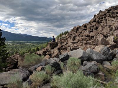
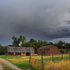
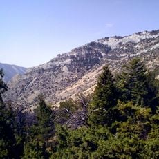
Ringing Rocks, Geological formation near Butte, Montana, US

Ringing Rocks is a boulder field near Butte, Montana, composed of numerous stones scattered across a mountainous area. The boulders vary in size and create a natural, scattered arrangement across the terrain.

The boulders formed approximately 200 million years ago during the early Jurassic Period when diabase sills emerged in the region. These geological processes created the conditions for the stones to produce sound today.

The boulders are known locally as singing stones and draw visitors who want to hear their musical sounds firsthand. People strike them with hammers to experience the range of tones that emerge from the rocky ground.

A high-clearance vehicle is needed to travel the gravel road from Interstate 90 to reach the site. Visitors should bring a hammer to strike the rocks and experience their sounds firsthand.

Each stone produces a distinct musical note when struck, but this sound disappears if the boulder is moved from its original location. This phenomenon remains partially unexplained and fascinates both visitors and researchers.

Location: Whitehall

Address: Whitehall, MT 59759, USA

Phone: +14065337600

Website: https://visitmt.com/listings/general/landmark/ringing-rocks-point-of-interest

GPS coordinates: 45.94384,-112.23898

Latest update: December 6, 2025 19:02

Photos
Visiting Montana: National Parks, Historic Towns, and Glaciers

Montana offers a range of landscapes from the peaks of Glacier National Park to the central plains. The state has several mountain routes including the Going-to-the-Sun Road and the Beartooth Highway, both exceeding 3,000 meters in elevation. Glacial lakes such as Flathead Lake and Lake McDonald...

Around this place
Our Lady of the Rockies
United States of America

Our Lady of the Rockies

17.2 km
Anaconda Smelter Stack
United States of America

Anaconda Smelter Stack

55.3 km
Dumas Brothel
United States of America

Dumas Brothel

24 km
Lewis and Clark Caverns
United States of America

Lewis and Clark Caverns

33 km
Missouri Headwaters State Park
United States of America

Missouri Headwaters State Park

57.4 km
Columbia Gardens
United States of America

Columbia Gardens

18.8 km
Mai Wah Museum
United States of America

Mai Wah Museum

23.9 km
Doncaster Round Barn
United States of America

Doncaster Round Barn

42 km
Butte-Anaconda Historic District
United States of America

Butte-Anaconda Historic District

28.6 km
Lewis & Clark Caverns State Park

Lewis & Clark Caverns State Park

31.6 km
Mount Jefferson
United States of America

Mount Jefferson

41.9 km
World Museum of Mining
United States of America

World Museum of Mining

26.3 km
Socialist Hall
United States of America

Socialist Hall

21.9 km
Ancient Order of Hibernians Hall
United States of America

Ancient Order of Hibernians Hall

58.6 km
Burton K. Wheeler House
United States of America

Burton K. Wheeler House

22.8 km
Anaconda City Hall
United States of America

Anaconda City Hall

58.5 km
Butte, Anaconda and Pacific Railway Historic District
United States of America

Butte, Anaconda and Pacific Railway Historic District

40.3 km
Fraternity Hall
United States of America

Fraternity Hall

43.3 km
Jefferson County Courthouse
United States of America

Jefferson County Courthouse

33.8 km
Adams Block
United States of America

Adams Block

53.5 km
Ferris-Hermsmeyer-Fenton Ranch
United States of America

Ferris-Hermsmeyer-Fenton Ranch

55 km
Lewis and Clark Caverns State Park
United States of America

Lewis and Clark Caverns State Park

31.6 km
Ling Rock - Ferry Crossing Headwaters State Park
United States of America

Ling Rock - Ferry Crossing Headwaters State Park

57.7 km
Star Theatre
United States of America

Star Theatre

13.6 km
Bleu Horses
United States of America

Bleu Horses

50 km
Ruby Theatre
United States of America

Ruby Theatre

53.6 km
Cave Visitor Center
United States of America

Cave Visitor Center

31.1 km
Lewis and Clark Caverns Historic District
United States of America

Lewis and Clark Caverns Historic District

31.1 km
Show the full map
Reviews

Visited this place? Tap the stars to rate it and share your experience / photos with the community! Try now! You can cancel it anytime.

« Ringing Rocks - Geological formation near Butte, Montana, US » is provided by Around Us (aroundus.com). Images and texts are derived from Wikimedia project under a Creative Commons license. You are allowed to copy, distribute, and modify copies of this page, under the conditions set by the license, as long as this note is clearly visible.

Discover hidden gems everywhere you go!

From secret cafés to breathtaking viewpoints, skip the crowded tourist spots and find places that match your style. Our app makes it easy with voice search, smart filtering, route optimization, and insider tips from travelers worldwide. Download now for the complete mobile experience.

Around Us App Screenshot

A unique approach to discovering new places

Le Figaro

All the places worth exploring

France Info

A tailor-made excursion in just a few clicks

20 Minutes