Enable Location

We need your location to show you interesting places around you

Discover nearby places

Find interesting locations and hidden gems around you

Precise directions

Get accurate directions and distances to places

Your location is never shared with other users. It's only used when you tap the location button.

Whitehall

Log in to your account

Start exploring — it's free

Trusted by 63,412 travelers worldwide

Continue with Google
Continue with Apple
or

We will send you a code to connect

By continuing, you accept our Terms and Conditions and our Privacy Policy

Check your inbox

We've sent a pincode in your inbox. Please enter the code below.

Discussion Reviews 1 Photos
17.4k Popularity

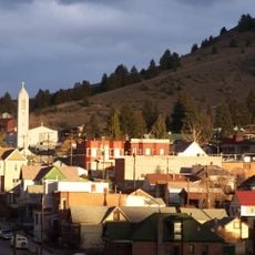
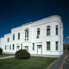
Whitehall, town in Jefferson County, Montana, United States

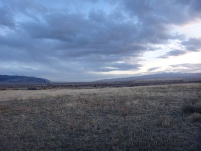
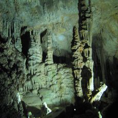
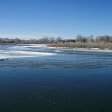
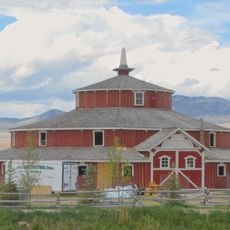
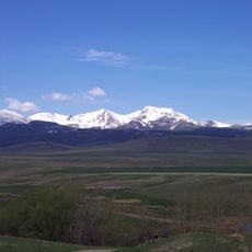
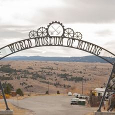
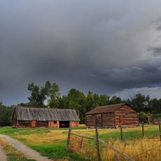
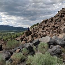
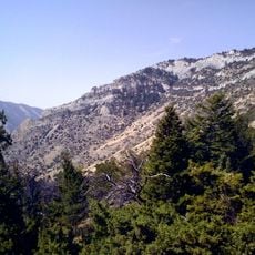
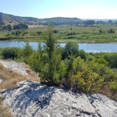
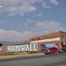
Whitehall is a small town in southwestern Montana situated along Interstate 90 and the Jefferson River. It sits among tall mountains and green forests, serving as a hub for exploring several major rivers including the Beaverhead, Big Hole, and Madison, as well as nearby Lewis and Clark Caverns and Delmoe Lake.

Native American tribes used the area around Whitehall as a stopping point during their travels between the plains and mountains. The Lewis and Clark Expedition passed near the area in the early 1800s, followed by fur traders who explored the waterways throughout the region.

The town's name may come from a place in Illinois or from a station on Whitehall Creek. Local murals throughout town depict the Lewis and Clark Expedition, connecting residents and visitors to the explorers' journey and the area's early American history.

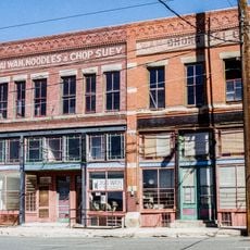
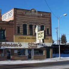
The town sits conveniently along Interstate 90, making it easy to reach by car. Visitors will find several accommodation options including motels, RV parks, and inns, as well as local shops and galleries selling handmade crafts and gifts.

A striking landmark in town is a tall smokestack left over from a failed sugar beet factory that began in 1917 but was never completed. The structure stands as a quiet reminder of the economic hopes and struggles that shaped the town's early growth.

The community of curious travelers

AroundUs brings together thousands of curated places, local tips, and hidden gems, enriched daily by 60,000 contributors worldwide.

Start exploring
Location
Elevation above the sea
1,329 m
GPS coordinates
45.87028,-112.09833
Latest update
February 17, 2026 00:40
Around this place
Our Lady of the Rockies
United States of America

Our Lady of the Rockies

30.6 km
Dumas Brothel
United States of America

Dumas Brothel

37.2 km
Lewis and Clark Caverns
United States of America

Lewis and Clark Caverns

19.9 km
Missouri Headwaters State Park
United States of America

Missouri Headwaters State Park

46.8 km
Columbia Gardens
United States of America

Columbia Gardens

32.1 km
Madison Buffalo Jump State Park
United States of America

Madison Buffalo Jump State Park

50 km
Mai Wah Museum
United States of America

Mai Wah Museum

36.9 km
Doncaster Round Barn
United States of America

Doncaster Round Barn

37.4 km
Butte-Anaconda Historic District
United States of America

Butte-Anaconda Historic District

41.4 km
Lewis & Clark Caverns State Park

Lewis & Clark Caverns State Park

18.7 km
Mount Jefferson
United States of America

Mount Jefferson

30.5 km
World Museum of Mining
United States of America

World Museum of Mining

39.3 km
Socialist Hall
United States of America

Socialist Hall

34.9 km
Burton K. Wheeler House
United States of America

Burton K. Wheeler House

36 km
St. Mary of the Assumption Church
United States of America

St. Mary of the Assumption Church

57.5 km
Butte, Anaconda and Pacific Railway Historic District
United States of America

Butte, Anaconda and Pacific Railway Historic District

53.3 km
Fraternity Hall
United States of America

Fraternity Hall

46.6 km
Jefferson County Courthouse
United States of America

Jefferson County Courthouse

40.7 km
Adams Block
United States of America

Adams Block

42.5 km
Ferris-Hermsmeyer-Fenton Ranch
United States of America

Ferris-Hermsmeyer-Fenton Ranch

48 km
Ringing Rocks
United States of America

Ringing Rocks

13.6 km
Lewis and Clark Caverns State Park
United States of America

Lewis and Clark Caverns State Park

18.7 km
Ling Rock - Ferry Crossing Headwaters State Park
United States of America

Ling Rock - Ferry Crossing Headwaters State Park

47.4 km
Star Theatre
United States of America

Star Theatre

57 m
Bleu Horses
United States of America

Bleu Horses

40.9 km
Ruby Theatre
United States of America

Ruby Theatre

42.3 km
Cave Visitor Center
United States of America

Cave Visitor Center

18.3 km
Lewis and Clark Caverns Historic District
United States of America

Lewis and Clark Caverns Historic District

18.3 km
Show the full map
Reviews
Share your experience

No review yet

Discussions
Start a discussion...

No discussion yet

« Whitehall - town in Jefferson County, Montana, United States » is provided by Around Us (aroundus.com). Images and texts are derived from Wikimedia project under a Creative Commons license. You are allowed to copy, distribute, and modify copies of this page, under the conditions set by the license, as long as this note is clearly visible.

Discover hidden gems everywhere you go!

From secret cafés to breathtaking viewpoints, skip the crowded tourist spots and find places that match your style. Our app makes it easy with voice search, smart filtering, route optimization, and insider tips from travelers worldwide. Download now for the complete mobile experience.

Around Us App Screenshot

A unique approach to discovering new places

Le Figaro

All the places worth exploring

France Info

A tailor-made excursion in just a few clicks

20 Minutes

Around Us
Travel Guide & Maps
Download

Send to your phone

QR Code
1

Open the camera app on your mobile.

2

Point at the QR code with your camera. A notification will appear.

3

Tap the notification to open the link.