The world's largest river flows through endless jungle, home to jaguars, anacondas, and thousands of fish species.
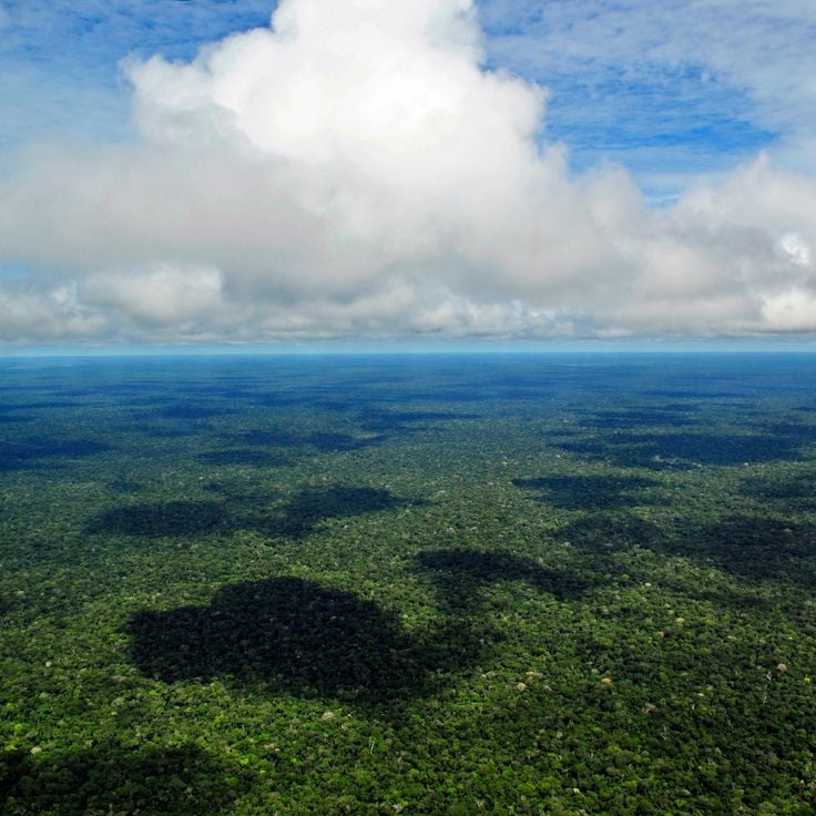
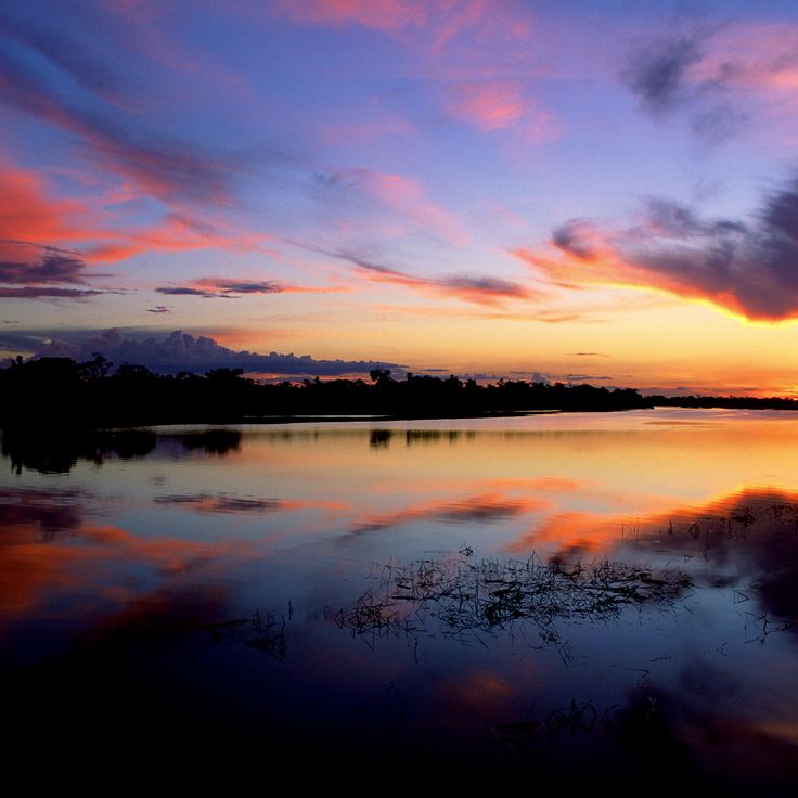
The Amazon River is the world's largest river and flows through the world's largest rainforest. Its waters and those of its many tributaries support an incredible range of life: river dolphins, thousands of fish species, jaguars, anacondas, and countless other animals. The forest itself is a dense green expanse where rain falls regularly and the air stays warm and humid. People have lived here for thousands of years, and ancient rock carvings along the riverbanks tell stories of their presence. The river passes through several South American countries and connects different landscapes: flooded forests where trees stand in water, broad islands with their own wildlife, and table mountains that rise like giant fortresses from the jungle. Visitors can watch pink river dolphins, hike through thick forest, and boat along the brown waters. Places like Manaus show where different river channels meet and change color. The Mamirauá Reserve protects one of the largest flooded forest areas. In the Pantepui region, table mountains rise steeply, appearing almost otherworldly.
The world's largest river flows through endless jungle, home to jaguars, anacondas, and thousands of fish species.
The Amazon River is the world's largest river and flows through the world's largest rainforest. Its waters and those of its many tributaries support an incredible range of life: river dolphins, thousands of fish species, jaguars, anacondas, and countless other animals. The forest itself is a dense green expanse where rain falls regularly and the air stays warm and humid. People have lived here for thousands of years, and ancient rock carvings along the riverbanks tell stories of their presence. The river passes through several South American countries and connects different landscapes: flooded forests where trees stand in water, broad islands with their own wildlife, and table mountains that rise like giant fortresses from the jungle. Visitors can watch pink river dolphins, hike through thick forest, and boat along the brown waters. Places like Manaus show where different river channels meet and change color. The Mamirauá Reserve protects one of the largest flooded forest areas. In the Pantepui region, table mountains rise steeply, appearing almost otherworldly.
The Amazon Rainforest covers a vast area across several South American countries and is the largest rainforest on Earth. River dolphins swim through its waters, while a huge range of animal and plant species live among the trees. Ancient rock carvings along the riverbanks record the presence of people who have made this place home for thousands of years. The forest shifts between flooded lowlands and tall table mountains, with each zone shaped by its own wildlife and plant life.
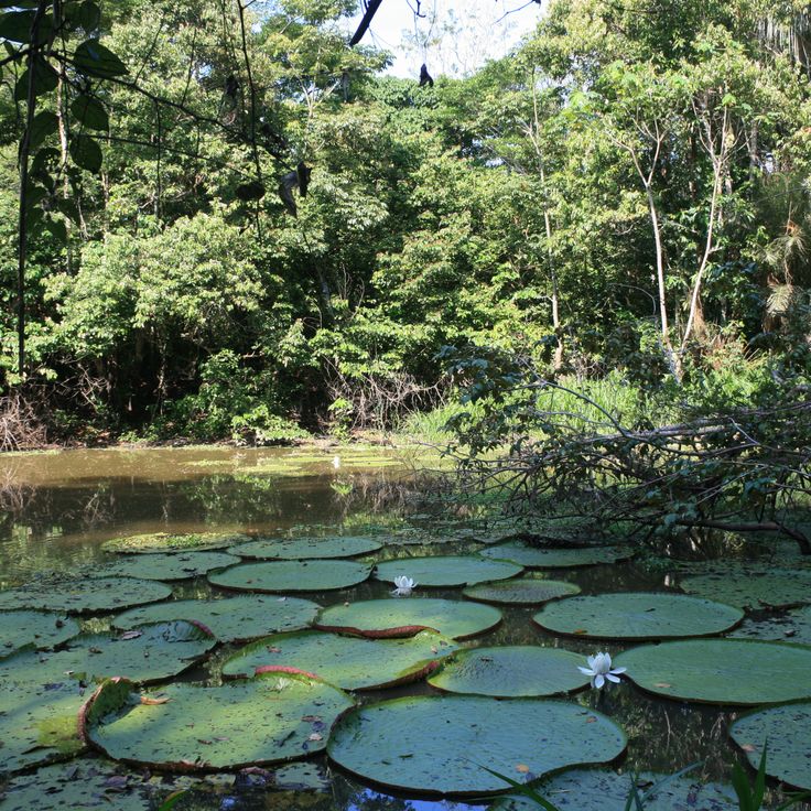
The Mamirauá Reserve sits near the city of Tefé and protects one of the largest flooded forest areas in the Amazon basin. For much of the year, trees stand in water, and the forest becomes a place where river dolphins swim between trunks and monkeys move through branches above the waterline. Researchers come here to study the plants and animals that have adapted to this seasonal flood cycle. The reserve gives a real sense of how the Amazon changes with the seasons.
Marajó is a large island at the mouth of the Amazon River in the Brazilian state of Pará, where the river meets the Atlantic Ocean. The island holds very different landscapes side by side: open grasslands, mangrove forests, and flooded lowlands. Pink river dolphins swim in the waters around it. Water buffalo graze across the flat plains, and many bird species gather along the shores. Traces of the Marajoara culture, an ancient indigenous civilization, show that people lived and worked here long ago.
The Yanomami Territory sits deep in the Amazon rainforest, spanning northern Brazil and Venezuela. People here live in hundreds of villages and farm the land using traditional methods passed down through generations. The forest around the settlements is thick and full of wildlife, and daily life follows a rhythm that has stayed largely the same for a very long time.
Leticia sits at the southern tip of Colombia, where Colombia, Peru, and Brazil meet. The city is a busy trading point where people and goods move between the three countries. From here, travelers can reach the Amazon River and its tributaries, home to river dolphins and a wide range of wildlife. The surrounding forest holds ancient rock carvings left by the people who have called this region home for thousands of years.
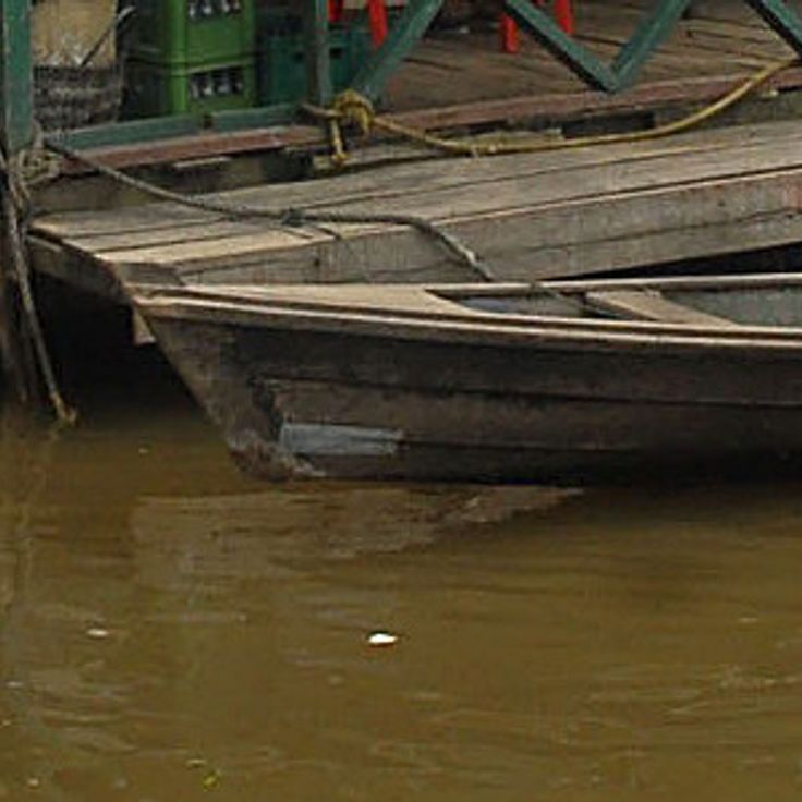
Anavilhanas is a river archipelago in the Amazon basin, made up of around 400 islands. Between the islands, shallow waters shelter many fish species and aquatic plants. Traveling through it by boat, you can see the river splitting into dozens of channels, trees standing in water, and the landscape shifting with the seasons as water levels rise and fall. This archipelago shows just how varied river habitats can be across the Amazon system.
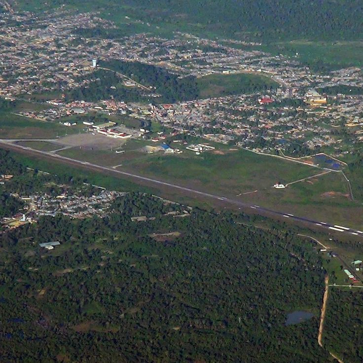
Iquitos sits deep in the rainforest of the Loreto Region and can only be reached by plane or by boat along the Amazon. This city is the main starting point for travel into the largest rainforest on Earth. From here, visitors can explore flooded forests, rivers where pink dolphins swim, and the many animals that live along the Amazon and its tributaries.
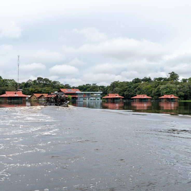
The Uakari Floating Lodge is a wooden structure built on floating logs in the Mamirauá Reserve. It rises and falls with the river's water level throughout the year. From this lodge, guests can watch river dolphins, explore the surrounding forest, and find ancient rock carvings left by the people who have lived along these riverbanks for centuries.
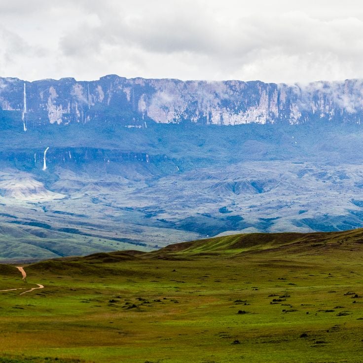
The Pantepui Region sits within the Amazon Basin in Venezuela, where flat-topped mountains rise steeply from the surrounding forest, their vertical walls reaching up about 1000 meters. The summits and the sheer rock faces create separate habitats, each with plant and animal species found almost nowhere else. Walking here or seeing these formations from a distance gives a strong sense of how ancient and isolated this part of the Amazon truly is.
Jaú National Park sits deep in the Amazon basin and protects a wide network of rivers, side channels, and flooded forests. Water and trees mix here in a way that shapes everything: fish move among the roots of standing trees, and the forest floor disappears under water for part of the year. The park gives a clear sense of how the Amazon works when left to its own rhythm.
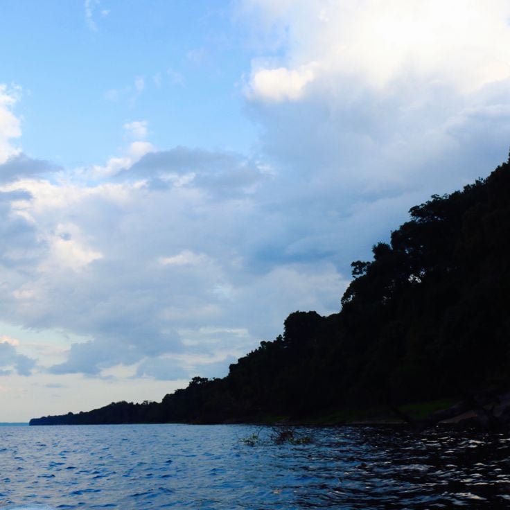
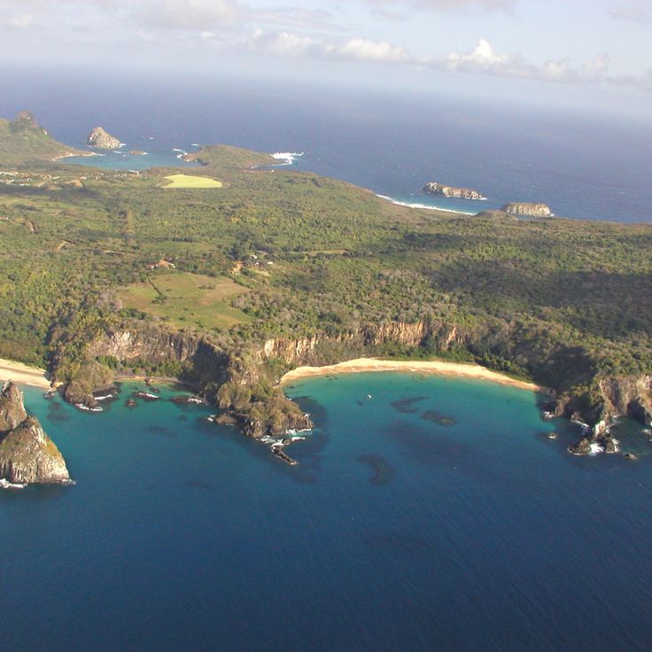
The Fernando de Noronha Archipelago sits far off the Brazilian coast in the Atlantic Ocean and is part of the wider natural world of South America. Around its islands, dolphins, sea turtles, and fish move through warm, shallow waters above coral reefs. The archipelago shows how South American ecosystems reach far beyond the Amazon rainforest and the flooded forests of the interior.
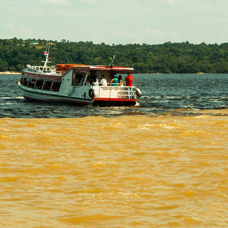
The Meeting of Waters near Manaus is where the dark Rio Negro and the sandy-brown Solimões River come together to form the Amazon River. The two rivers flow side by side for several miles without mixing, because their waters have different temperatures, densities, and speeds. From a boat, you can clearly see the line between the two colors running along the surface. This is one of the most visible natural events in the Amazon region.
The Amazon Rainforest covers a vast area across several South American countries and is the largest rainforest on Earth. River dolphins swim through its waters, while a huge range of animal and plant species live among the trees. Ancient rock carvings along the riverbanks record the presence of people who have made this place home for thousands of years. The forest shifts between flooded lowlands and tall table mountains, with each zone shaped by its own wildlife and plant life.
The Mamirauá Reserve sits near the city of Tefé and protects one of the largest flooded forest areas in the Amazon basin. For much of the year, trees stand in water, and the forest becomes a place where river dolphins swim between trunks and monkeys move through branches above the waterline. Researchers come here to study the plants and animals that have adapted to this seasonal flood cycle. The reserve gives a real sense of how the Amazon changes with the seasons.
Marajó is a large island at the mouth of the Amazon River in the Brazilian state of Pará, where the river meets the Atlantic Ocean. The island holds very different landscapes side by side: open grasslands, mangrove forests, and flooded lowlands. Pink river dolphins swim in the waters around it. Water buffalo graze across the flat plains, and many bird species gather along the shores. Traces of the Marajoara culture, an ancient indigenous civilization, show that people lived and worked here long ago.
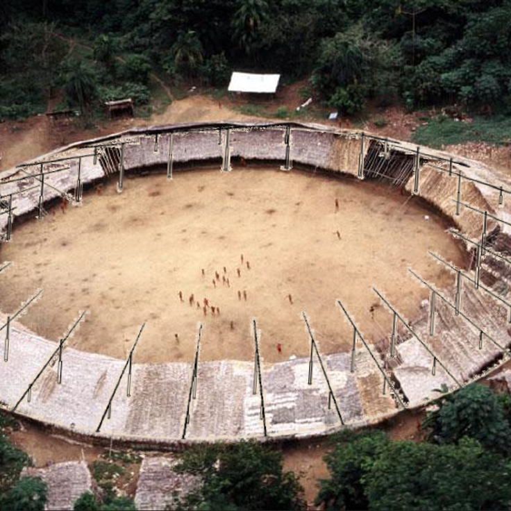
The Yanomami Territory sits deep in the Amazon rainforest, spanning northern Brazil and Venezuela. People here live in hundreds of villages and farm the land using traditional methods passed down through generations. The forest around the settlements is thick and full of wildlife, and daily life follows a rhythm that has stayed largely the same for a very long time.
Leticia sits at the southern tip of Colombia, where Colombia, Peru, and Brazil meet. The city is a busy trading point where people and goods move between the three countries. From here, travelers can reach the Amazon River and its tributaries, home to river dolphins and a wide range of wildlife. The surrounding forest holds ancient rock carvings left by the people who have called this region home for thousands of years.
Anavilhanas is a river archipelago in the Amazon basin, made up of around 400 islands. Between the islands, shallow waters shelter many fish species and aquatic plants. Traveling through it by boat, you can see the river splitting into dozens of channels, trees standing in water, and the landscape shifting with the seasons as water levels rise and fall. This archipelago shows just how varied river habitats can be across the Amazon system.
Iquitos sits deep in the rainforest of the Loreto Region and can only be reached by plane or by boat along the Amazon. This city is the main starting point for travel into the largest rainforest on Earth. From here, visitors can explore flooded forests, rivers where pink dolphins swim, and the many animals that live along the Amazon and its tributaries.
The Uakari Floating Lodge is a wooden structure built on floating logs in the Mamirauá Reserve. It rises and falls with the river's water level throughout the year. From this lodge, guests can watch river dolphins, explore the surrounding forest, and find ancient rock carvings left by the people who have lived along these riverbanks for centuries.
The Pantepui Region sits within the Amazon Basin in Venezuela, where flat-topped mountains rise steeply from the surrounding forest, their vertical walls reaching up about 1000 meters. The summits and the sheer rock faces create separate habitats, each with plant and animal species found almost nowhere else. Walking here or seeing these formations from a distance gives a strong sense of how ancient and isolated this part of the Amazon truly is.
Jaú National Park sits deep in the Amazon basin and protects a wide network of rivers, side channels, and flooded forests. Water and trees mix here in a way that shapes everything: fish move among the roots of standing trees, and the forest floor disappears under water for part of the year. The park gives a clear sense of how the Amazon works when left to its own rhythm.
The Fernando de Noronha Archipelago sits far off the Brazilian coast in the Atlantic Ocean and is part of the wider natural world of South America. Around its islands, dolphins, sea turtles, and fish move through warm, shallow waters above coral reefs. The archipelago shows how South American ecosystems reach far beyond the Amazon rainforest and the flooded forests of the interior.
The Meeting of Waters near Manaus is where the dark Rio Negro and the sandy-brown Solimões River come together to form the Amazon River. The two rivers flow side by side for several miles without mixing, because their waters have different temperatures, densities, and speeds. From a boat, you can clearly see the line between the two colors running along the surface. This is one of the most visible natural events in the Amazon region.
The Amazon Rainforest covers a vast area across several South American countries and is the largest rainforest on Earth. River dolphins swim through its waters, while a huge range of animal and plant species live among the trees. Ancient rock carvings along the riverbanks record the presence of people who have made this place home for thousands of years. The forest shifts between flooded lowlands and tall table mountains, with each zone shaped by its own wildlife and plant life.
The Mamirauá Reserve sits near the city of Tefé and protects one of the largest flooded forest areas in the Amazon basin. For much of the year, trees stand in water, and the forest becomes a place where river dolphins swim between trunks and monkeys move through branches above the waterline. Researchers come here to study the plants and animals that have adapted to this seasonal flood cycle. The reserve gives a real sense of how the Amazon changes with the seasons.
Marajó is a large island at the mouth of the Amazon River in the Brazilian state of Pará, where the river meets the Atlantic Ocean. The island holds very different landscapes side by side: open grasslands, mangrove forests, and flooded lowlands. Pink river dolphins swim in the waters around it. Water buffalo graze across the flat plains, and many bird species gather along the shores. Traces of the Marajoara culture, an ancient indigenous civilization, show that people lived and worked here long ago.
The Yanomami Territory sits deep in the Amazon rainforest, spanning northern Brazil and Venezuela. People here live in hundreds of villages and farm the land using traditional methods passed down through generations. The forest around the settlements is thick and full of wildlife, and daily life follows a rhythm that has stayed largely the same for a very long time.
Leticia sits at the southern tip of Colombia, where Colombia, Peru, and Brazil meet. The city is a busy trading point where people and goods move between the three countries. From here, travelers can reach the Amazon River and its tributaries, home to river dolphins and a wide range of wildlife. The surrounding forest holds ancient rock carvings left by the people who have called this region home for thousands of years.
Anavilhanas is a river archipelago in the Amazon basin, made up of around 400 islands. Between the islands, shallow waters shelter many fish species and aquatic plants. Traveling through it by boat, you can see the river splitting into dozens of channels, trees standing in water, and the landscape shifting with the seasons as water levels rise and fall. This archipelago shows just how varied river habitats can be across the Amazon system.
Iquitos sits deep in the rainforest of the Loreto Region and can only be reached by plane or by boat along the Amazon. This city is the main starting point for travel into the largest rainforest on Earth. From here, visitors can explore flooded forests, rivers where pink dolphins swim, and the many animals that live along the Amazon and its tributaries.
The Uakari Floating Lodge is a wooden structure built on floating logs in the Mamirauá Reserve. It rises and falls with the river's water level throughout the year. From this lodge, guests can watch river dolphins, explore the surrounding forest, and find ancient rock carvings left by the people who have lived along these riverbanks for centuries.
The Pantepui Region sits within the Amazon Basin in Venezuela, where flat-topped mountains rise steeply from the surrounding forest, their vertical walls reaching up about 1000 meters. The summits and the sheer rock faces create separate habitats, each with plant and animal species found almost nowhere else. Walking here or seeing these formations from a distance gives a strong sense of how ancient and isolated this part of the Amazon truly is.
Jaú National Park sits deep in the Amazon basin and protects a wide network of rivers, side channels, and flooded forests. Water and trees mix here in a way that shapes everything: fish move among the roots of standing trees, and the forest floor disappears under water for part of the year. The park gives a clear sense of how the Amazon works when left to its own rhythm.
The Fernando de Noronha Archipelago sits far off the Brazilian coast in the Atlantic Ocean and is part of the wider natural world of South America. Around its islands, dolphins, sea turtles, and fish move through warm, shallow waters above coral reefs. The archipelago shows how South American ecosystems reach far beyond the Amazon rainforest and the flooded forests of the interior.
The Meeting of Waters near Manaus is where the dark Rio Negro and the sandy-brown Solimões River come together to form the Amazon River. The two rivers flow side by side for several miles without mixing, because their waters have different temperatures, densities, and speeds. From a boat, you can clearly see the line between the two colors running along the surface. This is one of the most visible natural events in the Amazon region.
The best time to visit depends on what you want to see. During the wet season, water levels rise and flooded forests become more accessible by boat, but trails become muddy and difficult. The dry season offers easier hiking but some areas become less accessible by water.