See the monuments around you in AROpen chests in the app
Around Us is built for your phone — point your camera at the streets and discover the monuments and places around you in augmented reality.Around Us is built for your phone — chests unlock when you walk, explore and capture nearby places.
Spanish archipelagos emerge along 8000 kilometers of coastline, from Portugal to North Africa.
Spain boasts some of the richest archipelagos in Europe. Its islands stretch along more than 8,000 kilometers of coastline, from off the coast of Portugal to the waters of Morocco. Mallorca and Ibiza are the most famous, but this collection includes 30, each telling a different story.
In the Balearic Islands, you'll find coves with crystal-clear waters and villages built of white stone. The Canary Islands, further south, offer volcanic landscapes and seemingly endless beaches. Along the Atlantic coast, in Galicia and the Basque Country, rocky islands rise from the ocean, while the Mediterranean reveals its small, protected archipelagos. Some islands are home to vibrant towns, while others remain wild and almost uninhabited.
What characterizes these places is their diversity. One island might have forested mountains while its neighbor is covered in rock formations. The beaches change from one region to another. Forgotten coastal villages lie alongside historic towns. Here there are places for walking, others for swimming, and still others for observing nature in peace and quiet.
Spanish archipelagos emerge along 8000 kilometers of coastline, from Portugal to North Africa.
Spain boasts some of the richest archipelagos in Europe. Its islands stretch along more than 8,000 kilometers of coastline, from off the coast of Portugal to the waters of Morocco. Mallorca and Ibiza are the most famous, but this collection includes 30, each telling a different story.
In the Balearic Islands, you'll find coves with crystal-clear waters and villages built of white stone. The Canary Islands, further south, offer volcanic landscapes and seemingly endless beaches. Along the Atlantic coast, in Galicia and the Basque Country, rocky islands rise from the ocean, while the Mediterranean reveals its small, protected archipelagos. Some islands are home to vibrant towns, while others remain wild and almost uninhabited.
What characterizes these places is their diversity. One island might have forested mountains while its neighbor is covered in rock formations. The beaches change from one region to another. Forgotten coastal villages lie alongside historic towns. Here there are places for walking, others for swimming, and still others for observing nature in peace and quiet.
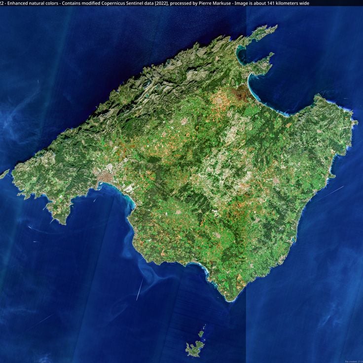
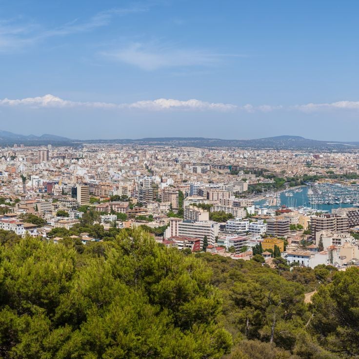
Majorca is the largest island in the Balearic archipelago. Its capital, Palma, has a Gothic cathedral and streets that fill with locals and visitors alike. To the north, the Serra de Tramuntana mountain range runs along the coast, dotted with stone villages and olive groves. The coastline shifts between rocky coves and sandy beaches, with water that turns from green to deep blue depending on the light. Inland, the pace slows down around almond tree fields, old manor houses, and small market towns.
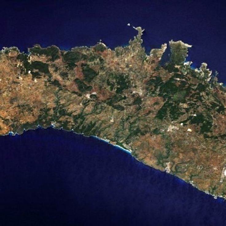
Minorca is the quietest of the Balearic Islands. Its coastline shifts between rocky coves and long sandy beaches. Inland, you find low hills, dry stone walls, and small villages where daily life moves slowly. The Camí de Cavalls is an old riding trail that circles the entire island, giving walkers close access to the shore. Minorca also has one of the highest concentrations of prehistoric sites in Europe, with taulas, navetas, and talayots scattered across the countryside.
Ibiza is a Balearic island that has much more to offer than its nightlife reputation suggests. The inland villages are built from white stone, with narrow streets and a slow daily pace. Along the coast, small coves alternate with sandy beaches, and the water turns deep blue or green depending on the light. The countryside is dotted with almond trees, pine forests, and old farmhouses that feel far removed from the crowds.
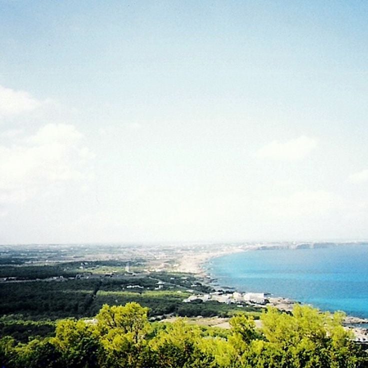
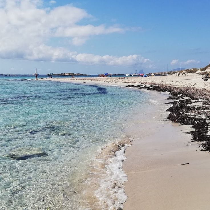
Formentera is the smallest of the Balearic Islands and sits just south of Ibiza, reachable only by ferry. That short crossing keeps the island calmer and less crowded than its neighbors. The beaches here, like Ses Illetes, have shallow, pale water and fine sand that stretches without interruption. The island is flat enough to explore almost entirely by bicycle, along paths that pass through salt flats, pine groves and small wine-growing villages.
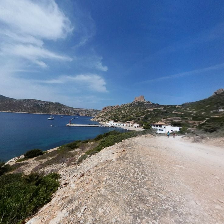
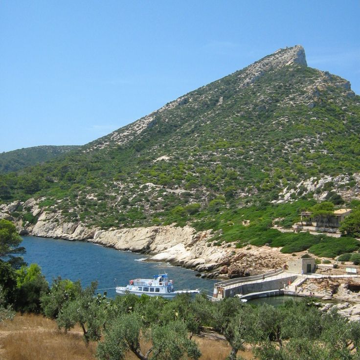
Cabrera is a protected archipelago off the southern tip of Mallorca. The islands have been a national park for decades, which means almost no one lives there permanently. You reach them by day trip from Mallorca. The waters around Cabrera are some of the clearest in the Balearics, and marine life thrives here because fishing and anchoring are tightly restricted. On land, there is an old watchtower, a small harbor, and dry scrubland paths to walk. The absence of noise and crowds is what most visitors remember.
Sa Dragonera is an uninhabited island just west of Mallorca. It has been a protected nature reserve since the 1980s, after local people fought to prevent it from being developed. Today, walking trails cross the island past cliffs, old lighthouses, and nesting seabirds. Sa Dragonera feels raw and open, far from the crowds that gather on the main island nearby.
Espalmador is a small, nearly uninhabited island sitting between Ibiza and Formentera. The land is flat, and the shore is sandy and pale. There are no roads and almost no buildings. People arrive by boat to swim in calm waters or sit on a white sand beach, away from crowds and noise.
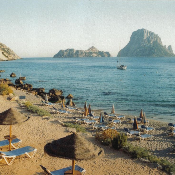
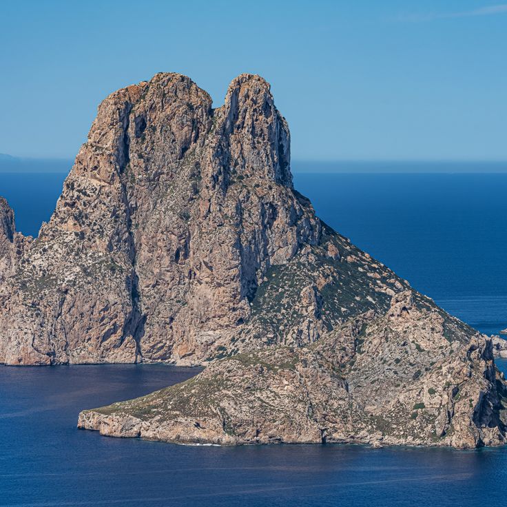
Es Vedrà is a rocky islet off the west coast of Ibiza. It rises almost vertically from the sea and can be seen from far away. The rock is uninhabited and closed to the public, as it is a protected nature reserve. From the nearby Torre des Savinar viewpoint, you can take in its full shape. The water around the rock is clear, and small boats often anchor nearby. In the evening, as the sun sets, the rock catches a warm light, making it a popular spot for late afternoon walks along the coast.
Tenerife is the largest of the Canary Islands. At its center stands the Teide, a volcano whose summit rises to about 12,200 feet (3,700 meters) and is often wrapped in clouds. The terrain around it is bare and shaped by old lava flows, a sharp contrast to the green forests in the north of the island. The south has long, sandy beaches with light-colored sand, while the north offers smaller coves with dark volcanic sand. The cities of Santa Cruz and La Laguna have historic centers with buildings dating from the 16th and 17th centuries. Daily life on the island has its own pace: open-air markets, fish restaurants, narrow streets and people sitting outside.
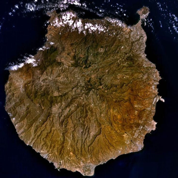
Gran Canaria is the third largest island in the Canary Islands and feels like a small continent on its own. The north is green and cool, with forests and mountain villages. The south opens onto wide sandy beaches and the famous Maspalomas dunes, where sand meets the ocean. Crossing the island, you pass through deep ravines, terraced fields, and old villages that seem to have changed little over the centuries.
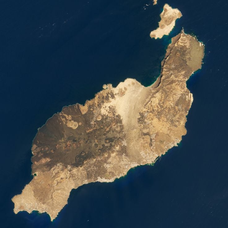
Lanzarote is one of the Canary Islands, and it looks unlike most other islands in Spain. Much of the land is covered in black lava fields left by old volcanic eruptions. White villages stand out against this dark ground, and local vineyards grow in hollows dug into the volcanic soil. The artist César Manrique shaped how the island looks today: he designed buildings inside lava caves, created public spaces, and pushed for a rule banning billboards across the island.
Fuerteventura is the second largest of the Canary Islands and sits close to the African coast. The island is known for its long sandy beaches that run along much of its shoreline. The interior is dry and open, with a landscape that feels much like a desert. Wind blows strongly here for most of the year, which makes the island popular with surfers and kitesurfers. Villages are small, and daily life tends to revolve around the coast.
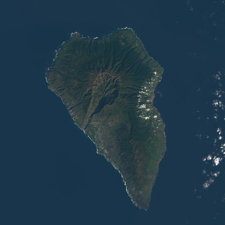
La Palma is one of the Canary Islands and sits in the Atlantic Ocean off the northwest coast of Africa. The island is covered with thick forests and cut through by volcanic craters. Hikers come here for the trails that wind through laurel forests and along lava fields. At night, the sky is dark enough to see the stars with remarkable clarity, which draws astronomers and curious visitors alike.
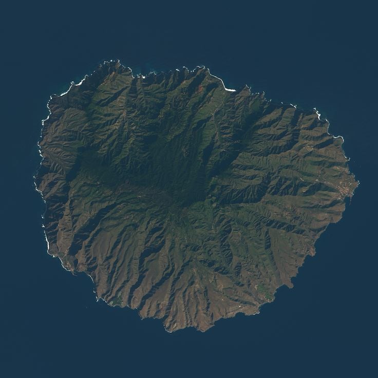
La Gomera stands apart from the other Canary Islands. Dense laurel forests cover its central highlands, kept green year-round by low clouds that settle over the peaks. The Garajonay National Park protects this ancient woodland, where the trees are draped in moss and the air feels cool even in summer. Small villages cling to the steep slopes, and the island is also known for Silbo, a whistled language that locals once used to communicate across its deep ravines.
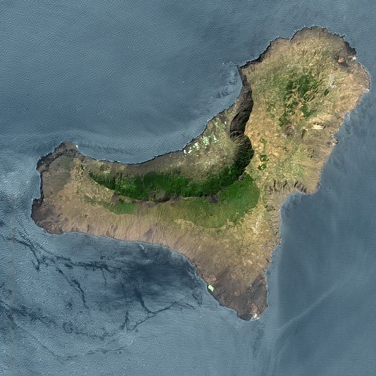
El Hierro is the westernmost of the main Canary Islands. The landscape is made up of lava fields, dense forests and sharp coastal cliffs. There is very little mass tourism here. The villages are small, the roads quiet, and daily life moves at its own pace. El Hierro has made a conscious choice to develop differently: the island generates much of its electricity from wind and water. Those who come here find excellent diving spots, walking trails and nature that can be enjoyed without crowds.
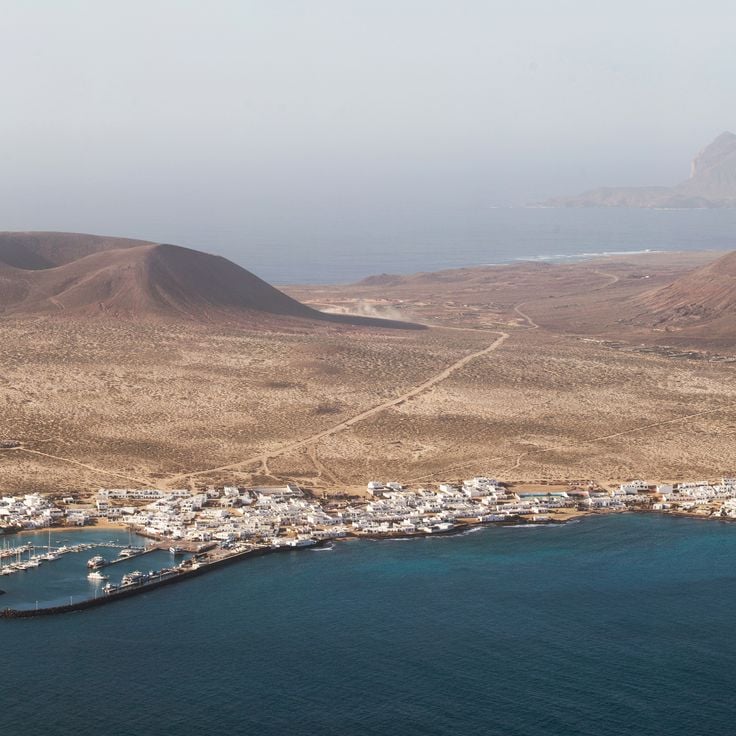
La Graciosa is the smallest inhabited island in the Canary Islands. There are no paved roads here, only sandy tracks used by people on foot, bicycle, or quad bike. A few hundred people live in white houses clustered around a small fishing harbor. The beaches are wide and covered in pale sand, with calm, clear water. Life moves slowly here, as if time has slowed to a near stop.
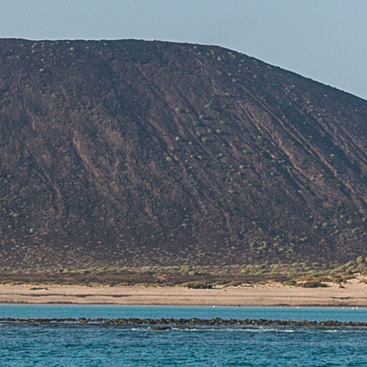
Lobos Island sits between Fuerteventura and Lanzarote, just a short ferry ride from the northern tip of Fuerteventura. It is a protected nature area with almost no permanent residents. The ground is volcanic, dark and rough, dotted with salt lagoons and dry scrubland. A walking path loops around the whole island, passing a small lighthouse and rocky shoreline. The shallow, clear water around the island makes snorkeling along the coast easy and rewarding. There are no hotels or shops here, just open land and the sound of seabirds.
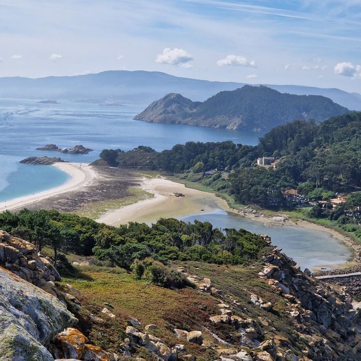
The Cíes Islands sit at the mouth of the Ría de Vigo, forming a natural barrier between the open Atlantic and the bay. These three islands are part of a national park and can only be reached by ferry. White sand beaches line the inner shores, while the outer side drops into tall cliffs battered by ocean waves. Coastal paths cross the islands, passing seabird colonies and rocky outcrops. The water is cold, the air smells of salt and pine, and the number of visitors allowed each day is limited.
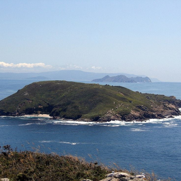
The island of Ons sits off the Galician coast, in the Atlantic Ocean, and is part of the Atlantic Islands National Park. It is quieter than the Cíes Islands and has coastal trails along the cliffs, small fishing villages, and open views of the ocean. Visitors can walk across the whole island, watch seabirds, and experience the raw, windswept feel of the northwest Spanish coast.
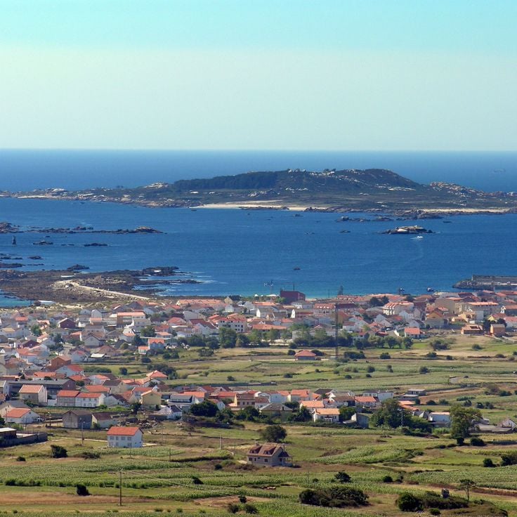
Sálvora Island sits in the Rías Baixas archipelago off the coast of Galicia. It is almost uninhabited and part of the Atlantic Islands National Park. An old lighthouse stands on the shore, while small wild horses roam freely across granite rocks and dry grass. The waters around the island are rough, the winds strong, and the landscape feels raw and remote. You can only reach it by boat, which keeps it well away from the crowds.
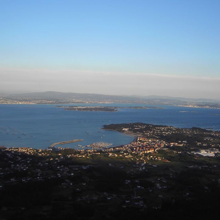
Arousa Island sits in the Galician rias and is connected to the mainland by a bridge, but it lives by its own pace. Fishing is at the heart of daily life here, along with shellfish farming in the surrounding waters. The harbors are working places, not just scenery, and the villages along the coast feel rooted in old maritime routines. It is one of the few islands in Spain where the sea is not just a backdrop but the main reason people are here.
Cortegada Island sits off the coast of Galicia and is covered almost entirely by a dense forest. This forest is a laurel forest, an ancient type of woodland that has mostly disappeared from Europe. Walking through it, you notice how quiet it is, with filtered light coming through the canopy and a feeling of being far from the outside world. The island is part of a national park and has almost no permanent residents.
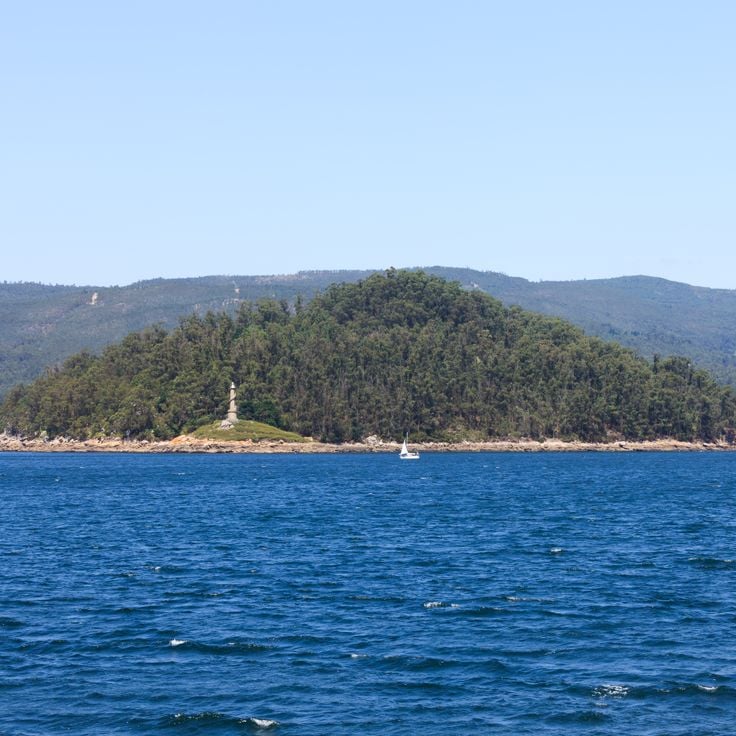
Tambo Island sits in the Ria de Pontevedra, off the coast of Galicia. It is covered in trees and was off-limits for a long time. Today, the only way to visit is through organized tours, which makes it feel more like a discovery than a typical stop. Visitors walk through dense woodland and come across old stone ruins, with the sea always visible between the branches.
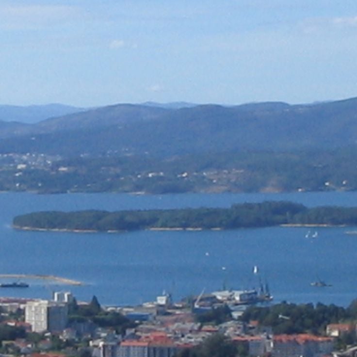
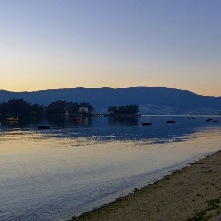
San Simón Island sits in the Ría de Vigo, a long sea inlet in northwestern Spain. It is small and tree-covered, with old stone walls and weathered buildings scattered across it. Over the centuries it served as a leper colony, a monastery, and a prison during the Civil War. Today it is a place of memory and culture, reached only by boat. Walking through it, you feel the weight of its past at every turn.
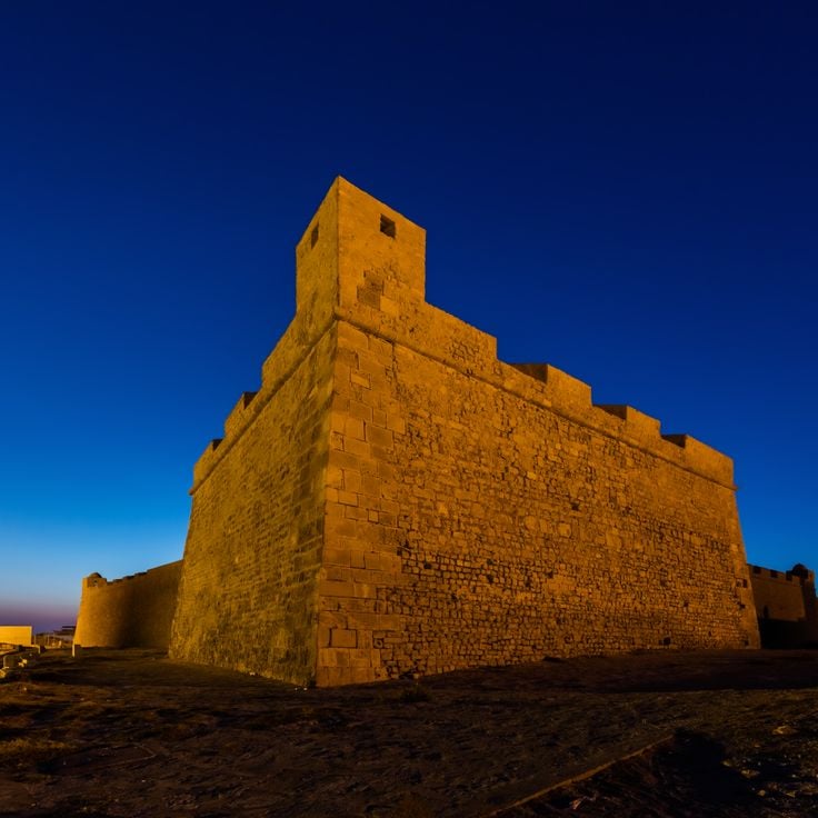
Tabarca sits just off the coast of Alicante and is the only inhabited island in the Valencian Community. The small village inside the old fortified walls has narrow lanes and low houses. Around the island, the first marine reserve in Spain was established, making the waters around Tabarca a protected area where sea life thrives. Snorkelers and divers come here to explore what lies beneath the surface. The coves are sheltered and the pace of life on the island is slow.
The Columbretes Islands sit off the coast of Castellón, rising from the sea as the remains of ancient volcanic activity. The archipelago is a protected natural area, which means very few people live here and boat access is controlled. Divers come for the clear water and the sea life below the surface. Above water, the islands are rocky and windswept, with a lighthouse and little else.
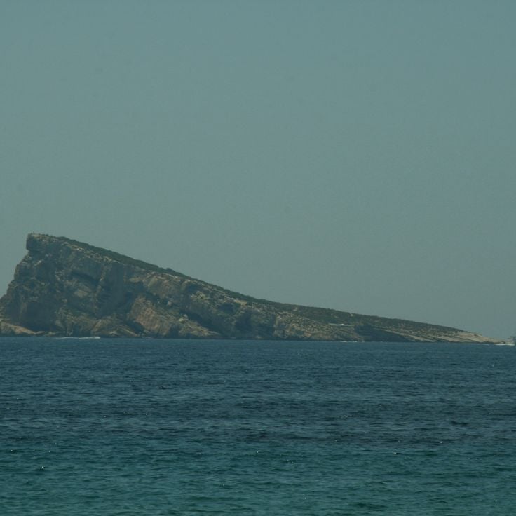
The island of Benidorm is a small, triangular piece of land sitting just off the coast, clearly visible from the beaches of Benidorm. Boats make the short crossing regularly, bringing visitors who come to swim, snorkel, or simply look back at the city from the water. There are no buildings on the island itself, and the sea around it is deep and open.
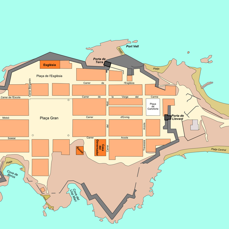
Nueva Tabarca is the only inhabited island in the Valencian Community. Behind its old stone walls, low white houses line narrow lanes that lead to the church, and daily life happens mostly outdoors. The island is part of the Tabarca archipelago and was once a fortified settlement. Today, visitors arrive by boat from Alicante to walk through the small historic center and swim in the surrounding coves.
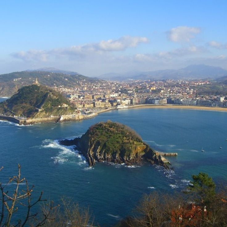
Santa Clara Island sits in the middle of La Concha Bay, just off the coast of San Sebastián. It is a small island with a sandy beach and walking paths that loop around the rocky edges. A lighthouse stands at one end, offering views of the bay and the city beyond. In summer, small boats make the short crossing from the city. The island is a natural part of the bay's landscape, visible from the famous promenade that lines the shore.
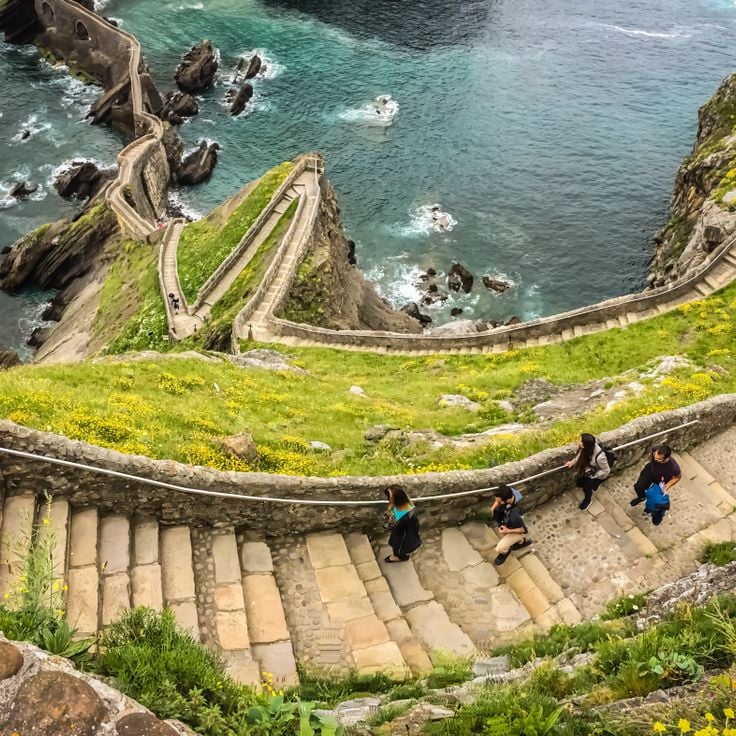
San Juan de Gaztelugatxe is a rocky islet jutting out from the Basque coast, connected to the mainland by a long stone stairway. At the top stands a small chapel that has drawn pilgrims since the Middle Ages. The path winds up steeply, with the sea crashing against the cliffs on both sides. The wind is almost always present. It is the kind of place you can only truly experience on foot, watching the waves far below.
Majorca is the largest island in the Balearic archipelago. Its capital, Palma, has a Gothic cathedral and streets that fill with locals and visitors alike. To the north, the Serra de Tramuntana mountain range runs along the coast, dotted with stone villages and olive groves. The coastline shifts between rocky coves and sandy beaches, with water that turns from green to deep blue depending on the light. Inland, the pace slows down around almond tree fields, old manor houses, and small market towns.
Minorca is the quietest of the Balearic Islands. Its coastline shifts between rocky coves and long sandy beaches. Inland, you find low hills, dry stone walls, and small villages where daily life moves slowly. The Camí de Cavalls is an old riding trail that circles the entire island, giving walkers close access to the shore. Minorca also has one of the highest concentrations of prehistoric sites in Europe, with taulas, navetas, and talayots scattered across the countryside.
Ibiza is a Balearic island that has much more to offer than its nightlife reputation suggests. The inland villages are built from white stone, with narrow streets and a slow daily pace. Along the coast, small coves alternate with sandy beaches, and the water turns deep blue or green depending on the light. The countryside is dotted with almond trees, pine forests, and old farmhouses that feel far removed from the crowds.
Formentera is the smallest of the Balearic Islands and sits just south of Ibiza, reachable only by ferry. That short crossing keeps the island calmer and less crowded than its neighbors. The beaches here, like Ses Illetes, have shallow, pale water and fine sand that stretches without interruption. The island is flat enough to explore almost entirely by bicycle, along paths that pass through salt flats, pine groves and small wine-growing villages.
Cabrera is a protected archipelago off the southern tip of Mallorca. The islands have been a national park for decades, which means almost no one lives there permanently. You reach them by day trip from Mallorca. The waters around Cabrera are some of the clearest in the Balearics, and marine life thrives here because fishing and anchoring are tightly restricted. On land, there is an old watchtower, a small harbor, and dry scrubland paths to walk. The absence of noise and crowds is what most visitors remember.
Sa Dragonera is an uninhabited island just west of Mallorca. It has been a protected nature reserve since the 1980s, after local people fought to prevent it from being developed. Today, walking trails cross the island past cliffs, old lighthouses, and nesting seabirds. Sa Dragonera feels raw and open, far from the crowds that gather on the main island nearby.
Espalmador is a small, nearly uninhabited island sitting between Ibiza and Formentera. The land is flat, and the shore is sandy and pale. There are no roads and almost no buildings. People arrive by boat to swim in calm waters or sit on a white sand beach, away from crowds and noise.
Es Vedrà is a rocky islet off the west coast of Ibiza. It rises almost vertically from the sea and can be seen from far away. The rock is uninhabited and closed to the public, as it is a protected nature reserve. From the nearby Torre des Savinar viewpoint, you can take in its full shape. The water around the rock is clear, and small boats often anchor nearby. In the evening, as the sun sets, the rock catches a warm light, making it a popular spot for late afternoon walks along the coast.
Tenerife is the largest of the Canary Islands. At its center stands the Teide, a volcano whose summit rises to about 12,200 feet (3,700 meters) and is often wrapped in clouds. The terrain around it is bare and shaped by old lava flows, a sharp contrast to the green forests in the north of the island. The south has long, sandy beaches with light-colored sand, while the north offers smaller coves with dark volcanic sand. The cities of Santa Cruz and La Laguna have historic centers with buildings dating from the 16th and 17th centuries. Daily life on the island has its own pace: open-air markets, fish restaurants, narrow streets and people sitting outside.
Gran Canaria is the third largest island in the Canary Islands and feels like a small continent on its own. The north is green and cool, with forests and mountain villages. The south opens onto wide sandy beaches and the famous Maspalomas dunes, where sand meets the ocean. Crossing the island, you pass through deep ravines, terraced fields, and old villages that seem to have changed little over the centuries.
Lanzarote is one of the Canary Islands, and it looks unlike most other islands in Spain. Much of the land is covered in black lava fields left by old volcanic eruptions. White villages stand out against this dark ground, and local vineyards grow in hollows dug into the volcanic soil. The artist César Manrique shaped how the island looks today: he designed buildings inside lava caves, created public spaces, and pushed for a rule banning billboards across the island.
Fuerteventura is the second largest of the Canary Islands and sits close to the African coast. The island is known for its long sandy beaches that run along much of its shoreline. The interior is dry and open, with a landscape that feels much like a desert. Wind blows strongly here for most of the year, which makes the island popular with surfers and kitesurfers. Villages are small, and daily life tends to revolve around the coast.
La Palma is one of the Canary Islands and sits in the Atlantic Ocean off the northwest coast of Africa. The island is covered with thick forests and cut through by volcanic craters. Hikers come here for the trails that wind through laurel forests and along lava fields. At night, the sky is dark enough to see the stars with remarkable clarity, which draws astronomers and curious visitors alike.
La Gomera stands apart from the other Canary Islands. Dense laurel forests cover its central highlands, kept green year-round by low clouds that settle over the peaks. The Garajonay National Park protects this ancient woodland, where the trees are draped in moss and the air feels cool even in summer. Small villages cling to the steep slopes, and the island is also known for Silbo, a whistled language that locals once used to communicate across its deep ravines.
El Hierro is the westernmost of the main Canary Islands. The landscape is made up of lava fields, dense forests and sharp coastal cliffs. There is very little mass tourism here. The villages are small, the roads quiet, and daily life moves at its own pace. El Hierro has made a conscious choice to develop differently: the island generates much of its electricity from wind and water. Those who come here find excellent diving spots, walking trails and nature that can be enjoyed without crowds.
La Graciosa is the smallest inhabited island in the Canary Islands. There are no paved roads here, only sandy tracks used by people on foot, bicycle, or quad bike. A few hundred people live in white houses clustered around a small fishing harbor. The beaches are wide and covered in pale sand, with calm, clear water. Life moves slowly here, as if time has slowed to a near stop.
Lobos Island sits between Fuerteventura and Lanzarote, just a short ferry ride from the northern tip of Fuerteventura. It is a protected nature area with almost no permanent residents. The ground is volcanic, dark and rough, dotted with salt lagoons and dry scrubland. A walking path loops around the whole island, passing a small lighthouse and rocky shoreline. The shallow, clear water around the island makes snorkeling along the coast easy and rewarding. There are no hotels or shops here, just open land and the sound of seabirds.
The Cíes Islands sit at the mouth of the Ría de Vigo, forming a natural barrier between the open Atlantic and the bay. These three islands are part of a national park and can only be reached by ferry. White sand beaches line the inner shores, while the outer side drops into tall cliffs battered by ocean waves. Coastal paths cross the islands, passing seabird colonies and rocky outcrops. The water is cold, the air smells of salt and pine, and the number of visitors allowed each day is limited.
The island of Ons sits off the Galician coast, in the Atlantic Ocean, and is part of the Atlantic Islands National Park. It is quieter than the Cíes Islands and has coastal trails along the cliffs, small fishing villages, and open views of the ocean. Visitors can walk across the whole island, watch seabirds, and experience the raw, windswept feel of the northwest Spanish coast.
Sálvora Island sits in the Rías Baixas archipelago off the coast of Galicia. It is almost uninhabited and part of the Atlantic Islands National Park. An old lighthouse stands on the shore, while small wild horses roam freely across granite rocks and dry grass. The waters around the island are rough, the winds strong, and the landscape feels raw and remote. You can only reach it by boat, which keeps it well away from the crowds.
Arousa Island sits in the Galician rias and is connected to the mainland by a bridge, but it lives by its own pace. Fishing is at the heart of daily life here, along with shellfish farming in the surrounding waters. The harbors are working places, not just scenery, and the villages along the coast feel rooted in old maritime routines. It is one of the few islands in Spain where the sea is not just a backdrop but the main reason people are here.
Cortegada Island sits off the coast of Galicia and is covered almost entirely by a dense forest. This forest is a laurel forest, an ancient type of woodland that has mostly disappeared from Europe. Walking through it, you notice how quiet it is, with filtered light coming through the canopy and a feeling of being far from the outside world. The island is part of a national park and has almost no permanent residents.
Tambo Island sits in the Ria de Pontevedra, off the coast of Galicia. It is covered in trees and was off-limits for a long time. Today, the only way to visit is through organized tours, which makes it feel more like a discovery than a typical stop. Visitors walk through dense woodland and come across old stone ruins, with the sea always visible between the branches.
San Simón Island sits in the Ría de Vigo, a long sea inlet in northwestern Spain. It is small and tree-covered, with old stone walls and weathered buildings scattered across it. Over the centuries it served as a leper colony, a monastery, and a prison during the Civil War. Today it is a place of memory and culture, reached only by boat. Walking through it, you feel the weight of its past at every turn.
Tabarca sits just off the coast of Alicante and is the only inhabited island in the Valencian Community. The small village inside the old fortified walls has narrow lanes and low houses. Around the island, the first marine reserve in Spain was established, making the waters around Tabarca a protected area where sea life thrives. Snorkelers and divers come here to explore what lies beneath the surface. The coves are sheltered and the pace of life on the island is slow.
The Columbretes Islands sit off the coast of Castellón, rising from the sea as the remains of ancient volcanic activity. The archipelago is a protected natural area, which means very few people live here and boat access is controlled. Divers come for the clear water and the sea life below the surface. Above water, the islands are rocky and windswept, with a lighthouse and little else.
The island of Benidorm is a small, triangular piece of land sitting just off the coast, clearly visible from the beaches of Benidorm. Boats make the short crossing regularly, bringing visitors who come to swim, snorkel, or simply look back at the city from the water. There are no buildings on the island itself, and the sea around it is deep and open.
Nueva Tabarca is the only inhabited island in the Valencian Community. Behind its old stone walls, low white houses line narrow lanes that lead to the church, and daily life happens mostly outdoors. The island is part of the Tabarca archipelago and was once a fortified settlement. Today, visitors arrive by boat from Alicante to walk through the small historic center and swim in the surrounding coves.
Santa Clara Island sits in the middle of La Concha Bay, just off the coast of San Sebastián. It is a small island with a sandy beach and walking paths that loop around the rocky edges. A lighthouse stands at one end, offering views of the bay and the city beyond. In summer, small boats make the short crossing from the city. The island is a natural part of the bay's landscape, visible from the famous promenade that lines the shore.
San Juan de Gaztelugatxe is a rocky islet jutting out from the Basque coast, connected to the mainland by a long stone stairway. At the top stands a small chapel that has drawn pilgrims since the Middle Ages. The path winds up steeply, with the sea crashing against the cliffs on both sides. The wind is almost always present. It is the kind of place you can only truly experience on foot, watching the waves far below.
Majorca is the largest island in the Balearic archipelago. Its capital, Palma, has a Gothic cathedral and streets that fill with locals and visitors alike. To the north, the Serra de Tramuntana mountain range runs along the coast, dotted with stone villages and olive groves. The coastline shifts between rocky coves and sandy beaches, with water that turns from green to deep blue depending on the light. Inland, the pace slows down around almond tree fields, old manor houses, and small market towns.
Minorca is the quietest of the Balearic Islands. Its coastline shifts between rocky coves and long sandy beaches. Inland, you find low hills, dry stone walls, and small villages where daily life moves slowly. The Camí de Cavalls is an old riding trail that circles the entire island, giving walkers close access to the shore. Minorca also has one of the highest concentrations of prehistoric sites in Europe, with taulas, navetas, and talayots scattered across the countryside.
Ibiza is a Balearic island that has much more to offer than its nightlife reputation suggests. The inland villages are built from white stone, with narrow streets and a slow daily pace. Along the coast, small coves alternate with sandy beaches, and the water turns deep blue or green depending on the light. The countryside is dotted with almond trees, pine forests, and old farmhouses that feel far removed from the crowds.
Formentera is the smallest of the Balearic Islands and sits just south of Ibiza, reachable only by ferry. That short crossing keeps the island calmer and less crowded than its neighbors. The beaches here, like Ses Illetes, have shallow, pale water and fine sand that stretches without interruption. The island is flat enough to explore almost entirely by bicycle, along paths that pass through salt flats, pine groves and small wine-growing villages.
Cabrera is a protected archipelago off the southern tip of Mallorca. The islands have been a national park for decades, which means almost no one lives there permanently. You reach them by day trip from Mallorca. The waters around Cabrera are some of the clearest in the Balearics, and marine life thrives here because fishing and anchoring are tightly restricted. On land, there is an old watchtower, a small harbor, and dry scrubland paths to walk. The absence of noise and crowds is what most visitors remember.
Sa Dragonera is an uninhabited island just west of Mallorca. It has been a protected nature reserve since the 1980s, after local people fought to prevent it from being developed. Today, walking trails cross the island past cliffs, old lighthouses, and nesting seabirds. Sa Dragonera feels raw and open, far from the crowds that gather on the main island nearby.
Espalmador is a small, nearly uninhabited island sitting between Ibiza and Formentera. The land is flat, and the shore is sandy and pale. There are no roads and almost no buildings. People arrive by boat to swim in calm waters or sit on a white sand beach, away from crowds and noise.
Es Vedrà is a rocky islet off the west coast of Ibiza. It rises almost vertically from the sea and can be seen from far away. The rock is uninhabited and closed to the public, as it is a protected nature reserve. From the nearby Torre des Savinar viewpoint, you can take in its full shape. The water around the rock is clear, and small boats often anchor nearby. In the evening, as the sun sets, the rock catches a warm light, making it a popular spot for late afternoon walks along the coast.
Tenerife is the largest of the Canary Islands. At its center stands the Teide, a volcano whose summit rises to about 12,200 feet (3,700 meters) and is often wrapped in clouds. The terrain around it is bare and shaped by old lava flows, a sharp contrast to the green forests in the north of the island. The south has long, sandy beaches with light-colored sand, while the north offers smaller coves with dark volcanic sand. The cities of Santa Cruz and La Laguna have historic centers with buildings dating from the 16th and 17th centuries. Daily life on the island has its own pace: open-air markets, fish restaurants, narrow streets and people sitting outside.
Gran Canaria is the third largest island in the Canary Islands and feels like a small continent on its own. The north is green and cool, with forests and mountain villages. The south opens onto wide sandy beaches and the famous Maspalomas dunes, where sand meets the ocean. Crossing the island, you pass through deep ravines, terraced fields, and old villages that seem to have changed little over the centuries.
Lanzarote is one of the Canary Islands, and it looks unlike most other islands in Spain. Much of the land is covered in black lava fields left by old volcanic eruptions. White villages stand out against this dark ground, and local vineyards grow in hollows dug into the volcanic soil. The artist César Manrique shaped how the island looks today: he designed buildings inside lava caves, created public spaces, and pushed for a rule banning billboards across the island.
Fuerteventura is the second largest of the Canary Islands and sits close to the African coast. The island is known for its long sandy beaches that run along much of its shoreline. The interior is dry and open, with a landscape that feels much like a desert. Wind blows strongly here for most of the year, which makes the island popular with surfers and kitesurfers. Villages are small, and daily life tends to revolve around the coast.
La Palma is one of the Canary Islands and sits in the Atlantic Ocean off the northwest coast of Africa. The island is covered with thick forests and cut through by volcanic craters. Hikers come here for the trails that wind through laurel forests and along lava fields. At night, the sky is dark enough to see the stars with remarkable clarity, which draws astronomers and curious visitors alike.
La Gomera stands apart from the other Canary Islands. Dense laurel forests cover its central highlands, kept green year-round by low clouds that settle over the peaks. The Garajonay National Park protects this ancient woodland, where the trees are draped in moss and the air feels cool even in summer. Small villages cling to the steep slopes, and the island is also known for Silbo, a whistled language that locals once used to communicate across its deep ravines.
El Hierro is the westernmost of the main Canary Islands. The landscape is made up of lava fields, dense forests and sharp coastal cliffs. There is very little mass tourism here. The villages are small, the roads quiet, and daily life moves at its own pace. El Hierro has made a conscious choice to develop differently: the island generates much of its electricity from wind and water. Those who come here find excellent diving spots, walking trails and nature that can be enjoyed without crowds.
La Graciosa is the smallest inhabited island in the Canary Islands. There are no paved roads here, only sandy tracks used by people on foot, bicycle, or quad bike. A few hundred people live in white houses clustered around a small fishing harbor. The beaches are wide and covered in pale sand, with calm, clear water. Life moves slowly here, as if time has slowed to a near stop.
Lobos Island sits between Fuerteventura and Lanzarote, just a short ferry ride from the northern tip of Fuerteventura. It is a protected nature area with almost no permanent residents. The ground is volcanic, dark and rough, dotted with salt lagoons and dry scrubland. A walking path loops around the whole island, passing a small lighthouse and rocky shoreline. The shallow, clear water around the island makes snorkeling along the coast easy and rewarding. There are no hotels or shops here, just open land and the sound of seabirds.
The Cíes Islands sit at the mouth of the Ría de Vigo, forming a natural barrier between the open Atlantic and the bay. These three islands are part of a national park and can only be reached by ferry. White sand beaches line the inner shores, while the outer side drops into tall cliffs battered by ocean waves. Coastal paths cross the islands, passing seabird colonies and rocky outcrops. The water is cold, the air smells of salt and pine, and the number of visitors allowed each day is limited.
The island of Ons sits off the Galician coast, in the Atlantic Ocean, and is part of the Atlantic Islands National Park. It is quieter than the Cíes Islands and has coastal trails along the cliffs, small fishing villages, and open views of the ocean. Visitors can walk across the whole island, watch seabirds, and experience the raw, windswept feel of the northwest Spanish coast.
Sálvora Island sits in the Rías Baixas archipelago off the coast of Galicia. It is almost uninhabited and part of the Atlantic Islands National Park. An old lighthouse stands on the shore, while small wild horses roam freely across granite rocks and dry grass. The waters around the island are rough, the winds strong, and the landscape feels raw and remote. You can only reach it by boat, which keeps it well away from the crowds.
Arousa Island sits in the Galician rias and is connected to the mainland by a bridge, but it lives by its own pace. Fishing is at the heart of daily life here, along with shellfish farming in the surrounding waters. The harbors are working places, not just scenery, and the villages along the coast feel rooted in old maritime routines. It is one of the few islands in Spain where the sea is not just a backdrop but the main reason people are here.
Cortegada Island sits off the coast of Galicia and is covered almost entirely by a dense forest. This forest is a laurel forest, an ancient type of woodland that has mostly disappeared from Europe. Walking through it, you notice how quiet it is, with filtered light coming through the canopy and a feeling of being far from the outside world. The island is part of a national park and has almost no permanent residents.
Tambo Island sits in the Ria de Pontevedra, off the coast of Galicia. It is covered in trees and was off-limits for a long time. Today, the only way to visit is through organized tours, which makes it feel more like a discovery than a typical stop. Visitors walk through dense woodland and come across old stone ruins, with the sea always visible between the branches.
San Simón Island sits in the Ría de Vigo, a long sea inlet in northwestern Spain. It is small and tree-covered, with old stone walls and weathered buildings scattered across it. Over the centuries it served as a leper colony, a monastery, and a prison during the Civil War. Today it is a place of memory and culture, reached only by boat. Walking through it, you feel the weight of its past at every turn.
Tabarca sits just off the coast of Alicante and is the only inhabited island in the Valencian Community. The small village inside the old fortified walls has narrow lanes and low houses. Around the island, the first marine reserve in Spain was established, making the waters around Tabarca a protected area where sea life thrives. Snorkelers and divers come here to explore what lies beneath the surface. The coves are sheltered and the pace of life on the island is slow.
The Columbretes Islands sit off the coast of Castellón, rising from the sea as the remains of ancient volcanic activity. The archipelago is a protected natural area, which means very few people live here and boat access is controlled. Divers come for the clear water and the sea life below the surface. Above water, the islands are rocky and windswept, with a lighthouse and little else.
The island of Benidorm is a small, triangular piece of land sitting just off the coast, clearly visible from the beaches of Benidorm. Boats make the short crossing regularly, bringing visitors who come to swim, snorkel, or simply look back at the city from the water. There are no buildings on the island itself, and the sea around it is deep and open.
Nueva Tabarca is the only inhabited island in the Valencian Community. Behind its old stone walls, low white houses line narrow lanes that lead to the church, and daily life happens mostly outdoors. The island is part of the Tabarca archipelago and was once a fortified settlement. Today, visitors arrive by boat from Alicante to walk through the small historic center and swim in the surrounding coves.
Santa Clara Island sits in the middle of La Concha Bay, just off the coast of San Sebastián. It is a small island with a sandy beach and walking paths that loop around the rocky edges. A lighthouse stands at one end, offering views of the bay and the city beyond. In summer, small boats make the short crossing from the city. The island is a natural part of the bay's landscape, visible from the famous promenade that lines the shore.
San Juan de Gaztelugatxe is a rocky islet jutting out from the Basque coast, connected to the mainland by a long stone stairway. At the top stands a small chapel that has drawn pilgrims since the Middle Ages. The path winds up steeply, with the sea crashing against the cliffs on both sides. The wind is almost always present. It is the kind of place you can only truly experience on foot, watching the waves far below.
If you travel during the off-season, you'll discover almost deserted islands where time seems to stand still. The locals will gladly tell you about their traditions and island life, far removed from the tourist bustle of the summer months.