Enable Location

We need your location to show you interesting places around you

Discover nearby places

Find interesting locations and hidden gems around you

Precise directions

Get accurate directions and distances to places

Your location is never shared with other users. It's only used when you tap the location button.

Iron County

Log in to your account

Start exploring — it's free

Trusted by 61,324 travelers worldwide

Continue with Google
Continue with Apple
or

We will send you a code to connect

By continuing, you accept our Terms and Conditions and our Privacy Policy

Check your inbox

We've sent a pincode in your inbox. Please enter the code below.

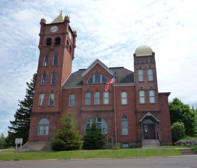
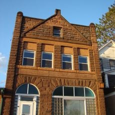
Iron County, County administrative division in Wisconsin, United States.

Description

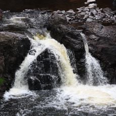
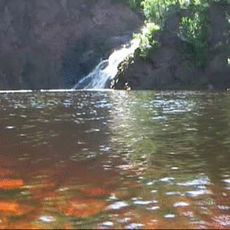
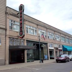
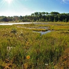
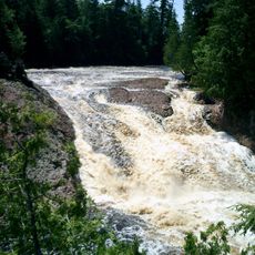
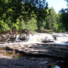
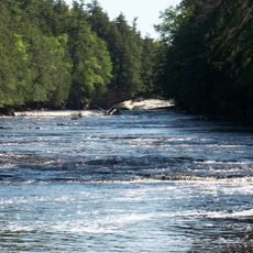
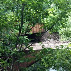
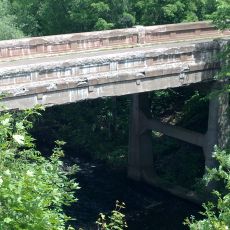
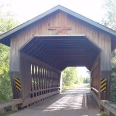
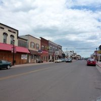
Iron County is an administrative division in northwestern Wisconsin. The landscape features thick forests, numerous lakes, and a rural character that shapes how people live and work across the region.

History

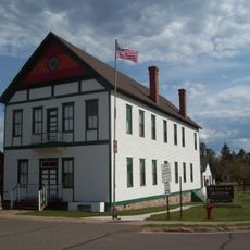
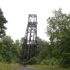
The county was established in 1893 and grew from a region known for substantial iron ore deposits. Mining shaped the area's economy and settlement patterns for many decades.

Culture

The county maintains living connections to Anishinaabe traditions through the Bad River and Lac du Flambeau reservations that occupy parts of its territory. These nations continue to shape the cultural identity of the region today.

Practical

Visitors can access the area via U.S. Highway 2 and U.S. Highway 51, which connect major communities. Traveling by car is practical, as towns are spread out with open roads between them.

Did you know?

The region is known for extensive freshwater lakes and wilderness areas that draw outdoor enthusiasts from surrounding regions. Despite these natural attractions, it remains one of the least populated areas in the state.

Location
Inception
March 1, 1893
Capital city
Hurley
Shares border with
Gogebic County, Ashland County, Vilas County, Price County
GPS coordinates
46.33000,-90.26000
Latest update
December 7, 2025 20:40

AroundUs brings together thousands of curated places, local tips, and hidden gems, enriched daily by 60,000 contributors worldwide. Discover all places nearby (Wisconsin).

Around this place
Copper Falls State Park
United States of America

Copper Falls State Park

29.9 km
United States of America

Northern Highland-American Legion State Forest

56.2 km
United States of America

Powell Marsh Wildlife Area

41 km
Superior Falls
United States of America

Superior Falls

28.5 km
Ironwood Theatre
United States of America

Ironwood Theatre

15.4 km
United States of America

Kakagon Sloughs

52.2 km
Black Tern Bog State Natural Area
United States of America

Black Tern Bog State Natural Area

59.3 km
Great Conglomerate Falls
United States of America

Great Conglomerate Falls

37.1 km
Manido Falls
United States of America

Manido Falls

47.2 km
Nawadaha Falls
United States of America

Nawadaha Falls

46.6 km
Ironwood Memorial/Municipal Building
United States of America

Ironwood Memorial/Municipal Building

15.7 km
Ironwood Carnegie Library
United States of America

Ironwood Carnegie Library

15.2 km
Gogebic County Courthouse
United States of America

Gogebic County Courthouse

23.2 km
Solomon S. Curry House
United States of America

Solomon S. Curry House

15.9 km
Annala Round Barn
United States of America

Annala Round Barn

12.4 km
Rice Creek State Natural Area
United States of America

Rice Creek State Natural Area

43.5 km
Fifield Fire Lookout Tower
United States of America

Fifield Fire Lookout Tower

49.6 km
Old Iron County Courthouse
United States of America

Old Iron County Courthouse

14.4 km
Mellen City Hall
United States of America

Mellen City Hall

30.7 km
Fifield Town Hall
United States of America

Fifield Town Hall

51.9 km
Marion Park Pavilion
United States of America

Marion Park Pavilion

33.5 km
Plummer Mine Headframe
United States of America

Plummer Mine Headframe

8.9 km
Planter Road – Jackson Creek Bridge
United States of America

Planter Road – Jackson Creek Bridge

30.2 km
Glidden State Bank
United States of America

Glidden State Bank

32.3 km
Lake Gogebic State Park
United States of America

Lake Gogebic State Park

54.4 km
Lake Gogebic
United States of America

Lake Gogebic

55.3 km
Main Street – Black River Bridge
United States of America

Main Street – Black River Bridge

25.5 km
Smith Rapids Covered Bridge
United States of America

Smith Rapids Covered Bridge

47.2 km
Show the full map
Administrative divisions
« Iron County - County administrative division in Wisconsin, United States » is provided by Around Us (aroundus.com). Images and texts are derived from Wikimedia project under a Creative Commons license. You are allowed to copy, distribute, and modify copies of this page, under the conditions set by the license, as long as this note is clearly visible.

Discover hidden gems everywhere you go!

From secret cafés to breathtaking viewpoints, skip the crowded tourist spots and find places that match your style. Our app makes it easy with voice search, smart filtering, route optimization, and insider tips from travelers worldwide. Download now for the complete mobile experience.

Around Us App Screenshot

A unique approach to discovering new places

Le Figaro

All the places worth exploring

France Info

A tailor-made excursion in just a few clicks

20 Minutes

Around Us
Travel Guide & Maps
Download

Send to your phone

QR Code
1

Open the camera app on your mobile.

2

Point at the QR code with your camera. A notification will appear.

3

Tap the notification to open the link.