Enable Location

We need your location to show you interesting places around you

Discover nearby places

Find interesting locations and hidden gems around you

Precise directions

Get accurate directions and distances to places

Your location is never shared with other users. It's only used when you tap the location button.

Hurley

Log in to your account

Start exploring — it's free

Trusted by 65,082 travelers worldwide

Continue with Google
Continue with Apple
or

We will send you a code to connect

By continuing, you accept our Terms and Conditions and our Privacy Policy

Check your inbox

We've sent a pincode in your inbox. Please enter the code below.

Discussion Reviews 1 Photos
20.1k Popularity

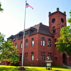
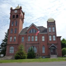
Hurley, city in and county seat of Iron County, Wisconsin, United States

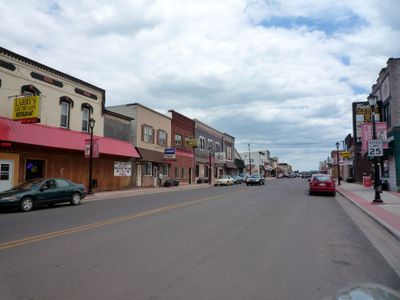
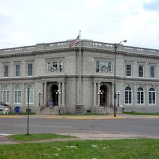
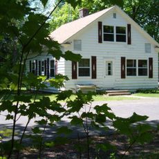
Hurley is a small city in northern Wisconsin that serves as the county seat of Iron County and has a clean, well-maintained appearance throughout. The town combines historic structures with newer additions while offering a clear sense of its long-standing presence in the region.

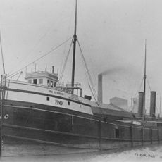
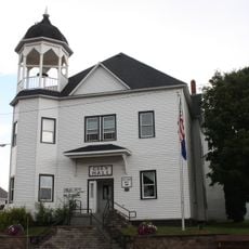
The city emerged in the late 1800s from mining and logging industries that drew many workers to the area. These industries fundamentally shaped its development and left lasting marks in buildings and infrastructure that remain visible today.

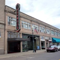
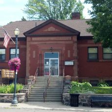
Silver Street holds stories from the mining and logging era that shaped the town, with historic buildings reflecting these industries. Residents maintain this connection through local museums and shared community stories about the area's working past.

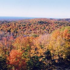
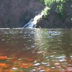
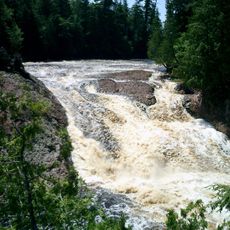
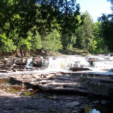
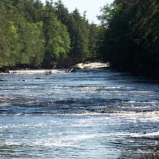
The city is easy to reach via US Route 77 and serves as a good base for exploring the region's lakes, forests, and hills. The nearby small airport makes arrival straightforward for visitors who do not have local ground transportation.

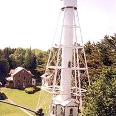
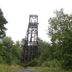
The Plummer Mine Headframe is the last steel structure of its kind remaining in Wisconsin, built in 1904 and standing about 80 feet tall. The shaft extended deep underground to move miners and equipment, closing in 1924 but now standing as a reminder of the area's mining heritage.

The community of curious travelers

AroundUs brings together thousands of curated places, local tips, and hidden gems, enriched daily by 60,000 contributors worldwide.

Start exploring
Location
Elevation above the sea
456 m
GPS coordinates
46.45028,-90.18972
Latest update
February 16, 2026 22:00
Around this place
Porcupine Mountains
United States of America

Porcupine Mountains

48.7 km
Copper Falls State Park
United States of America

Copper Falls State Park

35.8 km
SS Ira H. Owen
United States of America

SS Ira H. Owen

50 km
United States of America

Powell Marsh Wildlife Area

48.4 km
Michigan Island Light
United States of America

Michigan Island Light

52.4 km
Superior Falls
United States of America

Superior Falls

21.3 km
Ironwood Theatre
United States of America

Ironwood Theatre

1.6 km
United States of America

Kakagon Sloughs

48.3 km
Great Conglomerate Falls
United States of America

Great Conglomerate Falls

22.7 km
Manido Falls
United States of America

Manido Falls

32.8 km
Nawadaha Falls
United States of America

Nawadaha Falls

32.3 km
Ironwood Memorial/Municipal Building
United States of America

Ironwood Memorial/Municipal Building

1.9 km
Ironwood Carnegie Library
United States of America

Ironwood Carnegie Library

1.4 km
Gogebic County Courthouse
United States of America

Gogebic County Courthouse

11.1 km
Solomon S. Curry House
United States of America

Solomon S. Curry House

2.3 km
Annala Round Barn
United States of America

Annala Round Barn

4.2 km
Rice Creek State Natural Area
United States of America

Rice Creek State Natural Area

46.5 km
Old Iron County Courthouse
United States of America

Old Iron County Courthouse

582 m
Bergland Administrative Site
United States of America

Bergland Administrative Site

49.5 km
Mellen City Hall
United States of America

Mellen City Hall

38.6 km
Marion Park Pavilion
United States of America

Marion Park Pavilion

46.7 km
Plummer Mine Headframe
United States of America

Plummer Mine Headframe

9.2 km
Planter Road – Jackson Creek Bridge
United States of America

Planter Road – Jackson Creek Bridge

18.2 km
Glidden State Bank
United States of America

Glidden State Bank

45.7 km
Lake Gogebic State Park
United States of America

Lake Gogebic State Park

47.1 km
Porcupine Mountains Wilderness State Park
United States of America

Porcupine Mountains Wilderness State Park

49.7 km
Lake Gogebic
United States of America

Lake Gogebic

46.8 km
Main Street – Black River Bridge
United States of America

Main Street – Black River Bridge

14.7 km
Show the full map
Reviews
Share your experience

No review yet

Discussions
Start a discussion...

No discussion yet

« Hurley - city in and county seat of Iron County, Wisconsin, United States » is provided by Around Us (aroundus.com). Images and texts are derived from Wikimedia project under a Creative Commons license. You are allowed to copy, distribute, and modify copies of this page, under the conditions set by the license, as long as this note is clearly visible.

Discover hidden gems everywhere you go!

From secret cafés to breathtaking viewpoints, skip the crowded tourist spots and find places that match your style. Our app makes it easy with voice search, smart filtering, route optimization, and insider tips from travelers worldwide. Download now for the complete mobile experience.

Around Us App Screenshot

A unique approach to discovering new places

Le Figaro

All the places worth exploring

France Info

A tailor-made excursion in just a few clicks

20 Minutes

Around Us
Travel Guide & Maps
Download

Send to your phone

QR Code
1

Open the camera app on your mobile.

2

Point at the QR code with your camera. A notification will appear.

3

Tap the notification to open the link.