Enable Location

We need your location to show you interesting places around you

Discover nearby places

Find interesting locations and hidden gems around you

Precise directions

Get accurate directions and distances to places

Your location is never shared with other users. It's only used when you tap the location button.

Columbia

Log in to your account

Start exploring — it's free

Trusted by 61,334 travelers worldwide

Continue with Google
Continue with Apple
or

We will send you a code to connect

By continuing, you accept our Terms and Conditions and our Privacy Policy

Check your inbox

We've sent a pincode in your inbox. Please enter the code below.

Columbia, Educational center in Missouri, United States.

Description

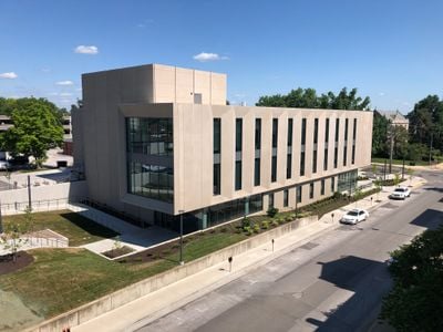
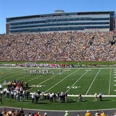
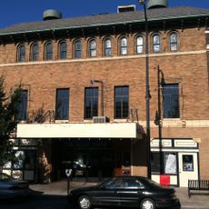
Columbia lies in central Missouri at an elevation of 757 feet (231 meters) and serves as the seat of Boone County. The city consists of several residential neighborhoods, a commercial center, and three large universities connected by public parks and wide avenues.

History

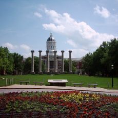
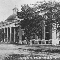
The settlement began in 1821 as a trading post on the route westward. With the founding of the University of Missouri, the town developed into an educational center for the region.

Culture

The name comes from Christopher Columbus and was chosen in 1821 by settlers from Kentucky. Many residents gather in downtown coffee shops or visit weekend farmers markets where local producers sell their goods.

Practical

Buses connect residential areas with downtown and campus districts throughout Boone County. Most streets are flat and allow easy walking or cycling between different parts of town.

Did you know?

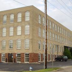
In the North Village Arts District, over seventy artists work in former warehouses and workshops. Visitors can walk through open studios and speak directly with creators painting, throwing pottery, or welding on site.

Location
Inception
1821
Elevation above the sea
231 m
GPS coordinates
38.95188,-92.33374
Latest update
December 15, 2025 03:08

AroundUs brings together thousands of curated places, local tips, and hidden gems, enriched daily by 60,000 contributors worldwide. Discover all places nearby (Boone County).

Around this place
Faurot Field
United States of America

Faurot Field

1.8 km
Mizzou Arena
United States of America

Mizzou Arena

2.2 km
Francis Quadrangle
United States of America

Francis Quadrangle

767 m
The Blue Note
United States of America

The Blue Note

532 m
Academic Hall
United States of America

Academic Hall

754 m
State Historical Society of Missouri
United States of America

State Historical Society of Missouri

1.1 km
Rock Bridge Memorial State Park
United States of America

Rock Bridge Memorial State Park

7.9 km
United States of America

Memorial Union

1.1 km
United States of America

Museum of Art and Archaeology

761 m
United States of America

Missouri Theatre Center for the Arts

619 m
Sanford F. Conley House
United States of America

Sanford F. Conley House

889 m
Sanborn Field
United States of America

Sanborn Field

1.6 km
Welch Hall
United States of America

Welch Hall

801 m
Frederick Douglass High School
United States of America

Frederick Douglass High School

352 m
United States of America

Boone County Historical Society

6 km
United States of America

Switzler Hall

684 m
Coca-Cola Bottling Company Building
United States of America

Coca-Cola Bottling Company Building

765 m
Hamilton-Brown Shoe Factory
United States of America

Hamilton-Brown Shoe Factory

1.4 km
Boone County Courthouse
United States of America

Boone County Courthouse

435 m
Mizzou Botanic Garden
United States of America

Mizzou Botanic Garden

848 m
Sigma Alpha Epsilon Fraternity House
United States of America

Sigma Alpha Epsilon Fraternity House

662 m
Stephens College South Campus Historic District
United States of America

Stephens College South Campus Historic District

903 m
David Guitar House
United States of America

David Guitar House

4 km
United States of America

Cosmo Park

3.5 km
John W. Boone House
United States of America

John W. Boone House

114 m
Samuel H. and Isabel Smith Elkins House
United States of America

Samuel H. and Isabel Smith Elkins House

736 m
Greenwood
United States of America

Greenwood

4.7 km
St. Paul A.M.E. Church
United States of America

St. Paul A.M.E. Church

373 m
Show the full map
« Columbia - Educational center in Missouri, United States » is provided by Around Us (aroundus.com). Images and texts are derived from Wikimedia project under a Creative Commons license. You are allowed to copy, distribute, and modify copies of this page, under the conditions set by the license, as long as this note is clearly visible.

Discover hidden gems everywhere you go!

From secret cafés to breathtaking viewpoints, skip the crowded tourist spots and find places that match your style. Our app makes it easy with voice search, smart filtering, route optimization, and insider tips from travelers worldwide. Download now for the complete mobile experience.

Around Us App Screenshot

A unique approach to discovering new places

Le Figaro

All the places worth exploring

France Info

A tailor-made excursion in just a few clicks

20 Minutes

Around Us
Travel Guide & Maps
Download

Send to your phone

QR Code
1

Open the camera app on your mobile.

2

Point at the QR code with your camera. A notification will appear.

3

Tap the notification to open the link.