Boone County

Log in to your account

AroundUs is a community-driven map of interesting places, built by curious explorers like you. It grows with every review, story, and photo you share.
Connect to save your favorite spots, contribute locations, and create personalized routes.
Continue with Google
Continue with Apple
Continue with X
Continue with Facebook
Continue with email
By continuing, you accept our Terms and Conditions and our Privacy Policy
Create an account
Add to collection
Map
Suggest a change
Share

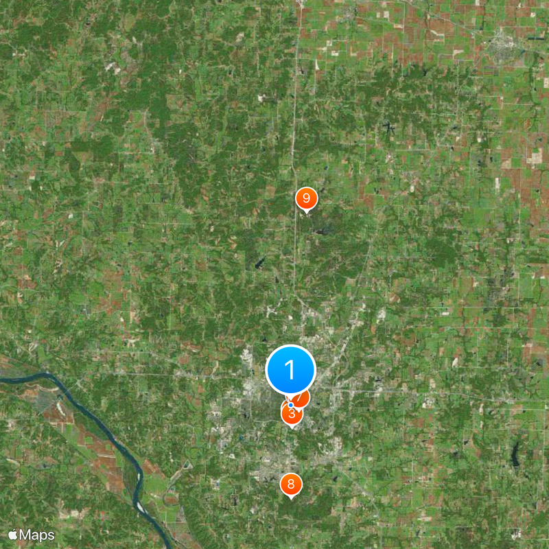
Boone County, Administrative county in Central Missouri, United States

Boone County is an administrative county in central Missouri with rolling hills, prairies, and the Missouri River marking its southern edge. The landscape shifts between open plains and forested areas, with Columbia as its largest city serving as the regional hub.

The county was established in 1820 and named after explorer Daniel Boone, whose family worked in the region. Early settlement focused on natural resources and farming, which laid the foundation for later development.

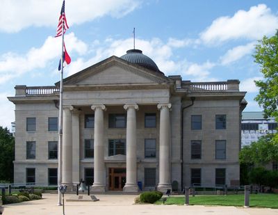
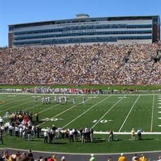
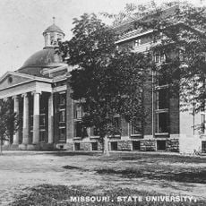
The University of Missouri shapes daily life here and attracts people from around the world. Its presence has influenced the region's character and opportunities for many generations.

Columbia, the county seat, offers various facilities including hospitals, shopping districts, and transportation access through Interstate 70 and US Route 63. The best time to visit is during milder seasons when weather is pleasant and outdoor activities are more enjoyable.

The county's volunteer fire protection district ranks among Missouri's largest and is staffed primarily by local volunteers. This organization shows how communities work together to keep residents safe.

Location: Missouri

Inception: November 16, 1820

Capital city: Columbia

Shares border with: Randolph County, Cole County, Moniteau County, Howard County, Cooper County, Audrain County, Callaway County

Website: http://showmeboone.com

GPS coordinates: 38.94833,-92.33389

Latest update: December 20, 2025 02:02

Photos
Around this place
Faurot Field
United States of America

Faurot Field

1.4 km
Mizzou Arena
United States of America

Mizzou Arena

1.8 km
Francis Quadrangle
United States of America

Francis Quadrangle

499 m
The Blue Note
United States of America

The Blue Note

694 m
Academic Hall
United States of America

Academic Hall

495 m
State Historical Society of Missouri
United States of America

State Historical Society of Missouri

805 m
Rock Bridge Memorial State Park
United States of America

Rock Bridge Memorial State Park

7.5 km
Finger Lakes State Park
United States of America

Finger Lakes State Park

15.8 km
United States of America

Memorial Union

831 m
United States of America

Museum of Art and Archaeology

541 m
United States of America

Missouri Theatre Center for the Arts

561 m
Sanford F. Conley House
United States of America

Sanford F. Conley House

522 m
Sanborn Field
United States of America

Sanborn Field

1.4 km
Welch Hall
United States of America

Welch Hall

476 m
Frederick Douglass High School
United States of America

Frederick Douglass High School

746 m
United States of America

Boone County Historical Society

5.7 km
United States of America

Switzler Hall

432 m
Albert Bishop Chance House and Gardens
United States of America

Albert Bishop Chance House and Gardens

33.8 km
Coca-Cola Bottling Company Building
United States of America

Coca-Cola Bottling Company Building

818 m
Hamilton-Brown Shoe Factory
United States of America

Hamilton-Brown Shoe Factory

1.7 km
United States of America

Rocheport Interstate 70 Bridge

18.3 km
Boone County Courthouse
United States of America

Boone County Courthouse

688 m
Mizzou Botanic Garden
United States of America

Mizzou Botanic Garden

555 m
Chatol
United States of America

Chatol

33.3 km
Sigma Alpha Epsilon Fraternity House
United States of America

Sigma Alpha Epsilon Fraternity House

324 m
Stephens College South Campus Historic District
United States of America

Stephens College South Campus Historic District

1 km
Rocheport
United States of America

Rocheport

20.2 km
David Guitar House
United States of America

David Guitar House

4.3 km
Show the full map
Reviews

Visited this place? Tap the stars to rate it and share your experience / photos with the community! Try now! You can cancel it anytime.

Administrative divisions
« Boone County - Administrative county in Central Missouri, United States » is provided by Around Us (aroundus.com). Images and texts are derived from Wikimedia project under a Creative Commons license. You are allowed to copy, distribute, and modify copies of this page, under the conditions set by the license, as long as this note is clearly visible.

Discover hidden gems everywhere you go!

From secret cafés to breathtaking viewpoints, skip the crowded tourist spots and find places that match your style. Our app makes it easy with voice search, smart filtering, route optimization, and insider tips from travelers worldwide. Download now for the complete mobile experience.

Around Us App Screenshot

A unique approach to discovering new places

Le Figaro

All the places worth exploring

France Info

A tailor-made excursion in just a few clicks

20 Minutes