Enable Location

We need your location to show you interesting places around you

Discover nearby places

Find interesting locations and hidden gems around you

Precise directions

Get accurate directions and distances to places

Your location is never shared with other users. It's only used when you tap the location button.

Madison County

Log in to your account

Start exploring — it's free

Trusted by 61,748 travelers worldwide

Continue with Google
Continue with Apple
or

We will send you a code to connect

By continuing, you accept our Terms and Conditions and our Privacy Policy

Check your inbox

We've sent a pincode in your inbox. Please enter the code below.

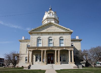
Madison County, Administrative county in Iowa, United States

Description

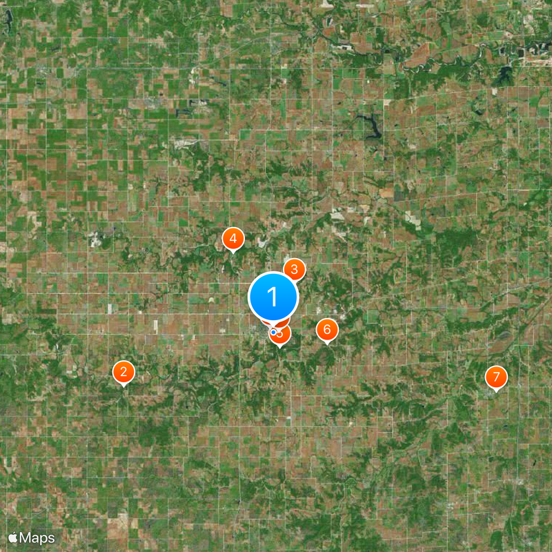
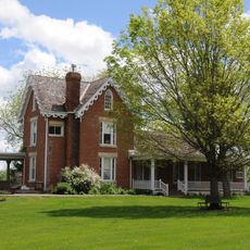
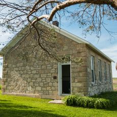
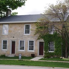
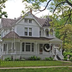
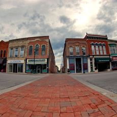
Madison County is a rural administrative county in central Iowa featuring agricultural land, small towns, and villages spread throughout its area. The county's territory is crossed by several highways that link it to neighboring regions.

History

Established in 1846 and named after President James Madison, the county followed a common naming pattern for the era. Local government organization began in 1849 as early settlers arrived.

Culture

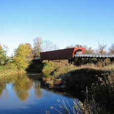
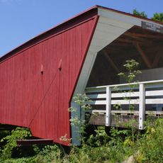
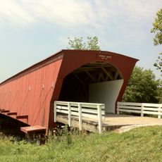
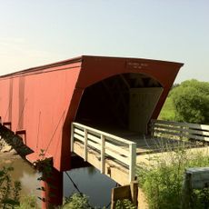
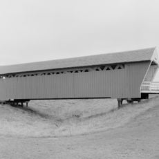
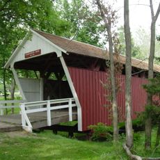
The six covered wooden bridges scattered throughout the county, including the Cedar Bridge and Roseman Bridge, demonstrate how 19th-century builders solved the problem of crossing rivers. These structures remain popular destinations for visitors exploring rural heritage.

Practical

The region is best explored by car, with major roads well distributed throughout and towns connected via routes like Interstate 80 and U.S. Highway 6. The rural character means attractions and towns are spread out rather than clustered.

Did you know?

A limestone highway tunnel exists in Pammel Park, the only one of its kind in Iowa and a rare structure in this region. This tunnel cuts through a hillside along the Middle River and surprises many visitors.

Location
Inception
1846
Capital city
Winterset
Shares border with
Dallas County, Union County, Clarke County, Adair County, Warren County, Guthrie County, Polk County
GPS coordinates
41.33000,-94.01000
Latest update
December 20, 2025 15:13

AroundUs brings together thousands of curated places, local tips, and hidden gems, enriched daily by 60,000 contributors worldwide. Discover all places nearby (Iowa).

Around this place
Roseman Covered Bridge
United States of America

Roseman Covered Bridge

12.4 km
Cedar Covered Bridge
United States of America

Cedar Covered Bridge

4.2 km
Hogback Covered Bridge
United States of America

Hogback Covered Bridge

7 km
United States of America

Clark Tower

1.2 km
Holliwell Covered Bridge
United States of America

Holliwell Covered Bridge

4.3 km
Imes Bridge
United States of America

Imes Bridge

18.1 km
Cutler–Donahoe Bridge
United States of America

Cutler–Donahoe Bridge

453 m
John Wayne Birthplace Museum
United States of America

John Wayne Birthplace Museum

428 m
St. Patrick's Church
United States of America

St. Patrick's Church

21.2 km
Madison County Courthouse
United States of America

Madison County Courthouse

658 m
Henry C. Wallace House
United States of America

Henry C. Wallace House

966 m
United States of America

Miller Bridge

10.8 km
United States of America

Hogan and Martha A. Runkle Queen House

9.9 km
C.D. Bevington House and Stone Barn
United States of America

C.D. Bevington House and Stone Barn

486 m
North River Stone Schoolhouse
United States of America

North River Stone Schoolhouse

8.5 km
United States of America

John Andrew and Sara Macumber Ice House

9.9 km
Guiberson House
United States of America

Guiberson House

744 m
United States of America

Duff Barn

4.2 km
W.J. and Nettie J. Cornell House
United States of America

W.J. and Nettie J. Cornell House

1 km
Winterset Courthouse Square Commercial Historic District
United States of America

Winterset Courthouse Square Commercial Historic District

631 m
United States of America

Sprague, Brown, and Knowlton Store

594 m
United States of America

John and Amanda Bigler Drake House

17.9 km
United States of America

Cunningham Bridge

14.8 km
United States of America

Miles and Elizabeth Smith Kellogg House

2.6 km
Earlham Public School
United States of America

Earlham Public School

20.3 km
United States of America

William Ogburn House

11.5 km
United States of America

John and Fredericka Meyer Schnellbacher House

12.1 km
United States of America

Seymour Church House

8.4 km
Show the full map
Administrative divisions
« Madison County - Administrative county in Iowa, United States » is provided by Around Us (aroundus.com). Images and texts are derived from Wikimedia project under a Creative Commons license. You are allowed to copy, distribute, and modify copies of this page, under the conditions set by the license, as long as this note is clearly visible.

Discover hidden gems everywhere you go!

From secret cafés to breathtaking viewpoints, skip the crowded tourist spots and find places that match your style. Our app makes it easy with voice search, smart filtering, route optimization, and insider tips from travelers worldwide. Download now for the complete mobile experience.

Around Us App Screenshot

A unique approach to discovering new places

Le Figaro

All the places worth exploring

France Info

A tailor-made excursion in just a few clicks

20 Minutes

Around Us
Travel Guide & Maps
Download

Send to your phone

QR Code
1

Open the camera app on your mobile.

2

Point at the QR code with your camera. A notification will appear.

3

Tap the notification to open the link.