Enable Location

We need your location to show you interesting places around you

Discover nearby places

Find interesting locations and hidden gems around you

Precise directions

Get accurate directions and distances to places

Your location is never shared with other users. It's only used when you tap the location button.

Taney County

Log in to your account

Start exploring — it's free

Trusted by 61,345 travelers worldwide

Continue with Google
Continue with Apple
or

We will send you a code to connect

By continuing, you accept our Terms and Conditions and our Privacy Policy

Check your inbox

We've sent a pincode in your inbox. Please enter the code below.

Taney County, Administrative division in southwestern Missouri, United States

Description

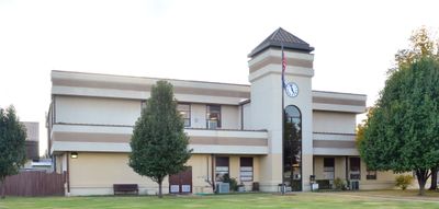
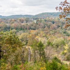
Taney County is an administrative division in southwestern Missouri that spreads across forested hills with rivers and lakes throughout. Forsyth serves as the county seat and lies centrally in the region, while major highways like U.S. Route 65 cross through the area.

History

The county was established in 1837 and named after Roger Brooke Taney, a leading Supreme Court justice of the nation. Its creation reflected the period of westward expansion and the building of new administrative structures in the Midwest.

Culture

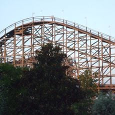
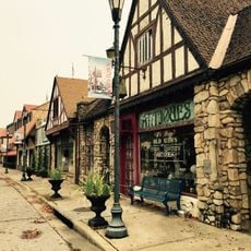
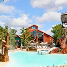
The area reflects rural traditions and local craftsmanship visible in markets and festivals throughout the year. Residents and visitors gather regularly at community events that mirror the pace and values of Ozark life.

Practical

Visitors can best explore the area by car, as main roads like U.S. Route 65 offer good connections through the region. Most services and information centers are located in Forsyth, where the main public buildings are concentrated.

Did you know?

The county borders several neighboring Missouri counties and extends southward to the Arkansas border. This border location creates a special connection between two states and shapes the local sense of place.

Location
Inception
1837
Capital city
Forsyth
Shares border with
Christian County, Boone County, Douglas County, Ozark County, Marion County, Carroll County, Stone County
GPS coordinates
36.65000,-93.04000
Latest update
December 22, 2025 12:11

AroundUs brings together thousands of curated places, local tips, and hidden gems, enriched daily by 60,000 contributors worldwide. Discover all places nearby (Missouri).

Around this place
Table Rock Lake
United States of America

Table Rock Lake

25 km
Titanic Museum
United States of America

Titanic Museum

21.5 km
United States of America

Lake Taneycomo

12.2 km
Celebration City
United States of America

Celebration City

22.9 km
United States of America

White Water Branson

23.2 km
Hollywood Wax Museum Branson
United States of America

Hollywood Wax Museum Branson

21.2 km
Table Rock State Park
United States of America

Table Rock State Park

25.1 km
Silver Dollar City's WhiteWater
United States of America

Silver Dollar City's WhiteWater

21.7 km
Ozark Wildcat
United States of America

Ozark Wildcat

22.7 km
THE TRACK Family Fun Parks (Track 4)
United States of America

THE TRACK Family Fun Parks (Track 4)

21.8 km
United States of America

Hercules Glades Wilderness

9.7 km
Shepherd of the Hills State Park
United States of America

Shepherd of the Hills State Park

23.8 km
World's Largest Toy Museum
United States of America

World's Largest Toy Museum

22.1 km
Downing Street Historic District
United States of America

Downing Street Historic District

16 km
Grand Country Fun Spot
United States of America

Grand Country Fun Spot

19.2 km
United States of America

Bonniebrook Homestead

21.1 km
Splash Country Indoor Waterpark
United States of America

Splash Country Indoor Waterpark

19.4 km
Veterans Memorial Museum
United States of America

Veterans Memorial Museum

18 km
United States of America

Samuel T. and Mary B. Parnell House

15.2 km
United States of America

Sammy Lane Resort Historic District

15.7 km
Dinosaur Museum
United States of America

Dinosaur Museum

22.1 km
United States of America

Swan Creek Bridge

6.9 km
United States of America

Branson City Park Historic District

15.5 km
United States of America

John Ross House

24 km
Presleys' Country Jubilee
United States of America

Presleys' Country Jubilee

21 km
Andy Williams Performing Arts Center and Theatre
United States of America

Andy Williams Performing Arts Center and Theatre

20.2 km
United States of America

Hughes Brothers Theatre

21.8 km
United States of America

Branson Events Center

19.4 km
Show the full map
Administrative divisions
« Taney County - Administrative division in southwestern Missouri, United States » is provided by Around Us (aroundus.com). Images and texts are derived from Wikimedia project under a Creative Commons license. You are allowed to copy, distribute, and modify copies of this page, under the conditions set by the license, as long as this note is clearly visible.

Discover hidden gems everywhere you go!

From secret cafés to breathtaking viewpoints, skip the crowded tourist spots and find places that match your style. Our app makes it easy with voice search, smart filtering, route optimization, and insider tips from travelers worldwide. Download now for the complete mobile experience.

Around Us App Screenshot

A unique approach to discovering new places

Le Figaro

All the places worth exploring

France Info

A tailor-made excursion in just a few clicks

20 Minutes

Around Us
Travel Guide & Maps
Download

Send to your phone

QR Code
1

Open the camera app on your mobile.

2

Point at the QR code with your camera. A notification will appear.

3

Tap the notification to open the link.