Chest opened
+${chestReward.xp} XP
Explorer
NOUVEAU ×${chestReward.collectible.quantity}
tapez pour fermer
Chest locked

Open chests in the app

Around Us is built for your phone — chests unlock when you walk, explore and capture nearby places.

Enable Location

We need your location to show you interesting places around you

Discover nearby places

Find interesting locations and hidden gems around you

Precise directions

Get accurate directions and distances to places

Your location is never shared with other users. It's only used when you tap the location button.

K. I. Sawyer Air Force Base

Log in to your account

Start exploring — it's free

Trusted by 72,961 travelers worldwide

Continue with Google
Continue with Apple
or

We will send you a code to connect

By continuing, you accept our Terms and Conditions and our Privacy Policy

Check your inbox

We've sent a pincode in your inbox. Please enter the code below.

K. I. Sawyer Air Force Base
Discussion Reviews 1 Photos
32.3k Popularity

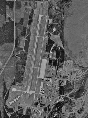
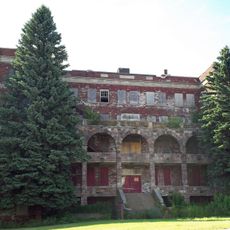
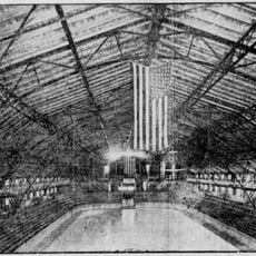
K. I. Sawyer Air Force Base, Former Air Force base in Marquette County, Michigan.

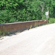
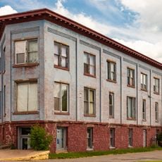
K. I. Sawyer Air Force Base is a former military installation in Michigan's Upper Peninsula with an active regional airport, featuring buildings that once served military operations and personnel. The airfield remains in use for commercial flights, while the grounds contain former barracks, hangars, and support structures from its operational days.

Built in 1944, the base served as a Strategic Air Command facility during the Cold War era until it closed in September 1995. This 50-year span shaped military operations and employment patterns across the Upper Peninsula during one of the nation's most tense historical periods.

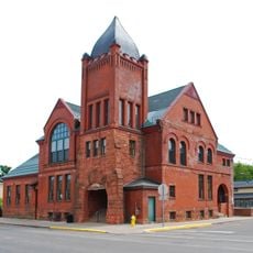
The site shaped life in this part of Michigan for generations, with military personnel and their families leaving a mark on the community. This long presence influenced how the region developed and how people here built their everyday routines.

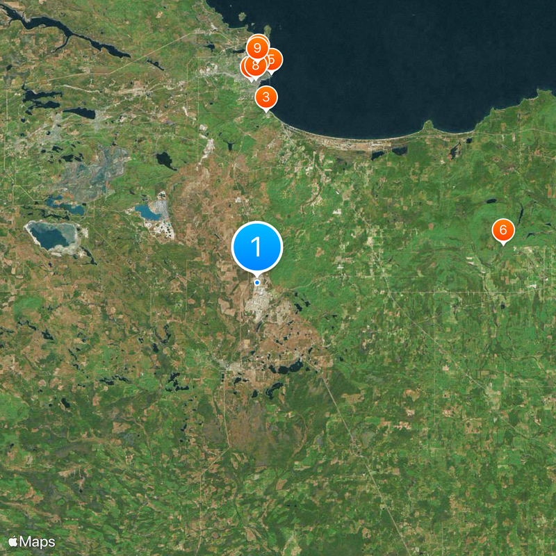
You can reach the site through Sawyer International Airport, which has regular service to surrounding regions. Before visiting, check what areas are open to the public, as parts of the former base still have restricted access for safety or cleanup work.

The grounds are undergoing environmental remediation focused on PFAS contamination in specific zones across the former installation. This cleanup work is part of broader efforts at military sites nationwide to address pollution from decades of operations.

The community of curious travelers

AroundUs brings together thousands of curated places, local tips, and hidden gems, enriched daily by 60,000 contributors worldwide.

Start exploring
Location
Inception
1944
GPS coordinates
46.35361,-87.39528
Latest update
December 20, 2025 00:35
Around this place
Superior Dome
United States of America

Superior Dome

23 km
Marquette Branch Prison
United States of America

Marquette Branch Prison

17.7 km
Holy Family Orphanage
United States of America

Holy Family Orphanage

20.8 km
Marquette Harbor Light
United States of America

Marquette Harbor Light

21.6 km
Laughing Whitefish Falls Scenic Site
United States of America

Laughing Whitefish Falls Scenic Site

25.6 km
Peter White Public Library
United States of America

Peter White Public Library

21.3 km
Marquette County Courthouse
United States of America

Marquette County Courthouse

20.9 km
Palestra, The Marquette
United States of America

Palestra, The Marquette

22.7 km
Lakenenland
United States of America

Lakenenland

24.2 km
Marquette City Hall
United States of America

Marquette City Hall

21.2 km
Lakenenland
United States of America

Lakenenland

24.2 km
Coaster II
United States of America

Coaster II

20.9 km
Savings Bank Building
United States of America

Savings Bank Building

21.1 km
Presque Isle Harbor Breakwater Light
United States of America

Presque Isle Harbor Breakwater Light

24.6 km
Call House
United States of America

Call House

21.4 km
Arch and Ridge Streets Historic District
United States of America

Arch and Ridge Streets Historic District

21.4 km
Carp River Forge
United States of America

Carp River Forge

22.8 km
Longyear Building
United States of America

Longyear Building

21.2 km
Sundberg Block
United States of America

Sundberg Block

23.3 km
King Road–Whitefish River Bridge
United States of America

King Road–Whitefish River Bridge

25.3 km
Ishpeming Municipal Building
United States of America

Ishpeming Municipal Building

25.8 km
County Road 557–West Branch Escanaba River Bridge
United States of America

County Road 557–West Branch Escanaba River Bridge

23.6 km
Cleveland Mine Engine House Number 3
United States of America

Cleveland Mine Engine House Number 3

25.2 km
Longyear Hall of Pedagogy
United States of America

Longyear Hall of Pedagogy

22.5 km
Marquette Maritime Museum
United States of America

Marquette Maritime Museum

21.4 km
Marquette Regional History Center
United States of America

Marquette Regional History Center

20.9 km
Negaunee State Bank Building
United States of America

Negaunee State Bank Building

23.1 km
Steel Bridge
United States of America

Steel Bridge

25.7 km
Show the full map
Reviews
Share your experience

No review yet

Discussions
Start a discussion...

No discussion yet

« K. I. Sawyer Air Force Base - Former Air Force base in Marquette County, Michigan » is provided by Around Us (aroundus.com). Images and texts are derived from Wikimedia project under a Creative Commons license. You are allowed to copy, distribute, and modify copies of this page, under the conditions set by the license, as long as this note is clearly visible.

Discover hidden gems everywhere you go!

From secret cafés to breathtaking viewpoints, skip the crowded tourist spots and find places that match your style. Our app makes it easy with voice search, smart filtering, route optimization, and insider tips from travelers worldwide. Download now for the complete mobile experience.

Around Us App Screenshot

A unique approach to discovering new places

Le Figaro

All the places worth exploring

France Info

A tailor-made excursion in just a few clicks

20 Minutes

Around Us
Travel Guide & Maps
Download

Send to your phone

QR Code
1

Open the camera app on your mobile.

2

Point at the QR code with your camera. A notification will appear.

3

Tap the notification to open the link.