Chest opened
+${chestReward.xp} XP
Explorer
NOUVEAU ×${chestReward.collectible.quantity}
tapez pour fermer
Chest locked

Open chests in the app

Around Us is built for your phone — chests unlock when you walk, explore and capture nearby places.

Enable Location

We need your location to show you interesting places around you

Discover nearby places

Find interesting locations and hidden gems around you

Precise directions

Get accurate directions and distances to places

Your location is never shared with other users. It's only used when you tap the location button.

Westminster

Log in to your account

Start exploring — it's free

Trusted by 72,880 travelers worldwide

Continue with Google
Continue with Apple
or

We will send you a code to connect

By continuing, you accept our Terms and Conditions and our Privacy Policy

Check your inbox

We've sent a pincode in your inbox. Please enter the code below.

Discussion Reviews 1 Photos
17.3k Popularity

Westminster, Administrative division in Orange County, California, United States

Westminster is an administrative division in Orange County, California that includes multiple neighborhoods with residential and commercial areas connected by community parks and public spaces. The city features a mixed-use layout with zones supporting daily activities and local services.

The area was originally farmland before transforming into a suburban community after its incorporation in 1957. This shift marked a turning point in the region's development and growth trajectory.

The community celebrates Lunar New Year with traditional Vietnamese performances and cultural events that reflect the strong presence of Asian-American residents. These observances shape the local character and bring people together throughout the year.

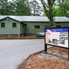
The Community Services Department operates several recreational facilities and organizes year-round programs for residents of all age groups. Visitors can easily find accessible parks and community spaces throughout the area to explore at their own pace.

The city operates under a Council-Manager system where elected officials set policy while professional administrators handle the day-to-day operations. This approach separates political decision-making from administrative implementation.

The community of curious travelers

AroundUs brings together thousands of curated places, local tips, and hidden gems, enriched daily by 60,000 contributors worldwide.

Start exploring
GPS coordinates
34.66482,-83.09654
Latest update
December 7, 2025 19:25
Around this place
Memorial Stadium, Clemson
United States of America

Memorial Stadium, Clemson

23.3 km
Littlejohn Coliseum
United States of America

Littlejohn Coliseum

23 km
Fort Hill
United States of America

Fort Hill

23.6 km
Oconee State Park
United States of America

Oconee State Park

22.5 km
Issaqueena Falls
United States of America

Issaqueena Falls

16 km
Travelers Rest
United States of America

Travelers Rest

14.5 km
President's House
United States of America

President's House

24.4 km
Clemson University Historic District I
United States of America

Clemson University Historic District I

24.1 km
Lake Hartwell State Park
United States of America

Lake Hartwell State Park

19.9 km
Lee and Lowry Hall
United States of America

Lee and Lowry Hall

23.7 km
Ram Cat Alley Historic District
United States of America

Ram Cat Alley Historic District

13.4 km
Long Creek Academy
United States of America

Long Creek Academy

19.7 km
St. John's Lutheran Church
United States of America

St. John's Lutheran Church

11.4 km
McPhail Angus Farm
United States of America

McPhail Angus Farm

18.8 km
Oconee County Cage
United States of America

Oconee County Cage

11.4 km
Stephens County Courthouse
United States of America

Stephens County Courthouse

23.5 km
Faith Cabin Library at Seneca Junior College
United States of America

Faith Cabin Library at Seneca Junior College

12.7 km
Seneca Historic District (Seneca, South Carolina)
United States of America

Seneca Historic District (Seneca, South Carolina)

13 km
Keil Farm
United States of America

Keil Farm

8.3 km
Walhalla Graded School
United States of America

Walhalla Graded School

11.7 km
James B. Simmons House
United States of America

James B. Simmons House

23.5 km
Retreat Rosenwald School
United States of America

Retreat Rosenwald School

4 km
Alexander-Hill House
United States of America

Alexander-Hill House

21.1 km
Oconee County Courthouse
United States of America

Oconee County Courthouse

11.5 km
Jarrett-Hayes House
United States of America

Jarrett-Hayes House

15.4 km
Oconee History Museum
United States of America

Oconee History Museum

11.4 km
Oconee Station State Historic Site
United States of America

Oconee Station State Historic Site

20.3 km
Oconee State Park Historic District
United States of America

Oconee State Park Historic District

22.4 km
Show the full map
Reviews
Share your experience

No review yet

Discussions
Start a discussion...

No discussion yet

« Westminster - Administrative division in Orange County, California, United States » is provided by Around Us (aroundus.com). Images and texts are derived from Wikimedia project under a Creative Commons license. You are allowed to copy, distribute, and modify copies of this page, under the conditions set by the license, as long as this note is clearly visible.

Discover hidden gems everywhere you go!

From secret cafés to breathtaking viewpoints, skip the crowded tourist spots and find places that match your style. Our app makes it easy with voice search, smart filtering, route optimization, and insider tips from travelers worldwide. Download now for the complete mobile experience.

Around Us App Screenshot

A unique approach to discovering new places

Le Figaro

All the places worth exploring

France Info

A tailor-made excursion in just a few clicks

20 Minutes

Around Us
Travel Guide & Maps
Download

Send to your phone

QR Code
1

Open the camera app on your mobile.

2

Point at the QR code with your camera. A notification will appear.

3

Tap the notification to open the link.