Enable Location

We need your location to show you interesting places around you

Discover nearby places

Find interesting locations and hidden gems around you

Precise directions

Get accurate directions and distances to places

Your location is never shared with other users. It's only used when you tap the location button.

North Bend

Log in to your account

Start exploring — it's free

Trusted by 63,623 travelers worldwide

Continue with Google
Continue with Apple
or

We will send you a code to connect

By continuing, you accept our Terms and Conditions and our Privacy Policy

Check your inbox

We've sent a pincode in your inbox. Please enter the code below.

North Bend
Discussion Reviews 1 Photos
15.3k Popularity

North Bend, village in Ohio

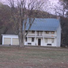
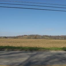
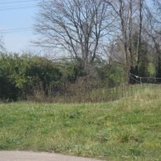
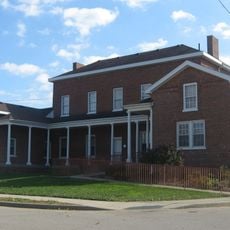
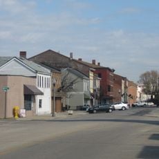
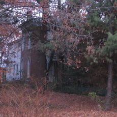
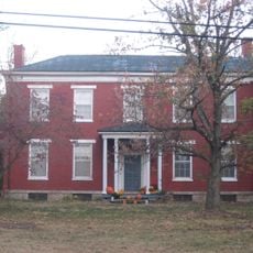
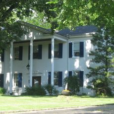
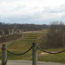
North Bend is a small village in Miami Township, Hamilton County, Ohio, located near Cincinnati. The community features well-kept homes, local streets, and parks where residents gather, with easy access to nearby areas and the Ohio River.

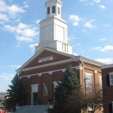
North Bend's origins connect to the distinctive northernmost bend of the Ohio River, which inspired its name. Over the years, the village developed strong local roots and became known for honoring its past through ongoing community traditions.

North Bend takes its name from the northernmost bend of the Ohio River, and this geographic connection shapes the community's identity today. The village celebrates this heritage through annual ceremonies, particularly the birthday tribute to President William Henry Harrison, which brings residents together to honor local roots.

The village's simple layout with clear maps makes it easy to navigate on foot and explore the neighborhoods at a relaxed pace. Walking along local roads offers good access to parks and the river area nearby.

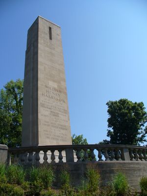
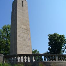
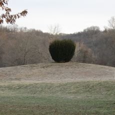
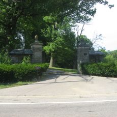
The village cemetery contains the tomb of President William Henry Harrison, giving North Bend historical significance that extends far beyond its small size. Each year residents and visitors gather for a wreath-laying ceremony at this site, honoring this important place.

The community of curious travelers

AroundUs brings together thousands of curated places, local tips, and hidden gems, enriched daily by 60,000 contributors worldwide.

Start exploring
Location
Location
Elevation above the sea
175 m
GPS coordinates
39.14970,-84.74580
Latest update
February 20, 2026 00:00
Around this place
Creation Museum
United States of America

Creation Museum

7.8 km
William Henry Harrison Tomb State Memorial
United States of America

William Henry Harrison Tomb State Memorial

596 m
Carroll Lee Cropper Bridge
United States of America

Carroll Lee Cropper Bridge

8.6 km
Shawnee Lookout Archeological District
United States of America

Shawnee Lookout Archeological District

5.3 km
Miami Whitewater Forest
United States of America

Miami Whitewater Forest

10.3 km
Story Mound
United States of America

Story Mound

6.1 km
State Line Archeological District
United States of America

State Line Archeological District

6.5 km
Mount Nebo Archaeological District
United States of America

Mount Nebo Archaeological District

4.2 km
Eighteen Mile House
United States of America

Eighteen Mile House

10.1 km
Short Woods Park Mound
United States of America

Short Woods Park Mound

5.4 km
Pine Meer
United States of America

Pine Meer

11.6 km
Dearborn County Courthouse
United States of America

Dearborn County Courthouse

11.1 km
Wesley Butler Archeological District
United States of America

Wesley Butler Archeological District

5.9 km
Episcopal Church of the Resurrection
United States of America

Episcopal Church of the Resurrection

4.5 km
Conrad Mound Archeological Site
United States of America

Conrad Mound Archeological Site

2.3 km
Vance-Tousey House
United States of America

Vance-Tousey House

11.4 km
Hugh Campbell House
United States of America

Hugh Campbell House

12.6 km
Downtown Lawrenceburg Historic District
United States of America

Downtown Lawrenceburg Historic District

10.8 km
Westwood Town Center Historic District
United States of America

Westwood Town Center Historic District

12.7 km
George Bennett House
United States of America

George Bennett House

11.2 km
Rennert Mound Archeological District
United States of America

Rennert Mound Archeological District

5.5 km
Hamline Chapel United Methodist Church
United States of America

Hamline Chapel United Methodist Church

10.9 km
Roudebush Farm
United States of America

Roudebush Farm

10.2 km
Thomas Miller House
United States of America

Thomas Miller House

5.9 km
Village of Addyston Historic District
United States of America

Village of Addyston Historic District

3.2 km
W. L. Williams House
United States of America

W. L. Williams House

12.9 km
John Aston Warder House
United States of America

John Aston Warder House

1.5 km
Jehu John House
United States of America

Jehu John House

12.8 km
Show the full map
Reviews
Share your experience

No review yet

Discussions
Start a discussion...

No discussion yet

« North Bend - village in Ohio » is provided by Around Us (aroundus.com). Images and texts are derived from Wikimedia project under a Creative Commons license. You are allowed to copy, distribute, and modify copies of this page, under the conditions set by the license, as long as this note is clearly visible.

Discover hidden gems everywhere you go!

From secret cafés to breathtaking viewpoints, skip the crowded tourist spots and find places that match your style. Our app makes it easy with voice search, smart filtering, route optimization, and insider tips from travelers worldwide. Download now for the complete mobile experience.

Around Us App Screenshot

A unique approach to discovering new places

Le Figaro

All the places worth exploring

France Info

A tailor-made excursion in just a few clicks

20 Minutes

Around Us
Travel Guide & Maps
Download

Send to your phone

QR Code
1

Open the camera app on your mobile.

2

Point at the QR code with your camera. A notification will appear.

3

Tap the notification to open the link.