Chest opened
+${chestReward.xp} XP
Explorer
NOUVEAU ×${chestReward.collectible.quantity}
tapez pour fermer
Chest locked

Open chests in the app

Around Us is built for your phone — chests unlock when you walk, explore and capture nearby places.

Enable Location

We need your location to show you interesting places around you

Discover nearby places

Find interesting locations and hidden gems around you

Precise directions

Get accurate directions and distances to places

Your location is never shared with other users. It's only used when you tap the location button.

Pomme de Terre Lake

Log in to your account

Start exploring — it's free

Trusted by 72,881 travelers worldwide

Continue with Google
Continue with Apple
or

We will send you a code to connect

By continuing, you accept our Terms and Conditions and our Privacy Policy

Check your inbox

We've sent a pincode in your inbox. Please enter the code below.

Pomme de Terre Lake
Discussion Reviews 1 Photos
14.6k Popularity

Pomme de Terre Lake, Recreational lake in southwest Missouri, United States

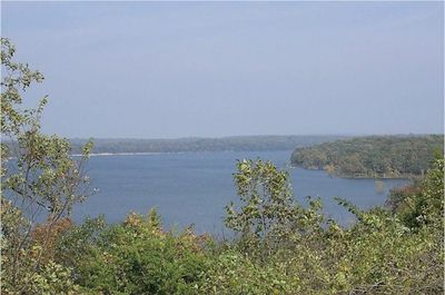
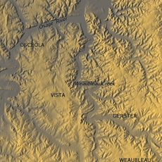
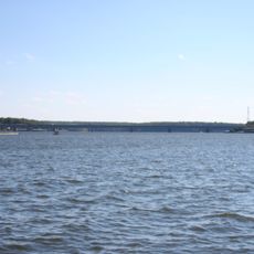
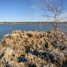
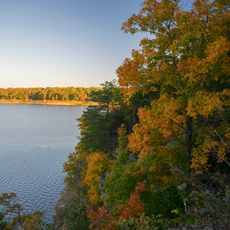
Pomme de Terre Lake is a reservoir in southwest Missouri featuring two main arms that branch into the surrounding landscape. The water body includes beaches, coves, and multiple access points designed for various water-based activities.

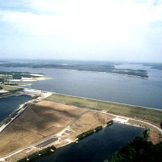
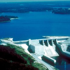
Construction of the reservoir started in 1957 by the United States Army Corps of Engineers and finished in 1961. The project served purposes of recreation and flood control for the surrounding area.

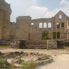
The name comes from French settlers who called the river "Pomme de Terre," meaning potato or earth-apple. This naming reflects the early French presence that shaped the region's heritage.

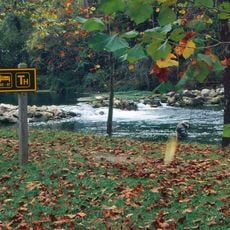
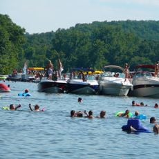
The lake provides camping grounds, public swimming areas, and boat launch ramps for water recreation. Visitors can find accessible spots for fishing, swimming, or boating based on their preferences.

The lake maintains a healthy muskellunge fish population through long-running breeding programs. These fish attract anglers seeking one of the most challenging species to catch in the region.

The community of curious travelers

AroundUs brings together thousands of curated places, local tips, and hidden gems, enriched daily by 60,000 contributors worldwide.

Start exploring
Location
Elevation above the sea
256 m
GPS coordinates
37.90167,-93.32028
Latest update
December 7, 2025 20:20
Around this place
Party Cove
United States of America

Party Cove

62.4 km
Ha Ha Tonka State Park
United States of America

Ha Ha Tonka State Park

49.6 km
Truman Reservoir
United States of America

Truman Reservoir

40.9 km
Stockton Lake
United States of America

Stockton Lake

49 km
Bennett Spring State Park
United States of America

Bennett Spring State Park

45.6 km
Lake of the Ozarks State Park
United States of America

Lake of the Ozarks State Park

62.4 km
Weaubleau structure
United States of America

Weaubleau structure

28.9 km
Grand Glaize Bridge
United States of America

Grand Glaize Bridge

64.7 km
Bridal Cave
United States of America

Bridal Cave

49.5 km
Pomme de Terre State Park
United States of America

Pomme de Terre State Park

3.4 km
Harry S Truman State Park
United States of America

Harry S Truman State Park

43.3 km
Upper Bridge
United States of America

Upper Bridge

38.6 km
Caplinger Mills Historic District
United States of America

Caplinger Mills Historic District

44.2 km
George Dimmitt Memorial Hospital
United States of America

George Dimmitt Memorial Hospital

25.4 km
Ralph E. Burley House
United States of America

Ralph E. Burley House

63.2 km
Bolivar Public Library
United States of America

Bolivar Public Library

33.1 km
Wallace House
United States of America

Wallace House

62.7 km
Ploger-Moneymaker Place
United States of America

Ploger-Moneymaker Place

62.6 km
Fiery Fork Conservation Area
United States of America

Fiery Fork Conservation Area

38.1 km
Big Surf Waterpark
United States of America

Big Surf Waterpark

58.1 km
Stockton Community Building
United States of America

Stockton Community Building

47.5 km
Boegel and Hine Flour Mill-Wommack Mill
United States of America

Boegel and Hine Flour Mill-Wommack Mill

59.6 km
Glasgow Commercial Historic District
United States of America

Glasgow Commercial Historic District

58.6 km
South Main Street Historic District
United States of America

South Main Street Historic District

41.5 km
Bennett Spring Dining Lodge
United States of America

Bennett Spring Dining Lodge

45.2 km
Camden County Historical Society
United States of America

Camden County Historical Society

55.4 km
Bennett Spring State Park Shelter House and Water Gauge Station
United States of America

Bennett Spring State Park Shelter House and Water Gauge Station

45.6 km
SLSF Sac River Bridge
United States of America

SLSF Sac River Bridge

47.7 km
Show the full map
Reviews
Share your experience

No review yet

Discussions
Start a discussion...

No discussion yet

« Pomme de Terre Lake - Recreational lake in southwest Missouri, United States » is provided by Around Us (aroundus.com). Images and texts are derived from Wikimedia project under a Creative Commons license. You are allowed to copy, distribute, and modify copies of this page, under the conditions set by the license, as long as this note is clearly visible.

Discover hidden gems everywhere you go!

From secret cafés to breathtaking viewpoints, skip the crowded tourist spots and find places that match your style. Our app makes it easy with voice search, smart filtering, route optimization, and insider tips from travelers worldwide. Download now for the complete mobile experience.

Around Us App Screenshot

A unique approach to discovering new places

Le Figaro

All the places worth exploring

France Info

A tailor-made excursion in just a few clicks

20 Minutes

Around Us
Travel Guide & Maps
Download

Send to your phone

QR Code
1

Open the camera app on your mobile.

2

Point at the QR code with your camera. A notification will appear.

3

Tap the notification to open the link.