Enable Location

We need your location to show you interesting places around you

Discover nearby places

Find interesting locations and hidden gems around you

Precise directions

Get accurate directions and distances to places

Your location is never shared with other users. It's only used when you tap the location button.

Caesars Head State Park

Log in to your account

Start exploring — it's free

Trusted by 60,654 travelers worldwide

Continue with Google
Continue with Apple
or

We will send you a code to connect

By continuing, you accept our Terms and Conditions and our Privacy Policy

Check your inbox

We've sent a pincode in your inbox. Please enter the code below.

Caesars Head State Park, State park in Greenville County, United States.

Description

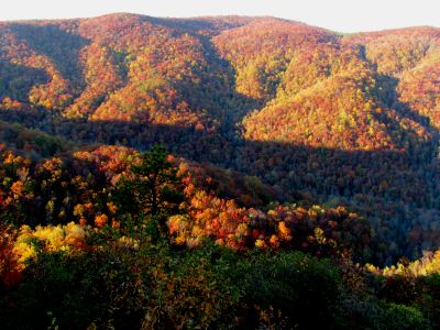
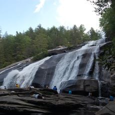
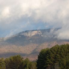
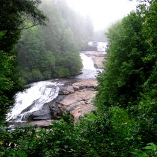
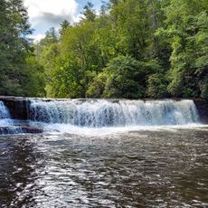
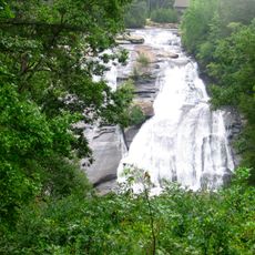
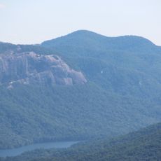
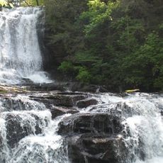
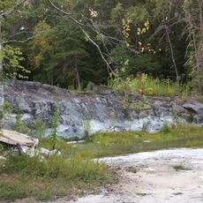
Caesars Head State Park is a nature reserve featuring a granitic gneiss outcropping at 3,208 feet elevation that offers wide views across the Blue Ridge Mountains and the Piedmont region. The park contains more than 60 miles of trails, including the popular Raven Cliff Falls path descending to a 420-foot waterfall through mountain forest.

History

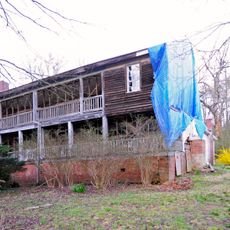
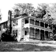
The area began as a private summer retreat with a hotel founded in 1848 that served wealthy visitors from the region. It became a protected state park in 1976 to preserve the natural landscapes for public access and recreation.

Culture

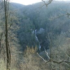
In autumn, the overlook becomes a gathering spot for bird watchers who observe the migration of thousands of hawks moving through the mountain wilderness. The location has turned into an important meeting place for nature enthusiasts tracking this seasonal bird passage.

Practical

Trails vary in difficulty, and the most popular paths can get crowded, especially during autumn migration season. Weekday visits outside the peak migration period offer a more solitary experience on the routes.

Did you know?

A suspension bridge crosses above Raven Cliff Falls, giving visitors an elevated vantage point over the water dropping into the mountain cove. This engineering feature allows viewpoints that would be impossible to experience from the forest floor.

Inception
1976
GPS coordinates
35.11670,-82.60000
Latest update
December 8, 2025 19:54

AroundUs brings together thousands of curated places, local tips, and hidden gems, enriched daily by 60,000 contributors worldwide. Discover all places nearby (Greenville County).

Around this place
Sassafras Mountain
United States of America

Sassafras Mountain

17.1 km
DuPont State Forest
United States of America

DuPont State Forest

9 km
Table Rock State Park
United States of America

Table Rock State Park

13.2 km
Triple Falls
United States of America

Triple Falls

9.2 km
Bridal Veil Falls
United States of America

Bridal Veil Falls

7 km
Hooker Falls
United States of America

Hooker Falls

9.8 km
High Falls
United States of America

High Falls

8.6 km
Pinnacle Mountain
United States of America

Pinnacle Mountain

15.9 km
Raven Cliff Falls
United States of America

Raven Cliff Falls

5.7 km
Connestee Falls and Batson Creek Falls
United States of America

Connestee Falls and Batson Creek Falls

13.1 km
Key Falls
United States of America

Key Falls

16.4 km
Holmes Educational State Forest
United States of America

Holmes Educational State Forest

14 km
John H. Goodwin House
United States of America

John H. Goodwin House

13.9 km
Table Rock Civilian Conservation Corps Camp Site
United States of America

Table Rock Civilian Conservation Corps Camp Site

13.9 km
Silvermont
United States of America

Silvermont

17.2 km
St. Philip's Episcopal Church
United States of America

St. Philip's Episcopal Church

17.5 km
George Salmon House
United States of America

George Salmon House

15.8 km
Charles E. Orr House
United States of America

Charles E. Orr House

17.4 km
Dillard B. and Georgia Sewell House
United States of America

Dillard B. and Georgia Sewell House

16 km
Godfrey-Barnette House
United States of America

Godfrey-Barnette House

17.5 km
Civilian Conservation Corps Quarry No. 2
United States of America

Civilian Conservation Corps Quarry No. 2

16.6 km
Roper House Complex
United States of America

Roper House Complex

13.5 km
Royal and Louise Morrow House
United States of America

Royal and Louise Morrow House

16.9 km
Transylvania County Courthouse
United States of America

Transylvania County Courthouse

17.8 km
William H. Grogan House
United States of America

William H. Grogan House

16.3 km
Main Street Historic District
United States of America

Main Street Historic District

17.8 km
Hanckel-Barclay House
United States of America

Hanckel-Barclay House

14.8 km
Max and Claire Brombacher House
United States of America

Max and Claire Brombacher House

16.8 km
Show the full map
« Caesars Head State Park - State park in Greenville County, United States » is provided by Around Us (aroundus.com). Images and texts are derived from Wikimedia project under a Creative Commons license. You are allowed to copy, distribute, and modify copies of this page, under the conditions set by the license, as long as this note is clearly visible.

Discover hidden gems everywhere you go!

From secret cafés to breathtaking viewpoints, skip the crowded tourist spots and find places that match your style. Our app makes it easy with voice search, smart filtering, route optimization, and insider tips from travelers worldwide. Download now for the complete mobile experience.

Around Us App Screenshot

A unique approach to discovering new places

Le Figaro

All the places worth exploring

France Info

A tailor-made excursion in just a few clicks

20 Minutes

Around Us
Travel Guide & Maps
Download

Send to your phone

QR Code
1

Open the camera app on your mobile.

2

Point at the QR code with your camera. A notification will appear.

3

Tap the notification to open the link.