Enable Location

We need your location to show you interesting places around you

Discover nearby places

Find interesting locations and hidden gems around you

Precise directions

Get accurate directions and distances to places

Your location is never shared with other users. It's only used when you tap the location button.

Table Rock State Park

Log in to your account

Start exploring — it's free

Trusted by 61,750 travelers worldwide

Continue with Google
Continue with Apple
or

We will send you a code to connect

By continuing, you accept our Terms and Conditions and our Privacy Policy

Check your inbox

We've sent a pincode in your inbox. Please enter the code below.

Table Rock State Park, State park and nature reserve in Pickens County, South Carolina

Description

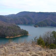
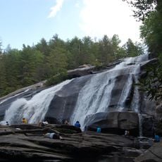
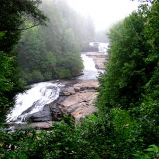
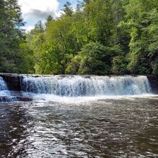
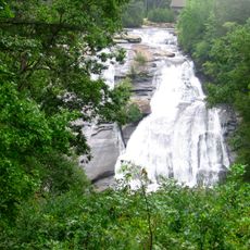
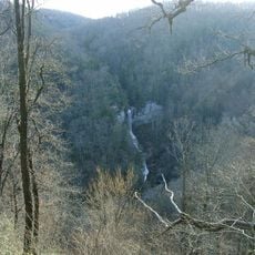
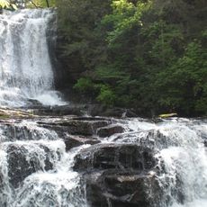
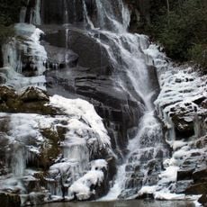
Table Rock State Park is a state park and nature reserve in Pickens County, South Carolina, covering roughly 5 square miles (12 square kilometers). Situated at the base of Table Rock Mountain, the park includes dense forests, streams, waterfalls, and two lakes connected by a network of hiking trails.

History

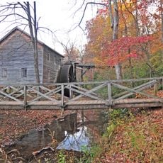
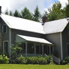
During the 1930s, the Civilian Conservation Corps built cabins, lodges, and trails throughout the park as part of Depression-era employment programs. These structures were constructed using local materials and continue to define the park's appearance today.

Culture

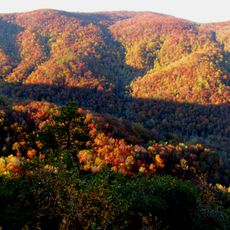
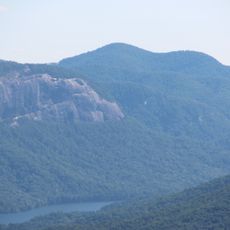
The name Table Rock comes from the flat summit shape of the mountain, which early travelers compared to a tabletop. Hikers today use the trails leading to overlooks where they can take in views across the Blue Ridge landscape.

Practical

Hikers should bring sturdy footwear, as trails can be steep and rocky, especially on higher sections. The two lakes are located near the park entrance and are easily accessible, while more demanding routes lead deeper into the backcountry.

Did you know?

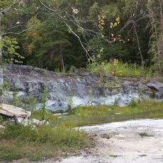
The granite dome of Table Rock Mountain rises roughly 2,000 feet (600 meters) above the valley floor, forming a natural landmark visible from great distances. Petroglyphs discovered in the late 1990s offer evidence of earlier use by indigenous peoples.

Location
Inception
1935
GPS coordinates
35.03590,-82.70590
Latest update
December 5, 2025 22:31

AroundUs brings together thousands of curated places, local tips, and hidden gems, enriched daily by 60,000 contributors worldwide. Discover all places nearby (South Carolina).

Around this place
Lake Jocassee
United States of America

Lake Jocassee

21.2 km
Sassafras Mountain
United States of America

Sassafras Mountain

7.3 km
DuPont State Forest
United States of America

DuPont State Forest

20.6 km
Triple Falls
United States of America

Triple Falls

19.8 km
Caesars Head State Park
United States of America

Caesars Head State Park

13.2 km
Bridal Veil Falls
United States of America

Bridal Veil Falls

17.5 km
Hooker Falls
United States of America

Hooker Falls

20 km
High Falls
United States of America

High Falls

19.4 km
Pinnacle Mountain
United States of America

Pinnacle Mountain

3.3 km
United States of America

Glassy Mountain

15.6 km
Raven Cliff Falls
United States of America

Raven Cliff Falls

8.7 km
Hagood Mill
United States of America

Hagood Mill

12.2 km
Connestee Falls and Batson Creek Falls
United States of America

Connestee Falls and Batson Creek Falls

14.4 km
Eastatoe Falls
United States of America

Eastatoe Falls

13.2 km
Table Rock Civilian Conservation Corps Camp Site
United States of America

Table Rock Civilian Conservation Corps Camp Site

1.7 km
Griffin-Christopher House
United States of America

Griffin-Christopher House

16.9 km
Old Pickens Jail
United States of America

Old Pickens Jail

17.3 km
Silvermont
United States of America

Silvermont

21.6 km
Hagood-Mauldin House
United States of America

Hagood-Mauldin House

16.8 km
Charles E. Orr House
United States of America

Charles E. Orr House

21.9 km
Flem Galloway House
United States of America

Flem Galloway House

16.3 km
Godfrey-Barnette House
United States of America

Godfrey-Barnette House

21.5 km
Civilian Conservation Corps Quarry No. 2
United States of America

Civilian Conservation Corps Quarry No. 2

3.6 km
Roper House Complex
United States of America

Roper House Complex

2 km
Royal and Louise Morrow House
United States of America

Royal and Louise Morrow House

21.3 km
William H. Grogan House
United States of America

William H. Grogan House

21.2 km
Hanckel-Barclay House
United States of America

Hanckel-Barclay House

17.8 km
Max and Claire Brombacher House
United States of America

Max and Claire Brombacher House

21.2 km
Show the full map
« Table Rock State Park - State park and nature reserve in Pickens County, South Carolina » is provided by Around Us (aroundus.com). Images and texts are derived from Wikimedia project under a Creative Commons license. You are allowed to copy, distribute, and modify copies of this page, under the conditions set by the license, as long as this note is clearly visible.

Discover hidden gems everywhere you go!

From secret cafés to breathtaking viewpoints, skip the crowded tourist spots and find places that match your style. Our app makes it easy with voice search, smart filtering, route optimization, and insider tips from travelers worldwide. Download now for the complete mobile experience.

Around Us App Screenshot

A unique approach to discovering new places

Le Figaro

All the places worth exploring

France Info

A tailor-made excursion in just a few clicks

20 Minutes

Around Us
Travel Guide & Maps
Download

Send to your phone

QR Code
1

Open the camera app on your mobile.

2

Point at the QR code with your camera. A notification will appear.

3

Tap the notification to open the link.