Río Catuche, River in Caracas, Venezuela
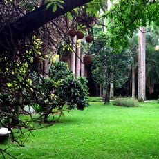
The Río Catuche begins in the coastal mountain range near Las Culebrillas at an elevation of 1807 meters and flows through Caracas for 7.4 kilometers. The waterway descends from these highlands into the urban area, carving a natural corridor through the city's landscape.
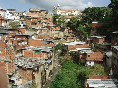
From the city's founding until the late 1800s, this river was the main water source for Caracas residents. As new water systems were developed, the river gradually lost this vital role in supplying the growing city.
The river's name comes from the Toromayma indigenous language and refers to a soursop tree that once grew densely along its banks. This botanical connection reflects how nature shaped the identity of the place and its early inhabitants.
The river flows through densely built urban areas, so access varies depending on which section you visit. Walking along different stretches is possible, but it is wise to check local conditions before planning your visit.
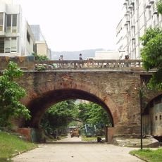
The stone Carlos III Bridge, built in 1772 by Juan Domingo del Sacramento Infante, still spans across the river as a surviving historical structure. This arch bridge reveals the engineering knowledge of its time and remains one of the oldest visible works crossing the waterway.
The community of curious travelers
AroundUs brings together thousands of curated places, local tips, and hidden gems, enriched daily by 60,000 contributors worldwide.