Enable Location

We need your location to show you interesting places around you

Discover nearby places

Find interesting locations and hidden gems around you

Precise directions

Get accurate directions and distances to places

Your location is never shared with other users. It's only used when you tap the location button.

El Paso

Log in to your account

Start exploring — it's free

Trusted by 64,488 travelers worldwide

Continue with Google
Continue with Apple
or

We will send you a code to connect

By continuing, you accept our Terms and Conditions and our Privacy Policy

Check your inbox

We've sent a pincode in your inbox. Please enter the code below.

Discussion Reviews 1 Photos
17.9k Popularity

El Paso, municipality of Canary Islands, Spain

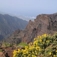
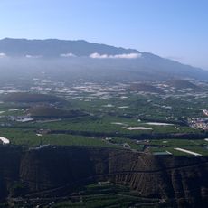
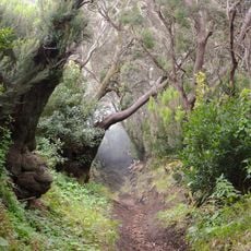
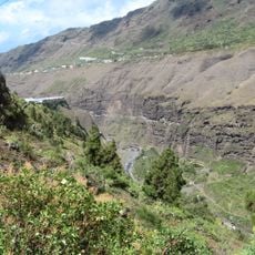
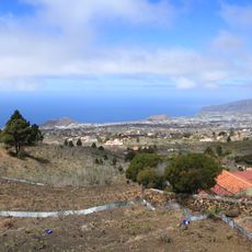
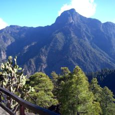
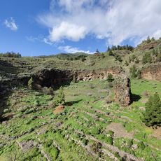
El Paso is a municipality in the center of La Palma and the only settlement on the island not located near the coast. The town is surrounded by fruit-bearing trees and extends across gentle hills with pine forests, while the Caldera de Taburiente with its cliffs and ravines dominates the landscape.

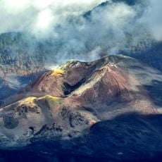
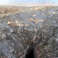
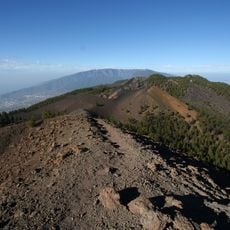
El Paso emerged as a settlement in the interior of La Palma and gradually became the island's largest municipal center. The village was shaped by the 2021 eruption, whose traces remain visible in the altered landscape and in local memory today.

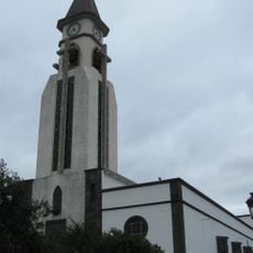
El Paso maintains an old tradition of silk production that visitors can explore at the craft center "Taller de Las Hilanderas", where silkworms are still raised and fabric is processed by hand. Twice a year, festivals take place with the streets decorated with colorful arches and flower carpets while locals gather in traditional dress.

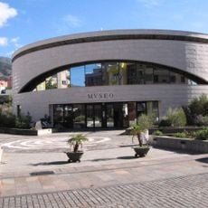
The visitor center in the town offers information about the Caldera de Taburiente and shows films about the region in multiple languages. Several well-marked trails lead to the Cumbrecita viewpoint and the Pico Bejenado summit, while overnight stays require permission from local authorities.

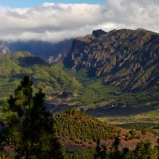
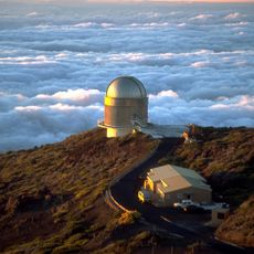
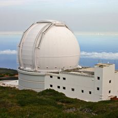
The sea of clouds phenomenon is particularly strong here, especially from the Llano del Jable viewpoint at 1200 meters elevation, where clouds roll like waves over the mountains and create a spectacular starry sky at night. This area has received Starlight Reserve status for its exceptionally clear star visibility.

The community of curious travelers

AroundUs brings together thousands of curated places, local tips, and hidden gems, enriched daily by 60,000 contributors worldwide.

Start exploring
Location
Elevation above the sea
630 m
Part of
Mancomunidad des municipalités de Montaña No Costeros de Canarias
Shares border with
Puntagorda, Los Llanos de Aridane, Fuencaliente de La Palma, Villa de Mazo, Breña Baja, Breña Alta, Santa Cruz de La Palma, Puntallana, San Andrés y Sauces, Barlovento, Garafía, Tijarafe
GPS coordinates
28.65129,-17.88057
Latest update
February 17, 2026 00:00
Reviews
Share your experience

No review yet

Discussions
Start a discussion...

No discussion yet

« El Paso - municipality of Canary Islands, Spain » is provided by Around Us (aroundus.com). Images and texts are derived from Wikimedia project under a Creative Commons license. You are allowed to copy, distribute, and modify copies of this page, under the conditions set by the license, as long as this note is clearly visible.

Discover hidden gems everywhere you go!

From secret cafés to breathtaking viewpoints, skip the crowded tourist spots and find places that match your style. Our app makes it easy with voice search, smart filtering, route optimization, and insider tips from travelers worldwide. Download now for the complete mobile experience.

Around Us App Screenshot

A unique approach to discovering new places

Le Figaro

All the places worth exploring

France Info

A tailor-made excursion in just a few clicks

20 Minutes

Around Us
Travel Guide & Maps
Download

Send to your phone

QR Code
1

Open the camera app on your mobile.

2

Point at the QR code with your camera. A notification will appear.

3

Tap the notification to open the link.