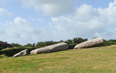
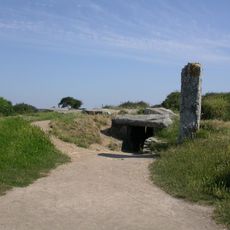
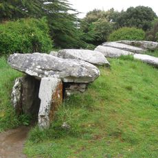
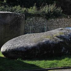
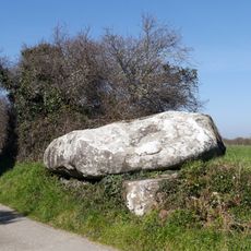
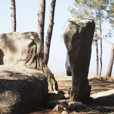
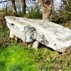
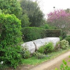
Menhir d'Er Grah, Neolithic menhir in Locmariaquer, France.
The menhir d'Er Grah is a colossal stone block now broken into four sections that rest on the ground at the site. Information panels nearby explain how such a monument was built and what it meant to the people who created it.
The monument was erected around 5000 BCE as part of a larger stone complex that included at least 18 other standing stones in the area. This site demonstrates that early societies in Brittany possessed the organization and labor capacity to undertake major construction projects.
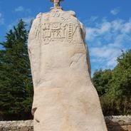
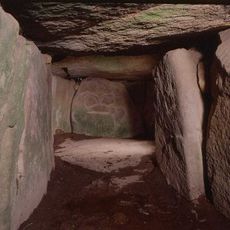
The stone surface displays ancient carvings showing tools like hatchets and ploughs, reflecting the skills and daily work of Neolithic people in Brittany. These engravings offer glimpses into how people lived and what they valued thousands of years ago.
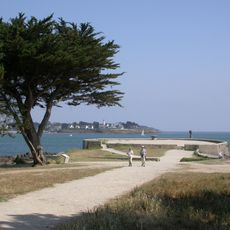
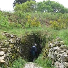
The site is easily accessible, allowing visitors to examine the four stone sections up close from different angles. The best time to visit is during daylight hours when the carvings and information panels can be clearly read and observed.
The stone blocks were transported across 10 to 20 kilometers, likely using rafts across the Gulf of Morbihan. This feat reveals that the builders possessed maritime knowledge and sophisticated transportation methods remarkable for that era.
The community of curious travelers
AroundUs brings together thousands of curated places, local tips, and hidden gems, enriched daily by 60,000 contributors worldwide.