Chest opened
+${chestReward.xp} XP
Explorer
NOUVEAU ×${chestReward.collectible.quantity}
tapez pour fermer
Chest locked

Open chests in the app

Around Us is built for your phone — chests unlock when you walk, explore and capture nearby places.

Enable Location

We need your location to show you interesting places around you

Discover nearby places

Find interesting locations and hidden gems around you

Precise directions

Get accurate directions and distances to places

Your location is never shared with other users. It's only used when you tap the location button.

Sinnar

Log in to your account

Start exploring — it's free

Trusted by 72,874 travelers worldwide

Continue with Google
Continue with Apple
or

We will send you a code to connect

By continuing, you accept our Terms and Conditions and our Privacy Policy

Check your inbox

We've sent a pincode in your inbox. Please enter the code below.

Sinnar
Discussion Reviews 1 Photos
18.5k Popularity

Sinnar, city in Nashik district, Nashik division, Maharashtra, India

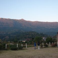
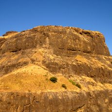
Sinnar is a town in Nashik district, Maharashtra, sitting at roughly 560 meters above sea level along the Girna River. Old temples stand alongside newer streets, and the surrounding land is used for both farming and industry.

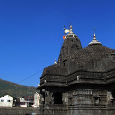
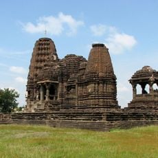
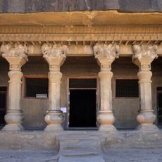
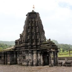
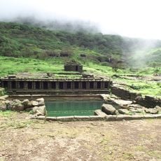
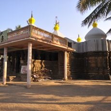
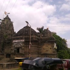
Sinnar was founded around 850 by a local chief named Rav Singuni and later came under the Yadava dynasty, known for building temples across the region. In 1294 Alauddin Khalji attacked the area, marking one of the most disruptive moments in the town's early history.

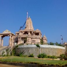
The people of Sinnar speak Marathi and mark local festivals with music and traditional food that draw the whole community together. Temples remain central to everyday life here, and the markets carry handmade crafts that reflect long-standing local skills.

Sinnar has no railway station, so most visitors arrive by bus or car, with the nearest train stations at Nasik Road and Devlali. The NH160 highway passes close to the town and connects it easily to other places in Maharashtra.

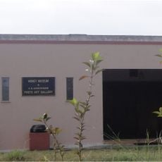
Sinnar is widely known as the Onion Belt of Nashik, making it one of the main centers for vegetable farming and export in the region. The town is also home to the Gargoti Museum, where rare minerals and crystals found locally are on display, drawing visitors with an interest in natural history.

The community of curious travelers

AroundUs brings together thousands of curated places, local tips, and hidden gems, enriched daily by 60,000 contributors worldwide.

Start exploring
Location
Elevation above the sea
651 m
GPS coordinates
19.84531,74.00002
Latest update
March 3, 2026 08:23
Reviews
Share your experience

No review yet

Discussions
Start a discussion...

No discussion yet

« Sinnar - city in Nashik district, Nashik division, Maharashtra, India » is provided by Around Us (aroundus.com). Images and texts are derived from Wikimedia project under a Creative Commons license. You are allowed to copy, distribute, and modify copies of this page, under the conditions set by the license, as long as this note is clearly visible.

Discover hidden gems everywhere you go!

From secret cafés to breathtaking viewpoints, skip the crowded tourist spots and find places that match your style. Our app makes it easy with voice search, smart filtering, route optimization, and insider tips from travelers worldwide. Download now for the complete mobile experience.

Around Us App Screenshot

A unique approach to discovering new places

Le Figaro

All the places worth exploring

France Info

A tailor-made excursion in just a few clicks

20 Minutes

Around Us
Travel Guide & Maps
Download

Send to your phone

QR Code
1

Open the camera app on your mobile.

2

Point at the QR code with your camera. A notification will appear.

3

Tap the notification to open the link.