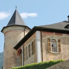
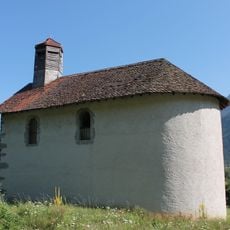
Pointe des Auges, Mountain summit in Faverges-Seythenex, France.
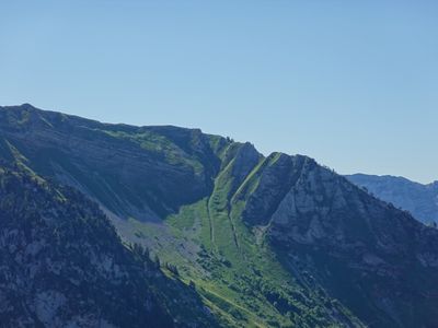
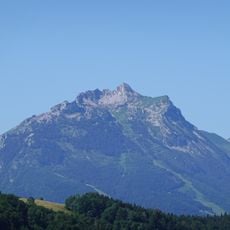
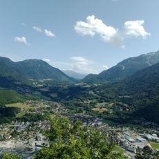
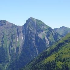
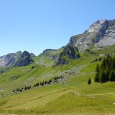
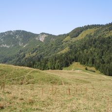
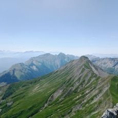
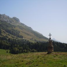
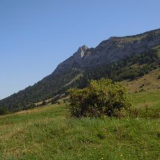
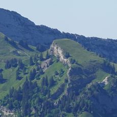
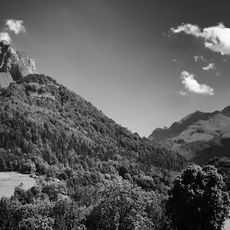
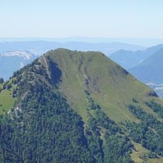
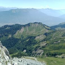
Pointe des Auges is a limestone summit in the Bauges Mountains that stands at 1814 meters high. From the top, you can see across multiple Alpine mountain ranges, and the slopes around it are covered with green meadows and natural limestone features.
During the 19th century, French geographers conducted surveys of the Bauges Mountains and used this summit as a reference point in their mapping work. These surveys helped establish an accurate understanding of the mountain range and its place in the Alpine region.
Shepherds use the slopes to graze livestock, which keeps the landscape open and green across the mountainside. This farming practice has shaped how the area looks and functions in the life of local communities.
The hike begins from the Plateau des Glières on a marked trail and takes about three hours to reach the summit. Bring proper hiking boots and appropriate clothing, as weather at altitude can change quickly.
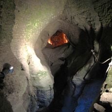
The mountain contains several natural caves created by water erosion that serve as habitats for local wildlife today. These hidden cave systems are part of the karst landscape that shapes the region beneath the surface.
Location: Faverges-Seythenex
Location: Jarsy
Elevation above the sea: 1,814 m
GPS coordinates: 45.69951,6.23057
Latest update: December 15, 2025 13:24
Tamié Abbey
5.9 km
Fort de Tamié
7 km
Abbaye de Tamié
5.9 km
Pointe de la Sambuy
2.9 km
Château de Gye
5.9 km
Réserve nationale de chasse et de faune sauvage des Bauges
3.6 km
Val de Tamié
6.1 km
Réserve biologique intégrale du Haut Chéran
6.8 km
Haut Chéran
4.1 km
Mont Julioz
5.5 km
Golf de Giez
6.3 km
Ruisseau de Bornette
5.3 km
Église Saint-Barthélémy de Giez
5.9 km
Croix d'Orizan
5.9 km
Grotte et cascade de Seythenex
6.4 km
Pointe de Chaurionde
2.8 km
Église Saint-André de Jarsy
6.3 km
Église Saint-Sigismond de Seythenex
6.2 km
Dent des Portes
3.4 km
Pointe de Banc Plat
4.3 km
Église Saint-Martin de Chevaline
7 km
Lanche Close
3.8 km
Chapelle Saint-Gingulph de Bourgeal
5.9 km
Dent de Pleuven
4.1 km
Pointe du Velan
2.1 km
Parc du Mouton
4.4 km
Chapelle Saints-Guérin-Clair-et-François-de-Sales du Mont-Devant
6.7 km
Chapelle Saint-Michel de la Lézine
6.9 kmVisited this place? Tap the stars to rate it and share your experience / photos with the community! Try now! You can cancel it anytime.
Discover hidden gems everywhere you go!
From secret cafés to breathtaking viewpoints, skip the crowded tourist spots and find places that match your style. Our app makes it easy with voice search, smart filtering, route optimization, and insider tips from travelers worldwide. Download now for the complete mobile experience.
A unique approach to discovering new places❞
— Le Figaro
All the places worth exploring❞
— France Info
A tailor-made excursion in just a few clicks❞
— 20 Minutes