Enable Location

We need your location to show you interesting places around you

Discover nearby places

Find interesting locations and hidden gems around you

Precise directions

Get accurate directions and distances to places

Your location is never shared with other users. It's only used when you tap the location button.

Pointe de Banc Plat

Log in to your account

Start exploring — it's free

Trusted by 61,919 travelers worldwide

Continue with Google
Continue with Apple
or

We will send you a code to connect

By continuing, you accept our Terms and Conditions and our Privacy Policy

Check your inbox

We've sent a pincode in your inbox. Please enter the code below.

Pointe de Banc Plat

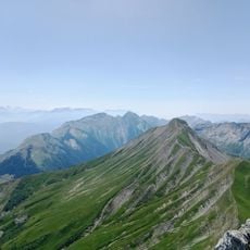
Pointe de Banc Plat, Mountain peak in Bellecombe-en-Bauges, France.

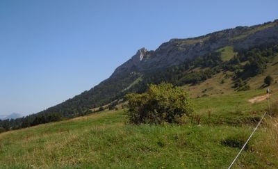
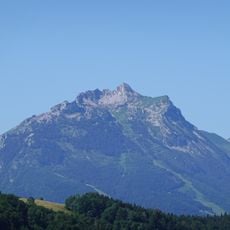
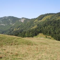
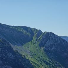
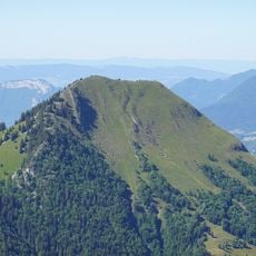
Pointe de Banc Plat is a mountain summit in the Bellecombe-en-Bauges area standing at 1907 meters with wooded slopes that transition through limestone cliffs to alpine meadows. The peak offers varied terrain across its elevation zones.

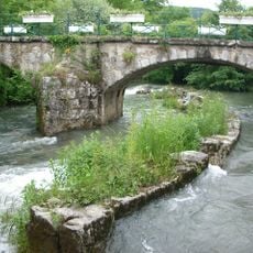
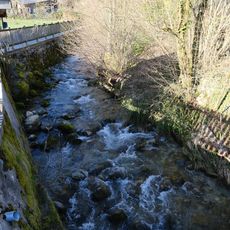
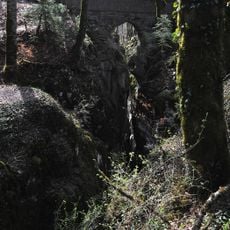
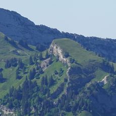
Pas de la Combe, a passage carved through limestone in 1893, created a direct route linking Lathuile village with the alpine pastures beyond the rock face. This work gave locals faster access to their seasonal grazing lands.

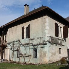
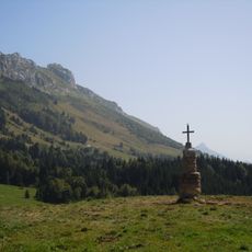
The Chalet de la Combe at 1572 meters preserves the tradition of alpine shelters where hikers rest and eat during their journeys. This refuge remains an important gathering place in the local hiking culture.

The hike starts at the Petit Reposoir parking area at 1085 meters and takes about 5 hours with roughly 900 meters of elevation gain. Sturdy footwear and plenty of water are essential since the route crosses exposed sections and steep terrain.

A rock inscription honors Camille Dunand, who was central to creating the path through the limestone cliffs of the massif. Visitors often miss this memorial stone while making their way up the trail.

The community of curious travelers

AroundUs brings together thousands of curated places, local tips, and hidden gems, enriched daily by 60,000 contributors worldwide.

Start exploring
Location
Elevation above the sea
1,907 m
GPS coordinates
45.72940,6.19477
Latest update
December 15, 2025 13:24
« Pointe de Banc Plat - Mountain peak in Bellecombe-en-Bauges, France » is provided by Around Us (aroundus.com). Images and texts are derived from Wikimedia project under a Creative Commons license. You are allowed to copy, distribute, and modify copies of this page, under the conditions set by the license, as long as this note is clearly visible.

Discover hidden gems everywhere you go!

From secret cafés to breathtaking viewpoints, skip the crowded tourist spots and find places that match your style. Our app makes it easy with voice search, smart filtering, route optimization, and insider tips from travelers worldwide. Download now for the complete mobile experience.

Around Us App Screenshot

A unique approach to discovering new places

Le Figaro

All the places worth exploring

France Info

A tailor-made excursion in just a few clicks

20 Minutes

Around Us
Travel Guide & Maps
Download

Send to your phone

QR Code
1

Open the camera app on your mobile.

2

Point at the QR code with your camera. A notification will appear.

3

Tap the notification to open the link.