Enable Location

We need your location to show you interesting places around you

Discover nearby places

Find interesting locations and hidden gems around you

Precise directions

Get accurate directions and distances to places

Your location is never shared with other users. It's only used when you tap the location button.

Mount Kurobōshi

Log in to your account

Start exploring — it's free

Trusted by 65,433 travelers worldwide

Continue with Google
Continue with Apple
or

We will send you a code to connect

By continuing, you accept our Terms and Conditions and our Privacy Policy

Check your inbox

We've sent a pincode in your inbox. Please enter the code below.

Mount Kurobōshi
Discussion Reviews 1 Photos
3.3k Popularity

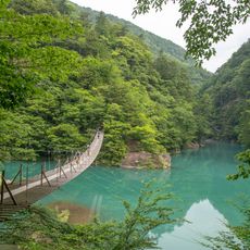
Mount Kurobōshi, Mountain peak in Tenryū Ward, Japan

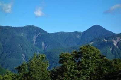
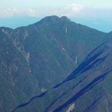
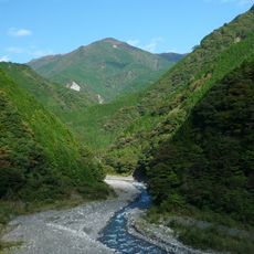
Mount Kurobōshi is a mountain summit located in Tenryū Ward, in the Kawanehon area of Shizuoka Prefecture, reaching 2,068 meters (about 6,785 feet) above sea level. Its slopes are steep and covered in dense forest that extends almost to the top.

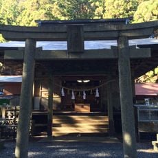
The mountains of the Tenryū region were early on part of the spiritual world of local communities, who gave peaks names linked to religious figures. This practice reflects how closely nature and belief were tied together in Japan's mountain culture.

The name Kurobōshi translates as Black Priest Peak in Japanese, linking the mountain to old spiritual traditions of naming natural formations after religious figures. Visitors walking the trails may notice small stone markers and offerings left at certain points along the path, which reflect this ongoing connection between the mountain and local belief.

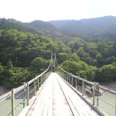
The trail involves steep sections and rocky ground that can become slippery, so sturdy footwear is a must. Setting off early gives you enough time to reach the top and come back down well before dark.

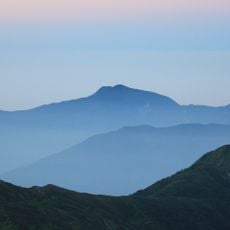
Kurobōshi is among the southernmost peaks in Japan to rise above 2,000 meters, which is rare at such a low latitude. Because of its remote location, it sees far fewer visitors than other summits of similar height in the region.

The community of curious travelers

AroundUs brings together thousands of curated places, local tips, and hidden gems, enriched daily by 60,000 contributors worldwide.

Start exploring
Location
Location
Elevation above the sea
2,068.09 m
GPS coordinates
35.19618,138.02940
Latest update
March 3, 2026 13:57
Reviews
Share your experience

No review yet

Discussions
Start a discussion...

No discussion yet

« Mount Kurobōshi - Mountain peak in Tenryū Ward, Japan » is provided by Around Us (aroundus.com). Images and texts are derived from Wikimedia project under a Creative Commons license. You are allowed to copy, distribute, and modify copies of this page, under the conditions set by the license, as long as this note is clearly visible.

Discover hidden gems everywhere you go!

From secret cafés to breathtaking viewpoints, skip the crowded tourist spots and find places that match your style. Our app makes it easy with voice search, smart filtering, route optimization, and insider tips from travelers worldwide. Download now for the complete mobile experience.

Around Us App Screenshot

A unique approach to discovering new places

Le Figaro

All the places worth exploring

France Info

A tailor-made excursion in just a few clicks

20 Minutes

Around Us
Travel Guide & Maps
Download

Send to your phone

QR Code
1

Open the camera app on your mobile.

2

Point at the QR code with your camera. A notification will appear.

3

Tap the notification to open the link.