Chest opened
+${chestReward.xp} XP
Explorer
NOUVEAU ×${chestReward.collectible.quantity}
tapez pour fermer

See the monuments around you in AR Open chests in the app

Around Us is built for your phone — point your camera at the streets and discover the monuments and places around you in augmented reality. Around Us is built for your phone — chests unlock when you walk, explore and capture nearby places.

Enable Location

We need your location to show you interesting places around you

Discover nearby places

Find interesting locations and hidden gems around you

Precise directions

Get accurate directions and distances to places

Your location is never shared with other users. It's only used when you tap the location button.

Peak Pobeda, Sakha

Log in to your account

Start exploring — it's free

Trusted by 85,321 travelers worldwide

Continue with Google
Continue with Apple
or

We will send you a code to connect

By continuing, you accept our Terms and Conditions and our Privacy Policy

Check your inbox

We've sent a pincode in your inbox. Please enter the code below.

Peak Pobeda, Sakha
Discussion Reviews 1 Photos
10.2k Popularity

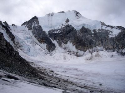
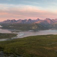
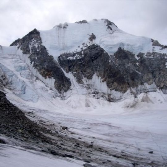
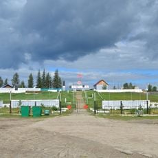
Peak Pobeda, Sakha, Mountain summit in Momsky District, Russia

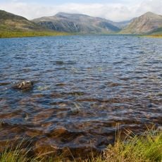
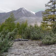
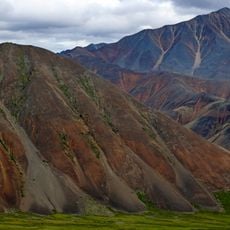
Peak Pobeda is a mountain summit in Momsky District, Russia, standing at 3003 meters above sea level. Its ridge extends roughly 700 meters and divides naturally into three sections: East, Central, and West.

The first successful ascent took place in 1956 when V. M. Abalakov and his team established a route via the North ridge. This early climbing achievement opened the mountain to future expeditions.

The name Pobeda means Victory in Russian and reflects how the local Yakut people connect with their natural surroundings. The mountain represents part of their traditional relationship with the land and landscape.

The nearest town for permits and transport arrangements is Ust-Nera, roughly 180 kilometers to the southwest. From there, you can organize access to base camps and the mountain itself.

Italian climbers Simone Moro and Tamara Lunger achieved the first winter ascent in 2018 while enduring temperatures plunging to minus 40 degrees Celsius. This feat highlights just how harsh the conditions become during the coldest months.

The community of curious travelers

AroundUs brings together thousands of curated places, local tips, and hidden gems, enriched daily by 60,000 contributors worldwide.
Start exploring
Location
Elevation above the sea
3,003 m
GPS coordinates
65.17735,146.01092
Latest update
September 3, 2026 15:06
Around this place
Pleistocene Park
Russian Federation

Pleistocene Park

479.1 mi
Batagaika crater
Russian Federation

Batagaika crater

352.4 mi
Labynkyr
Russian Federation

Labynkyr

198.9 mi
Mask of Sorrow
Russian Federation

Mask of Sorrow

415.6 mi
Jack London Lake
Russian Federation

Jack London Lake

239.9 mi
Magadan Nature Reserve
Russian Federation

Magadan Nature Reserve

385.6 mi
Kolyma Mountains
Russian Federation

Kolyma Mountains

353.4 mi
Magadan Music and Drama Theater
Russian Federation

Magadan Music and Drama Theater

417.2 mi
Kytalyk National Park
Russian Federation

Kytalyk National Park

395.2 mi
Gertner Cove
Russian Federation

Gertner Cove

419.6 mi
Momsky nature park
Russian Federation

Momsky nature park

30.8 mi
Victory memorial in Yakutsk
Russian Federation

Victory memorial in Yakutsk

542.9 mi
Lake Ozhogino
Russian Federation

Lake Ozhogino

282.2 mi
Holy Trinity Cathedral
Russian Federation

Holy Trinity Cathedral

417.1 mi
Russian Federation

Bolschaja-Momskaja-Aufeis

50.5 mi
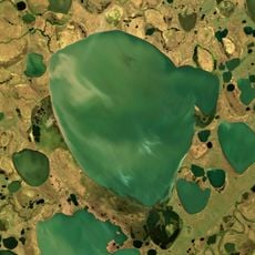
Kolyma Reservoir
Russian Federation

Kolyma Reservoir

249.6 mi
Myuryu
Russian Federation

Myuryu

483.8 mi
Lake Bolshoye Morskoye
Russian Federation

Lake Bolshoye Morskoye

474.3 mi
Northeast Science Station
Russian Federation

Northeast Science Station

482.1 mi
Russian Federation

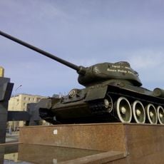
Tank memorial to fallen in WWII, Yakutsk

542.9 mi
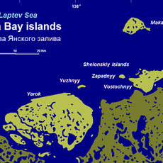
Yarok Island
Russian Federation

Yarok Island

485.7 mi
Angachak Range
Russian Federation

Angachak Range

242.3 mi
Намская улусная гимназия
Russian Federation

Намская улусная гимназия

523.1 mi
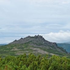
Gory Kamennyy Venets
Russian Federation

Gory Kamennyy Venets

418.6 mi
F. K. Popov yodgorlik-byusti
Russian Federation

F. K. Popov yodgorlik-byusti

539.1 mi
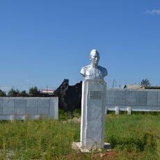
Памятник воинам-землякам, участникам Великой Отечественной войны (Петровка, Якутия)
Russian Federation

Памятник воинам-землякам, участникам Великой Отечественной войны (Петровка, Якутия)

540 mi
Памятник воинам-землякам (Майя)
Russian Federation

Памятник воинам-землякам (Майя)

539.1 mi
Памятник-часовня (Петровка)
Russian Federation

Памятник-часовня (Петровка)

540 mi
Show the full map
Reviews
Share your experience

No review yet

Discussions
Start a discussion...

No discussion yet

« Peak Pobeda, Sakha - Mountain summit in Momsky District, Russia » is provided by Around Us (aroundus.com). Images and texts are derived from Wikimedia project under a Creative Commons license. You are allowed to copy, distribute, and modify copies of this page, under the conditions set by the license, as long as this note is clearly visible.

Discover hidden gems everywhere you go!

From secret cafés to breathtaking viewpoints, skip the crowded tourist spots and find places that match your style. Our app makes it easy with voice search, smart filtering, route optimization, and insider tips from travelers worldwide. Download now for the complete mobile experience.
Around Us App Screenshot

A unique approach to discovering new places

Le Figaro

All the places worth exploring

France Info

A tailor-made excursion in just a few clicks

20 Minutes

Around Us
Travel Guide & Maps
Download

Send to your phone

QR Code
1

Open the camera app on your mobile.

2

Point at the QR code with your camera. A notification will appear.

3

Tap the notification to open the link.