Enable Location

We need your location to show you interesting places around you

Discover nearby places

Find interesting locations and hidden gems around you

Precise directions

Get accurate directions and distances to places

Your location is never shared with other users. It's only used when you tap the location button.

Log in to your account

Start exploring — it's free

Trusted by 62,282 travelers worldwide

Continue with Google
Continue with Apple
or

We will send you a code to connect

By continuing, you accept our Terms and Conditions and our Privacy Policy

Check your inbox

We've sent a pincode in your inbox. Please enter the code below.

Kamennaya Balka

Kamennaya Balka, Protected area and river system in Rostov Oblast, Russia.

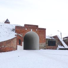
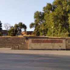
Kamennaya Balka is a protected nature reserve with a river system in southern Rostov Oblast, featuring wooded valleys and water channels. The terrain shows the typical forms of this region with steep banks, forested slopes, and flowing watercourses.

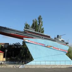
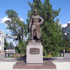
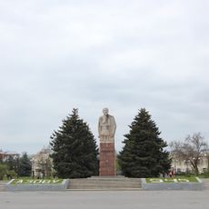
The area witnessed major events during the German occupation between 1941 and 1943. This period remains central to how the place is understood and valued by the region.

The place serves as a space where local people connect with the region's past and natural environment together. Walking here, you experience both the beauty of the landscape and a sense of memory woven into the surroundings.

Access is through designated entry points, with walks and nature viewing available depending on the season. Spring through autumn offers the best conditions for visiting, when trails are accessible and wildlife is most active.

The area combines conservation efforts with memorial sites, where forests and waterways exist alongside plaques and educational markers. This blend allows visitors to encounter both ecological and human stories in the same landscape.

The community of curious travelers

AroundUs brings together thousands of curated places, local tips, and hidden gems, enriched daily by 60,000 contributors worldwide.

Start exploring
Location
GPS coordinates
47.26268,39.35324
Latest update
December 14, 2025 17:02
Around this place
Tanais
Russian Federation

Tanais

1.5 km
Azov Fortress
Russian Federation

Azov Fortress

17.1 km
Archaeological museum-reserve "Tanais"
Russian Federation

Archaeological museum-reserve "Tanais"

1.5 km
Azov History, Archaeology and Paleontology Museum-Reserve
Russian Federation

Azov History, Archaeology and Paleontology Museum-Reserve

17.6 km
Steppe mammoth
Russian Federation

Steppe mammoth

17.6 km
Alekseevsky Gate
Russian Federation

Alekseevsky Gate

17.2 km
Powder Cellar Museum
Russian Federation

Powder Cellar Museum

17 km
Church of the Transfiguration
Russian Federation

Church of the Transfiguration

14.4 km
Church of the Intercession
Russian Federation

Church of the Intercession

16.9 km
Church of the Ascension
Russian Federation

Church of the Ascension

11.4 km
Monument to Peter I
Russian Federation

Monument to Peter I

17.6 km
Monument to the sailors of the Azov Flotilla
Russian Federation

Monument to the sailors of the Azov Flotilla

16.9 km
Samoylovitch house, Azov
Russian Federation

Samoylovitch house, Azov

17.6 km
White Swan
Russian Federation

White Swan

17.3 km
Monument to Aleksei Shein
Russian Federation

Monument to Aleksei Shein

17.6 km
Church of All Saints
Russian Federation

Church of All Saints

4.8 km
Church of the Dormition of the Theotokos, Nedvigovka
Russian Federation

Church of the Dormition of the Theotokos, Nedvigovka

847 m
Former men's progymnasium building, Azov
Russian Federation

Former men's progymnasium building, Azov

17.8 km
Museum of Krym village
Russian Federation

Museum of Krym village

12.8 km
The House of Kovalev
Russian Federation

The House of Kovalev

17.6 km
Old Believers church of Dormition of the Mother of God in Azovsky
Russian Federation

Old Believers church of Dormition of the Mother of God in Azovsky

16.2 km
Pantheon of Glory
Russian Federation

Pantheon of Glory

13.1 km
Vladimir Lenin monument, Azov
Russian Federation

Vladimir Lenin monument, Azov

17.5 km
Historical and Ethnographical Museum of Myasnikovsky rayon
Russian Federation

Historical and Ethnographical Museum of Myasnikovsky rayon

11.3 km
Church of Christ the Savior
Russian Federation

Church of Christ the Savior

12.8 km
Церковь Георгия Победоносца (Донской)
Azerbaijan

Церковь Георгия Победоносца (Донской)

16.6 km
Building of ataman's district of Elizavetinskiy Cossack yurt
Russian Federation

Building of ataman's district of Elizavetinskiy Cossack yurt

17 km
Abandoned household at Hleborobnaya Street in Chaltyr
Russian Federation

Abandoned household at Hleborobnaya Street in Chaltyr

10.4 km
Show the full map
« Kamennaya Balka - Protected area and river system in Rostov Oblast, Russia » is provided by Around Us (aroundus.com). Images and texts are derived from Wikimedia project under a Creative Commons license. You are allowed to copy, distribute, and modify copies of this page, under the conditions set by the license, as long as this note is clearly visible.

Discover hidden gems everywhere you go!

From secret cafés to breathtaking viewpoints, skip the crowded tourist spots and find places that match your style. Our app makes it easy with voice search, smart filtering, route optimization, and insider tips from travelers worldwide. Download now for the complete mobile experience.

Around Us App Screenshot

A unique approach to discovering new places

Le Figaro

All the places worth exploring

France Info

A tailor-made excursion in just a few clicks

20 Minutes

Around Us
Travel Guide & Maps
Download

Send to your phone

QR Code
1

Open the camera app on your mobile.

2

Point at the QR code with your camera. A notification will appear.

3

Tap the notification to open the link.