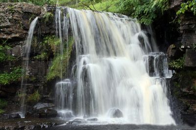
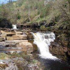
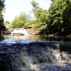
East Gill Force, Natural waterfall in Muker, England.
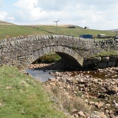
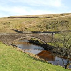
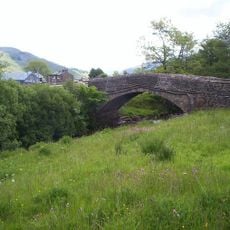
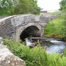
East Gill Force is a waterfall near Muker in the Yorkshire Dales, featuring water that drops and cascades through a narrow wooded valley. The site sits surrounded by grassy slopes and bordered by traditional stone walls that frame the water's descent.
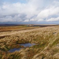
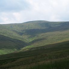
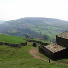
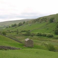
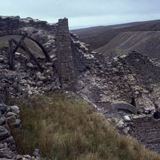
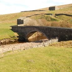
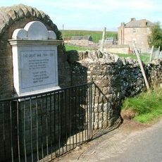
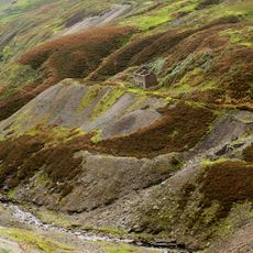
The area around this waterfall was shaped by medieval farming practices, with ancient stone walls and field systems still visible on the surrounding hillsides. These remnants show how people adapted the steep terrain for agriculture over many centuries.
The waterfall serves as a gathering point along popular walking routes, where hikers naturally pause to experience the sound and sight of flowing water. People use the surrounding area to rest and orient themselves during their journeys through the Yorkshire Dales.
The waterfall is reachable on foot from Muker village via established walking paths that connect with other trails in the region. Wear sturdy footwear as the ground near the water can be wet and slippery, especially after rainfall.
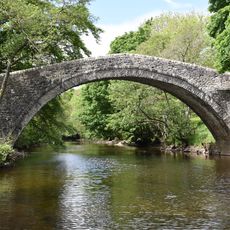
The waterfall sits directly beneath an old stone bridge, allowing visitors to view the falling water from above and below simultaneously. A second smaller cascade flows further downstream, creating multiple photographic vantage points within a short walking distance.
Location: Muker
GPS coordinates: 54.40533,-2.16110
Latest update: December 13, 2025 17:04
Tan Hill
5.6 km
Nine Standards Rigg
8.9 km
Tan Hill Inn
5.6 km
Kisdon Force
260 m
Great Shunner Fell
6.1 km
Kisdon
1.3 km
Wain Wath Force
1.3 km
Catrake Force
436 m
Lovely Seat
6.3 km
Church of Saint Mary
3.5 km
Arkengarthdale Gunnerside and Reeth Moors
6 km
Angram Bottoms
1.3 km
Ravenseat Packhorse Bridge
4 km
Bridge Approximately 200 Metres East Of Firs Farmhouse
3.2 km
Lead mines, ore works and smeltmills at Old Gang on Reeth High Moor
7.6 km
United Reform Church And Former Manse, With Railings
343 m
Long Close Bridge
3.2 km
Scar House Bridge
3.2 km
Turnip House And Attached Byre
8.7 km
Bridge Approximately 30 Metres East Of Stone House
3.7 km
Ivelet Bridge
4.9 km
Beldi Hill Low Level lead mine and ore works
755 m
Boundary Stone On North Side Of Road To North West Of Gate House
7.9 km
Stone Approximately 75 Metres South Of North Yorkshire-Cumbria Boundary
8.9 km
Keld War Memorial, North Yorkshire
422 m
Gunnerside Gill lead mines and ore works
4.2 km
Glory Be And Attached Outbuildings
8.8 km
Cantrells Barn
8.7 kmVisited this place? Tap the stars to rate it and share your experience / photos with the community! Try now! You can cancel it anytime.
Discover hidden gems everywhere you go!
From secret cafés to breathtaking viewpoints, skip the crowded tourist spots and find places that match your style. Our app makes it easy with voice search, smart filtering, route optimization, and insider tips from travelers worldwide. Download now for the complete mobile experience.
A unique approach to discovering new places❞
— Le Figaro
All the places worth exploring❞
— France Info
A tailor-made excursion in just a few clicks❞
— 20 Minutes