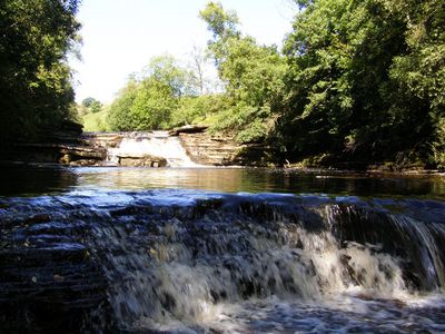
Catrake Force, Waterfall in Muker, North Yorkshire, England
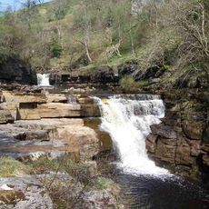
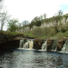
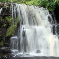
Catrake Force is a waterfall featuring multiple cascading steps along the River Swale, characterized by a main drop of about 20 feet (6 meters). The water flows over successive tiers, creating a series of falls that cut through the moorland landscape.
The name Force derives from the Norse word Foss, demonstrating strong Scandinavian influence on place names across northern England. This naming convention persisted through the centuries and continues to characterize the region's geographical vocabulary.
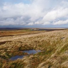
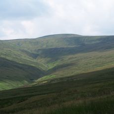
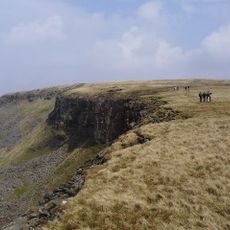
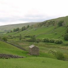
This waterfall forms part of the Pennine Way walking route, connecting travelers to centuries of pedestrian exploration through Yorkshire's natural landmarks.
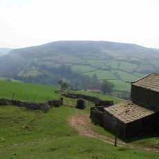
Reaching the waterfall requires walking through a campsite in Keld, since the cascade is not visible from the main road. It helps to ask locals for directions or follow marked paths to find the best route to the falls.
This cascade is part of a sequence of three waterfalls along this stretch of river, with Wain Wath Force upstream and Kisdon Force downstream. This arrangement makes the Swale Valley especially rewarding for walkers seeking to explore multiple water features in one outing.
Location: Muker
Part of: River Swale
GPS coordinates: 54.40701,-2.16718
Latest update: December 13, 2025 11:42
Tan Hill
5.5 km
Nine Standards Rigg
8.5 km
Tan Hill Inn
5.4 km
Kisdon Force
696 m
Great Shunner Fell
5.9 km
Kisdon
1.6 km
Wain Wath Force
877 m
East Gill Force
436 m
High Seat
9 km
Lovely Seat
6.4 km
Church of Saint Mary
3.9 km
Arkengarthdale Gunnerside and Reeth Moors
6.3 km
Angram Bottoms
1.4 km
Bridge Approximately 200 Metres East Of Firs Farmhouse
2.8 km
Ravenseat Packhorse Bridge
3.6 km
Lead mines, ore works and smeltmills at Old Gang on Reeth High Moor
8 km
United Reform Church And Former Manse, With Railings
165 m
Long Close Bridge
3.5 km
Scar House Bridge
3.4 km
Turnip House And Attached Byre
9.1 km
Bridge Approximately 30 Metres East Of Stone House
3.3 km
Beldi Hill Low Level lead mine and ore works
1.2 km
Ivelet Bridge
5.4 km
Boundary Stone On North Side Of Road To North West Of Gate House
7.6 km
Stone Approximately 75 Metres South Of North Yorkshire-Cumbria Boundary
8.4 km
Boundary Stone At Hollow Mill Cross
8.5 km
Keld War Memorial, North Yorkshire
408 m
Gunnerside Gill lead mines and ore works
4.6 kmVisited this place? Tap the stars to rate it and share your experience / photos with the community! Try now! You can cancel it anytime.
Discover hidden gems everywhere you go!
From secret cafés to breathtaking viewpoints, skip the crowded tourist spots and find places that match your style. Our app makes it easy with voice search, smart filtering, route optimization, and insider tips from travelers worldwide. Download now for the complete mobile experience.
A unique approach to discovering new places❞
— Le Figaro
All the places worth exploring❞
— France Info
A tailor-made excursion in just a few clicks❞
— 20 Minutes