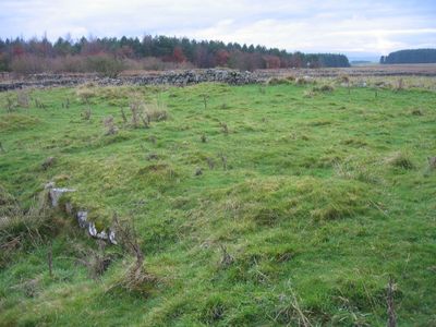
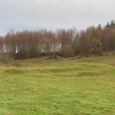
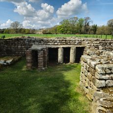
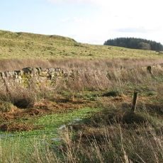
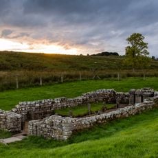
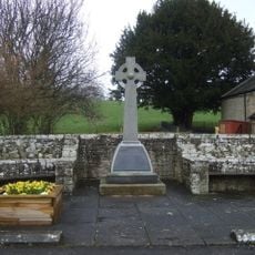
Milecastle 30, Roman fortification on Hadrian's Wall, Northumberland, England.
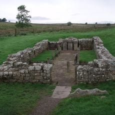
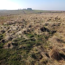
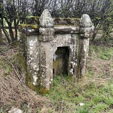
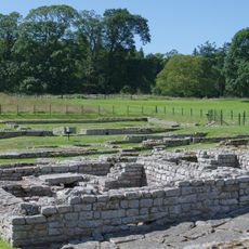
Milecastle 30 is a small Roman fortification on Hadrian's Wall in Northumberland that served as a checkpoint for soldiers on patrol. The ruins still show foundation walls and gate passages that mark where soldiers once guarded this section of the frontier.
This fortification was built in the 2nd century to strengthen Rome's northern frontier in Britain. It was part of a connected system of watchtowers and forts that stretched across the region.
This fortification demonstrates Roman military engineering through its long-axis design, featuring two gateways and barracks that accommodated between twenty and thirty auxiliary soldiers.
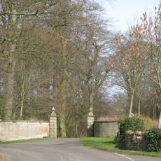
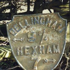
The site sits along the Hadrian's Wall Path National Trail, a walking route that makes the ruins easy to reach. You can view the remains from the B6318 road, which runs beside the site.
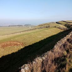
At this location, the wall transitions between narrower and broader stone foundations, revealing different building phases. This shift allows visitors to see how the fortifications changed and improved over time.
Location: Northumberland
Part of: Hadrian's Wall
GPS coordinates: 55.03850,-2.19656
Latest update: December 14, 2025 18:13
Carrawburgh
1.7 km
Chesters
3.6 km
Milecastle 29
1.4 km
Walwick Grange
3.9 km
Newbrough Hall
3.3 km
Chesters Roman Fort
3.9 km
Milecastle 28
3 km
Milecastle 32
3 km
Milecastle 31
2 km
Town Hall
3.7 km
Church of St Mungo, Simonsburn
2 km
Coventina's Well
1.8 km
Thornton Tower
3.2 km
Clayton Museum
3.8 km
Carrawburgh Roman fort and Hadrian's Wall and vallum
1.8 km
Simonburn Castle tower house
2.5 km
Brocolitia Mithraic temple
1.7 km
Simonburn War Memorial, Village Green
2.1 km
Little Walwick
3 km
Power House To North East Of Newbrough Hall
3.3 km
Newbrough War Memorial
3.7 km
Brocolitia Roman fort
1.7 km
Pant Beside Road 200 Metres North Of Junction By Heatheridge
2.8 km
Milepost On North Side Of Road Junction At Keepershield
2.8 km
The Roman fort, vicus, bridge abutments and associated remains of Hadrian's Wall at Chesters in wall mile 27
3.8 km
Stable Block 200 Metres North Of Chesters
3.5 km
Hadrian's Wall and vallum between the road to Simonburn and the field boundary east of Carrawburgh car park in wall miles 29, 30 and 31
291 m
Milestone, Rye Hill, Walwick
1.6 kmVisited this place? Tap the stars to rate it and share your experience / photos with the community! Try now! You can cancel it anytime.
Discover hidden gems everywhere you go!
From secret cafés to breathtaking viewpoints, skip the crowded tourist spots and find places that match your style. Our app makes it easy with voice search, smart filtering, route optimization, and insider tips from travelers worldwide. Download now for the complete mobile experience.
A unique approach to discovering new places❞
— Le Figaro
All the places worth exploring❞
— France Info
A tailor-made excursion in just a few clicks❞
— 20 Minutes