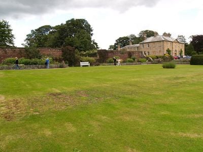
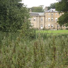
Newbrough Hall, Country house in Newbrough, England.
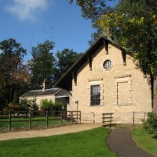
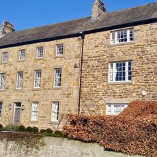
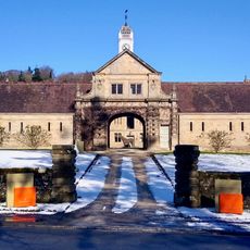
Newbrough Hall is an early nineteenth-century country residence featuring two stories with a symmetrical facade divided into five sections, crowned by a prominent central pediment. A separate coach house adjoins the property, together enclosing a functional courtyard.
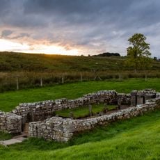
The Reverend Henry Wastell commissioned its construction in 1812, replacing a medieval defensive tower that once occupied the Manor of Thornton site. Architect John Dobson designed the new structure during a period when many older fortifications were being replaced with residential estates.
The name Newbrough refers to a new settlement in the area, reflecting medieval patterns of expansion. The house layout shows how a prosperous family organized their daily routines and entertainment across different rooms and wings.
The house is located west of Hexham and is accessible by car along country roads typical of rural Northumberland. Guest accommodations are available if you wish to experience a longer stay within the estate grounds.
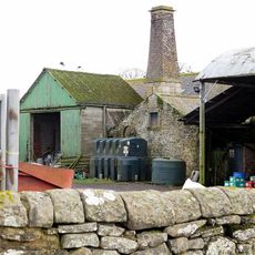
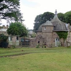
The property includes a listed powerhouse built in 1902 that originally supplied the hall with its first electrical system. This small building represents an early example of how rural estates adopted modern utilities during the industrial period.
Location: Newbrough
GPS coordinates: 55.00870,-2.19687
Latest update: December 14, 2025 18:13
Chesters Roman Fort
4.2 km
Carrawburgh
3.5 km
Chesters
4 km
Milecastle 29
3.2 km
Walwick Grange
3.4 km
Milecastle 30
3.3 km
Chesters Roman Fort
4.1 km
Milecastle 28
3.6 km
Milecastle 32
4 km
Milecastle 31
3.5 km
Warden Bridge
4.2 km
Town Hall
364 m
Church of St Michael
4.2 km
Coventina's Well
3.4 km
Thornton Tower
124 m
Clayton Museum
4.2 km
Carrawburgh Roman fort and Hadrian's Wall and vallum
3.4 km
Brocolitia Mithraic temple
3.2 km
Little Walwick
3.6 km
Power House To North East Of Newbrough Hall
61 m
Newbrough War Memorial
379 m
Brocolitia Roman fort
3.3 km
The Roman fort, vicus, bridge abutments and associated remains of Hadrian's Wall at Chesters in wall mile 27
3.9 km
Medieval wayside cross, 780m SSE of Walwick Grange
3.5 km
Stable Block 200 Metres North Of Chesters
4 km
Cross In Churchyard About 3 Metres South Of Tower Of Church Of St Michael
4.2 km
Hadrian's Wall and vallum between the road to Simonburn and the field boundary east of Carrawburgh car park in wall miles 29, 30 and 31
3.2 km
Milestone, Rye Hill, Walwick
3.4 kmVisited this place? Tap the stars to rate it and share your experience / photos with the community! Try now! You can cancel it anytime.
Discover hidden gems everywhere you go!
From secret cafés to breathtaking viewpoints, skip the crowded tourist spots and find places that match your style. Our app makes it easy with voice search, smart filtering, route optimization, and insider tips from travelers worldwide. Download now for the complete mobile experience.
A unique approach to discovering new places❞
— Le Figaro
All the places worth exploring❞
— France Info
A tailor-made excursion in just a few clicks❞
— 20 Minutes