Enable Location

We need your location to show you interesting places around you

Discover nearby places

Find interesting locations and hidden gems around you

Precise directions

Get accurate directions and distances to places

Your location is never shared with other users. It's only used when you tap the location button.

Kimball County

Log in to your account

Start exploring — it's free

Trusted by 61,817 travelers worldwide

Continue with Google
Continue with Apple
or

We will send you a code to connect

By continuing, you accept our Terms and Conditions and our Privacy Policy

Check your inbox

We've sent a pincode in your inbox. Please enter the code below.

Kimball County, County administrative division in Nebraska, United States

Description

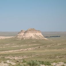
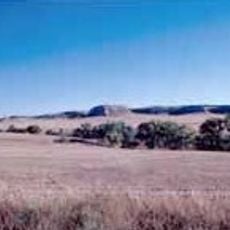
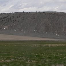
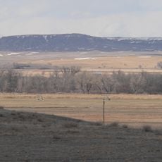
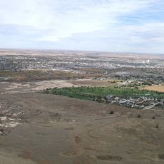
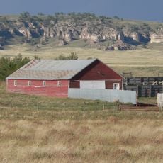
Kimball County is an administrative division in southwestern Nebraska that spans rolling farmland and grassland between Wyoming and Colorado. The landscape features gentle terrain typical of the Great Plains region.

History

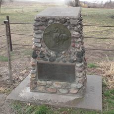
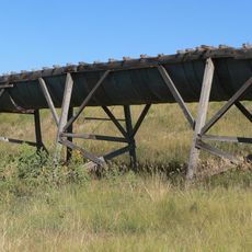
The county was established in 1888 and named for Thomas Lord Kimball, a railroad pioneer instrumental in bringing rail development to the region. The railroad shaped settlement patterns and economic growth throughout the area.

Culture

The county bears the name of a railroad pioneer whose influence shaped regional development. Visitors discover this connection through local stories and landmarks that reflect this heritage.

Practical

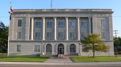
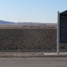
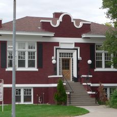
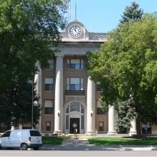
The county courthouse provides essential services including marriage licenses, birth certificates, and voter registration during business hours. Visitors should check operating times and plan to visit the main administrative center where these services are located.

Did you know?

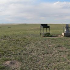
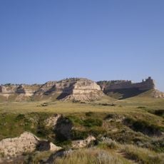
Panorama Point lies within the county at the state's highest elevation, making it a notable destination for visitors seeking the top geographic point in Nebraska. The elevated location offers views distinct from the otherwise flat surrounding plains.

Location
Inception
1888
Capital city
Kimball
Shares border with
Banner County, Weld County, Laramie County, Cheyenne County, Logan County
GPS coordinates
41.20000,-103.71000
Latest update
December 10, 2025 16:02

AroundUs brings together thousands of curated places, local tips, and hidden gems, enriched daily by 60,000 contributors worldwide. Discover all places nearby (Nebraska).

Around this place
Panorama Point
United States of America

Panorama Point

34.4 km
Pawnee Buttes
United States of America

Pawnee Buttes

47.2 km
North Sterling State Park
United States of America

North Sterling State Park

59.1 km
Hawk Springs State Recreation Area
United States of America

Hawk Springs State Recreation Area

69.8 km
Fort Mitchell, Nebraska
United States of America

Fort Mitchell, Nebraska

73.4 km
Signal Butte
United States of America

Signal Butte

68.5 km
Bighorn Mountain
United States of America

Bighorn Mountain

40.8 km
Camp Clarke Bridge Site
United States of America

Camp Clarke Bridge Site

69.1 km
Mud Springs Station Archeological District
United States of America

Mud Springs Station Archeological District

66 km
Texas Trail Museum
United States of America

Texas Trail Museum

30.2 km
Sioux Ordnance Depot Fire & Guard Headquarters
United States of America

Sioux Ordnance Depot Fire & Guard Headquarters

50.8 km
Fraternal Hall
United States of America

Fraternal Hall

5.7 km
Christ Episcopal Church
United States of America

Christ Episcopal Church

61.8 km
Northfield Park Arboretum
United States of America

Northfield Park Arboretum

70.8 km
Morrill County Courthouse
United States of America

Morrill County Courthouse

72.9 km
C.C. Hampton Homestead
United States of America

C.C. Hampton Homestead

53.9 km
Schuetz Log Cabin
United States of America

Schuetz Log Cabin

61.7 km
Sidney Carnegie Library
United States of America

Sidney Carnegie Library

62 km
Albin
United States of America

Albin

46.7 km
Maginnis Irrigation Aqueduct
United States of America

Maginnis Irrigation Aqueduct

6.6 km
Scotts Bluff County Courthouse
United States of America

Scotts Bluff County Courthouse

69.9 km
Fontenelle Apartment House
United States of America

Fontenelle Apartment House

73.7 km
Scottsbluff Carnegie Library
United States of America

Scottsbluff Carnegie Library

74 km
Marquis Opera House
United States of America

Marquis Opera House

73.9 km
US Post Office-Scottsbluff
United States of America

US Post Office-Scottsbluff

73.8 km
Midwest Theater
United States of America

Midwest Theater

74 km
Scotts Bluff
United States of America

Scotts Bluff

71 km
Scotts Bluff National Monument Visitor Center
United States of America

Scotts Bluff National Monument Visitor Center

70 km
Show the full map
Administrative divisions
« Kimball County - County administrative division in Nebraska, United States » is provided by Around Us (aroundus.com). Images and texts are derived from Wikimedia project under a Creative Commons license. You are allowed to copy, distribute, and modify copies of this page, under the conditions set by the license, as long as this note is clearly visible.

Discover hidden gems everywhere you go!

From secret cafés to breathtaking viewpoints, skip the crowded tourist spots and find places that match your style. Our app makes it easy with voice search, smart filtering, route optimization, and insider tips from travelers worldwide. Download now for the complete mobile experience.

Around Us App Screenshot

A unique approach to discovering new places

Le Figaro

All the places worth exploring

France Info

A tailor-made excursion in just a few clicks

20 Minutes

Around Us
Travel Guide & Maps
Download

Send to your phone

QR Code
1

Open the camera app on your mobile.

2

Point at the QR code with your camera. A notification will appear.

3

Tap the notification to open the link.