Enable Location

We need your location to show you interesting places around you

Discover nearby places

Find interesting locations and hidden gems around you

Precise directions

Get accurate directions and distances to places

Your location is never shared with other users. It's only used when you tap the location button.

Rock County

Log in to your account

Start exploring — it's free

Trusted by 61,815 travelers worldwide

Continue with Google
Continue with Apple
or

We will send you a code to connect

By continuing, you accept our Terms and Conditions and our Privacy Policy

Check your inbox

We've sent a pincode in your inbox. Please enter the code below.

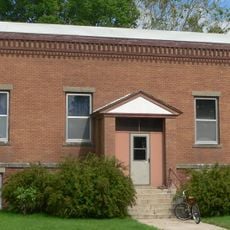
Rock County, County in north-central Nebraska, United States.

Description

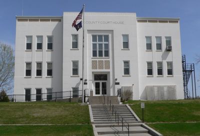
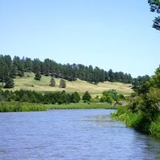
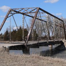
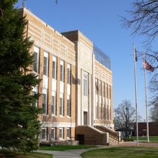
Rock County is an administrative division in north-central Nebraska featuring rolling hills, grasslands, and scattered small lakes with the Niobrara River forming its northern boundary. The county seat of Bassett sits at the intersection of two major highways that connect the region to surrounding areas.

History

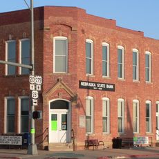
The county was established in 1888, taking its name from Rock Creek and incorporating the small settlements that grew during Nebraska's westward expansion. This founding reflects the period when communities first took root in the region.

Culture

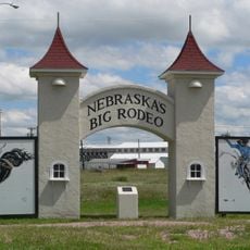
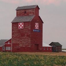
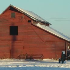
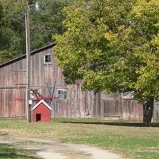
The local community centers on farming traditions that come alive at county fairs and gatherings where neighbors meet and share their way of life. These events shape the rhythm of life here and reveal how deeply agriculture is woven into daily routines.

Practical

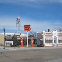
The county is accessible via two major highways that meet at Bassett, providing connections to services and neighboring areas. Visitors should know this is rural territory where planning ahead helps, as amenities can be spread out.

Did you know?

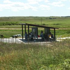
The John and Louise Seier National Wildlife Refuge protects native grassland habitats within the county, offering visitors a rare glimpse of pristine prairie ecology. This refuge demonstrates the region's commitment to preserving its natural heritage.

Location
Inception
1888
Capital city
Bassett
Shares border with
Keya Paha County, Loup County, Boyd County, Holt County, Brown County
GPS coordinates
42.42000,-99.45000
Latest update
December 10, 2025 15:51

AroundUs brings together thousands of curated places, local tips, and hidden gems, enriched daily by 60,000 contributors worldwide. Discover all places nearby (Nebraska).

Around this place
Smith Falls
United States of America

Smith Falls

88 km
Niobrara National Scenic River
United States of America

Niobrara National Scenic River

87.7 km
Valentine National Wildlife Refuge
United States of America

Valentine National Wildlife Refuge

92.6 km
Fort Niobrara National Wildlife Refuge
United States of America

Fort Niobrara National Wildlife Refuge

96.3 km
Fort Hartsuff State Historical Park
United States of America

Fort Hartsuff State Historical Park

85.2 km
Rad Slavin cis. 112 Z.C.B.J. Hall
United States of America

Rad Slavin cis. 112 Z.C.B.J. Hall

93.4 km
Niobrara Valley Preserve
United States of America

Niobrara Valley Preserve

62.3 km
United States of America

White Horse Ranch

59.9 km
Brewer Bridge
United States of America

Brewer Bridge

83.9 km
Carns State Aid Bridge
United States of America

Carns State Aid Bridge

35 km
A.T. Ranch Headquarters
United States of America

A.T. Ranch Headquarters

94.4 km
Bell Bridge
United States of America

Bell Bridge

88.8 km
Sargent Bridge
United States of America

Sargent Bridge

88.5 km
St. Augustine Church
United States of America

St. Augustine Church

91 km
Lewis Bridge
United States of America

Lewis Bridge

66.1 km
St. John's Catholic Church
United States of America

St. John's Catholic Church

72.9 km
Berry State Aid Bridge
United States of America

Berry State Aid Bridge

91.9 km
Garfield County Frontier Fairgrounds
United States of America

Garfield County Frontier Fairgrounds

76.7 km
Herrick Elevator
United States of America

Herrick Elevator

81.3 km
Burwell Carnegie Library
United States of America

Burwell Carnegie Library

75.7 km
Rouse Ranch
United States of America

Rouse Ranch

76.2 km
Brantly Sturdevant House
United States of America

Brantly Sturdevant House

40.6 km
Dallas Carnegie Library
United States of America

Dallas Carnegie Library

91 km
Holt County Courthouse
United States of America

Holt County Courthouse

66.1 km
Old Nebraska State Bank Building
United States of America

Old Nebraska State Bank Building

66.1 km
Rock County Courthouse
United States of America

Rock County Courthouse

19.4 km
Manthey Barn
United States of America

Manthey Barn

92.4 km
Smith Falls State Park
United States of America

Smith Falls State Park

88.3 km
Show the full map
Administrative divisions
« Rock County - County in north-central Nebraska, United States » is provided by Around Us (aroundus.com). Images and texts are derived from Wikimedia project under a Creative Commons license. You are allowed to copy, distribute, and modify copies of this page, under the conditions set by the license, as long as this note is clearly visible.

Discover hidden gems everywhere you go!

From secret cafés to breathtaking viewpoints, skip the crowded tourist spots and find places that match your style. Our app makes it easy with voice search, smart filtering, route optimization, and insider tips from travelers worldwide. Download now for the complete mobile experience.

Around Us App Screenshot

A unique approach to discovering new places

Le Figaro

All the places worth exploring

France Info

A tailor-made excursion in just a few clicks

20 Minutes

Around Us
Travel Guide & Maps
Download

Send to your phone

QR Code
1

Open the camera app on your mobile.

2

Point at the QR code with your camera. A notification will appear.

3

Tap the notification to open the link.