St. Clair County

Log in to your account

AroundUs is a community-driven map of interesting places, built by curious explorers like you. It grows with every review, story, and photo you share.
Connect to save your favorite spots, contribute locations, and create personalized routes.
Continue with Google
Continue with Apple
Continue with X
Continue with Facebook
Continue with email
By continuing, you accept our Terms and Conditions and our Privacy Policy
Create an account
Add to collection
Map
Suggest a change
Share

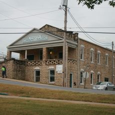
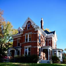
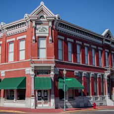
St. Clair County, County in western Missouri, United States

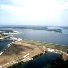
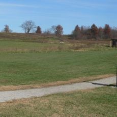
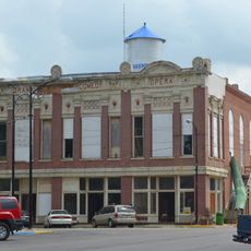
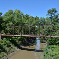
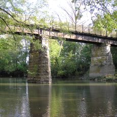
St. Clair County is an administrative division in western Missouri that spans across 702 square miles (1,820 square kilometers) of rural and developed land. The region contains several towns and encompasses farmland along with natural areas connected by state and federal highways.

The county was established in 1841 and named after General Arthur St. Clair, a military officer who served as Governor of the Northwest Territory. This honor reflected his significance during the early development of the United States.

The county maintains several educational districts, including Appleton City R-II, Hudson R-IX, and Osceola Public Schools, serving local communities.

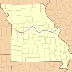
The main roads crossing this county are U.S. Route 54 and State Routes 13, 52, and 82, which help visitors navigate the area. The landscape is generally flat and easy to drive through for those exploring the region.

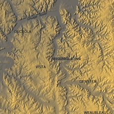
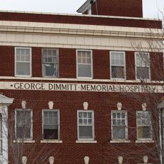
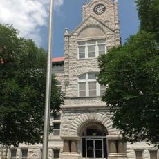
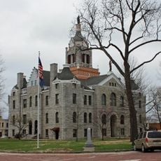
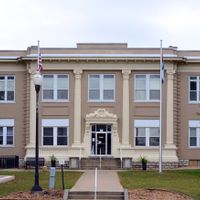
The county seat of Osceola manages administrative functions while Appleton City stands as the largest population center in the jurisdiction.

Location: Missouri

Inception: 1841

Capital city: Osceola

Shares border with: Henry County, Cedar County, Polk County, Hickory County, Benton County, Bates County, Vernon County

Website: http://stclaircomo.com

GPS coordinates: 38.04000,-93.77000

Latest update: December 7, 2025 20:41

Photos
Around this place
Truman Reservoir
United States of America

Truman Reservoir

40.5 km
Stockton Lake
United States of America

Stockton Lake

44.2 km
Weaubleau structure
United States of America

Weaubleau structure

13.5 km
Harry S Truman Birthplace State Historic Site
United States of America

Harry S Truman Birthplace State Historic Site

75 km
Rock Island Trail State Park
United States of America

Rock Island Trail State Park

59.9 km
Pomme de Terre State Park
United States of America

Pomme de Terre State Park

43.9 km
Harry S Truman State Park
United States of America

Harry S Truman State Park

39.5 km
Osage Village State Historic Site
United States of America

Osage Village State Historic Site

39.1 km
United States of America

Fort Carondelet

38.7 km
Marais des Cygnes National Wildlife Refuge
United States of America

Marais des Cygnes National Wildlife Refuge

79.8 km
Upper Bridge
United States of America

Upper Bridge

40.5 km
Caplinger Mills Historic District
United States of America

Caplinger Mills Historic District

27.2 km
Golden Prairie
United States of America

Golden Prairie

82.5 km
George Dimmitt Memorial Hospital
United States of America

George Dimmitt Memorial Hospital

32.2 km
Bolivar Public Library
United States of America

Bolivar Public Library

57.1 km
Vernon County Courthouse
United States of America

Vernon County Courthouse

56.2 km
Fiery Fork Conservation Area
United States of America

Fiery Fork Conservation Area

71.5 km
Greenfield Opera House
United States of America

Greenfield Opera House

69.9 km
Bates County Courthouse
United States of America

Bates County Courthouse

56.7 km
Papinville Marais des Cygnes River Bridge
United States of America

Papinville Marais des Cygnes River Bridge

40.6 km
Stockton Community Building
United States of America

Stockton Community Building

37.9 km
Glasgow Commercial Historic District
United States of America

Glasgow Commercial Historic District

21.8 km
South Main Street Historic District
United States of America

South Main Street Historic District

13.9 km
Long Shoals Bridge
United States of America

Long Shoals Bridge

74.9 km
Henry County Museum
United States of America

Henry County Museum

36.9 km
Marais des Cygnes Massacre Site
United States of America

Marais des Cygnes Massacre Site

79.1 km
SLSF Sac River Bridge
United States of America

SLSF Sac River Bridge

65.8 km
Caplinger Mills Bridge
United States of America

Caplinger Mills Bridge

27.5 km
Show the full map
Reviews

Visited this place? Tap the stars to rate it and share your experience / photos with the community! Try now! You can cancel it anytime.

Administrative divisions
« St. Clair County - County in western Missouri, United States » is provided by Around Us (aroundus.com). Images and texts are derived from Wikimedia project under a Creative Commons license. You are allowed to copy, distribute, and modify copies of this page, under the conditions set by the license, as long as this note is clearly visible.

Discover hidden gems everywhere you go!

From secret cafés to breathtaking viewpoints, skip the crowded tourist spots and find places that match your style. Our app makes it easy with voice search, smart filtering, route optimization, and insider tips from travelers worldwide. Download now for the complete mobile experience.

Around Us App Screenshot

A unique approach to discovering new places

Le Figaro

All the places worth exploring

France Info

A tailor-made excursion in just a few clicks

20 Minutes