Enable Location

We need your location to show you interesting places around you

Discover nearby places

Find interesting locations and hidden gems around you

Precise directions

Get accurate directions and distances to places

Your location is never shared with other users. It's only used when you tap the location button.

Lee County

Log in to your account

Start exploring — it's free

Trusted by 61,913 travelers worldwide

Continue with Google
Continue with Apple
or

We will send you a code to connect

By continuing, you accept our Terms and Conditions and our Privacy Policy

Check your inbox

We've sent a pincode in your inbox. Please enter the code below.

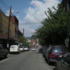
Lee County, County in southwestern Virginia, US

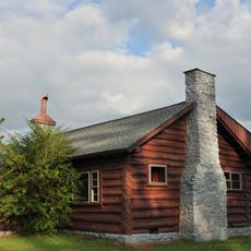
Lee County is an administrative division in southwestern Virginia that covers land across the Appalachian Mountains with limestone formations. The Powell River runs through the area and shapes its natural landscape.

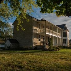
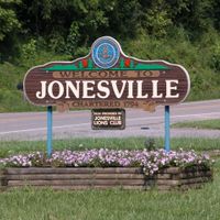
The county was established in 1792 when it separated from Russell County and took the name of Harry Lee, a former Governor of Virginia. This naming reflected respect for an important political figure of the early American Republic.

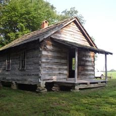
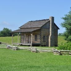
The county keeps local traditions alive through festivals and storytelling events that reflect the experiences of its residents. These gatherings show how the region maintains its heritage in everyday life.

The area offers various routes through its mountainous landscape, though careful planning helps with navigation. Spring and fall bring the most stable weather for exploring the region.

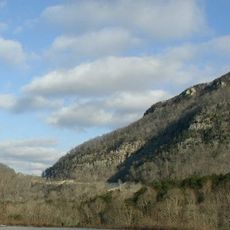
An area called 'the Cedars' displays limestone formations from the Ordovician period that create distinctive karst features. These geological structures shaped the landscape hundreds of millions of years ago and continue to mark the terrain today.

The community of curious travelers

AroundUs brings together thousands of curated places, local tips, and hidden gems, enriched daily by 60,000 contributors worldwide.

Start exploring
Location
Inception
October 25, 1792
Capital city
Jonesville
Shares border with
Harlan County, Hancock County, Claiborne County, Bell County, Wise County, Scott County
GPS coordinates
36.71000,-83.13000
Latest update
December 19, 2025 22:57
Around this place
United States Penitentiary
United States of America

United States Penitentiary

11.5 km
Hensley Settlement
United States of America

Hensley Settlement

35.8 km
United States of America

Wilderness Road State Park

36.1 km
United States of America

Tri-State Peak

50.2 km
United States of America

Gap Cave

49.4 km
Black Mountain Off-Road Adventure Area
United States of America

Black Mountain Off-Road Adventure Area

19.9 km
Southwest Virginia Museum Historical State Park
United States of America

Southwest Virginia Museum Historical State Park

35.5 km
The Cedars Natural Area Preserve
United States of America

The Cedars Natural Area Preserve

5.8 km
United States of America

Unthanks Cave Natural Area Preserve

13.7 km
United States of America

Cranks Creek Lake

9.6 km
June Tolliver House
United States of America

June Tolliver House

36.3 km
John Fox, Jr. House
United States of America

John Fox, Jr. House

35.8 km
United States of America

Stone Mountain Wilderness

21.8 km
Terrace Park Girl Scout Cabin
United States of America

Terrace Park Girl Scout Cabin

35.6 km
Jonesville Methodist Campground
United States of America

Jonesville Methodist Campground

3.3 km
United States Post Office and Courthouse
United States of America

United States Post Office and Courthouse

36.1 km
Dickinson-Milbourn House
United States of America

Dickinson-Milbourn House

2.7 km
United States of America

Roaring Branch

33.5 km
William Sayers Homestead
United States of America

William Sayers Homestead

40.8 km
Harlan Commercial District
United States of America

Harlan Commercial District

22.9 km
Wilderness Road State Park
United States of America

Wilderness Road State Park

36.4 km
United States of America

AMC Classic Harlan 4

19.4 km
United States of America

Herb Smith Lake

9.4 km
United States of America

Fletcher Cliff

18.4 km
United States of America

Ewing Theatre

36.7 km
United States of America

Earle Theatre

34.1 km
Cumberland Gap Historic District
United States of America

Cumberland Gap Historic District

50 km
United States of America

Lee Theater

9.6 km
Show the full map
Administrative divisions
« Lee County - County in southwestern Virginia, US » is provided by Around Us (aroundus.com). Images and texts are derived from Wikimedia project under a Creative Commons license. You are allowed to copy, distribute, and modify copies of this page, under the conditions set by the license, as long as this note is clearly visible.

Discover hidden gems everywhere you go!

From secret cafés to breathtaking viewpoints, skip the crowded tourist spots and find places that match your style. Our app makes it easy with voice search, smart filtering, route optimization, and insider tips from travelers worldwide. Download now for the complete mobile experience.

Around Us App Screenshot

A unique approach to discovering new places

Le Figaro

All the places worth exploring

France Info

A tailor-made excursion in just a few clicks

20 Minutes

Around Us
Travel Guide & Maps
Download

Send to your phone

QR Code
1

Open the camera app on your mobile.

2

Point at the QR code with your camera. A notification will appear.

3

Tap the notification to open the link.