Enable Location

We need your location to show you interesting places around you

Discover nearby places

Find interesting locations and hidden gems around you

Precise directions

Get accurate directions and distances to places

Your location is never shared with other users. It's only used when you tap the location button.

Liberty

Log in to your account

Start exploring — it's free

Trusted by 65,438 travelers worldwide

Continue with Google
Continue with Apple
or

We will send you a code to connect

By continuing, you accept our Terms and Conditions and our Privacy Policy

Check your inbox

We've sent a pincode in your inbox. Please enter the code below.

Discussion Reviews 1 Photos
18.6k Popularity

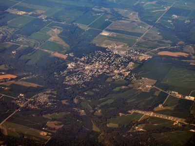
Liberty, town in Indiana, United States

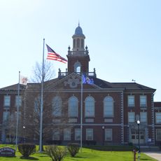
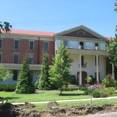
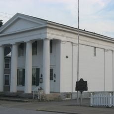
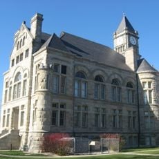
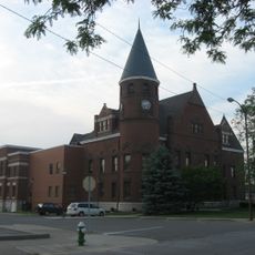
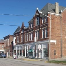
Liberty is a small town in Union County, in the eastern part of Indiana, close to the Ohio state line. Its center is built around the Courthouse Square, a public square surrounding the county courthouse, flanked by old brick buildings.

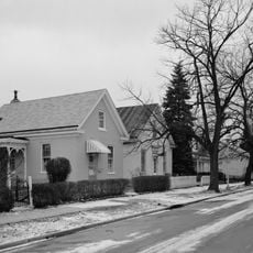
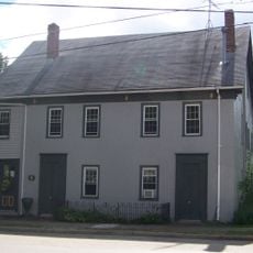
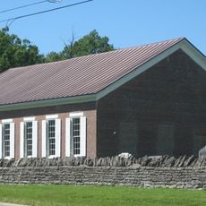
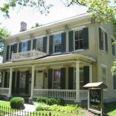
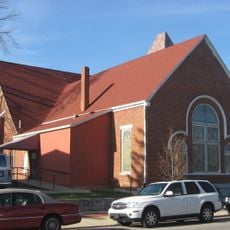
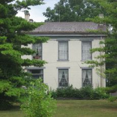
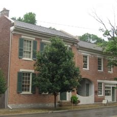
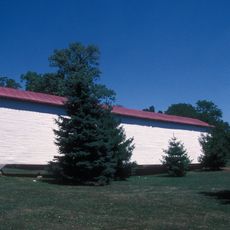
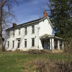
Liberty was established in the early 19th century, with its post office opening in 1824, marking one of the first signs of organized settlement in the area. Over the following decades, the town grew around its courthouse, and several of its buildings from that era are now listed on the National Register of Historic Places.

The Courthouse Square at the center of town is where public life still happens today, with locals gathering around the old county building. The brick storefronts and porches that line the square give visitors a clear sense of how small-town Indiana has looked for generations.

The town center is easy to walk around, and most points of interest are within a short distance of the Courthouse Square. If you need a wider range of shops or services, larger cities in the region are reachable by car in under an hour.

Liberty appeared as the setting of a fictional research project in an episode of the BBC series Sherlock, giving this small Indiana town an unexpected place in popular culture. Few visitors realize that the town name was chosen for a globally watched television production.

The community of curious travelers

AroundUs brings together thousands of curated places, local tips, and hidden gems, enriched daily by 60,000 contributors worldwide.

Start exploring
Location
Elevation above the sea
300 m
GPS coordinates
39.63580,-84.92890
Latest update
March 3, 2026 08:23
Around this place
Yager Stadium
United States of America

Yager Stadium

21.2 km
Hueston Woods State Park
United States of America

Hueston Woods State Park

17.1 km
Richmond High School
United States of America

Richmond High School

20.9 km
Whitewater Memorial State Park
United States of America

Whitewater Memorial State Park

4 km
Oxford Female Institute
United States of America

Oxford Female Institute

21 km
Elmhurst
United States of America

Elmhurst

18.6 km
Richmond Art Museum
United States of America

Richmond Art Museum

21 km
Thomas Ranck Round Barn
United States of America

Thomas Ranck Round Barn

13.2 km
Canal House
United States of America

Canal House

18.1 km
Old Richmond Historic District
United States of America

Old Richmond Historic District

21 km
Pugh's Mill Covered Bridge
United States of America

Pugh's Mill Covered Bridge

20.8 km
Forest Hills Country Club
United States of America

Forest Hills Country Club

19.4 km
Howe Tavern
United States of America

Howe Tavern

12.5 km
Hopewell Associate Reformed Presbyterian Church
United States of America

Hopewell Associate Reformed Presbyterian Church

14.9 km
Dr. William S. Alexander House
United States of America

Dr. William S. Alexander House

21 km
Bethel A.M.E. Church
United States of America

Bethel A.M.E. Church

21.4 km
Elias Kumler House
United States of America

Elias Kumler House

21.4 km
Union County Courthouse
United States of America

Union County Courthouse

190 m
Oliver P. Morton House
United States of America

Oliver P. Morton House

21.1 km
Fayette County Courthouse
United States of America

Fayette County Courthouse

18.2 km
Centerville Historic District
United States of America

Centerville Historic District

21.3 km
Earlham College Observatory
United States of America

Earlham College Observatory

21 km
Longwood Covered Bridge
United States of America

Longwood Covered Bridge

17.2 km
Liberty Courthouse Square Historic District
United States of America

Liberty Courthouse Square Historic District

98 m
Harshman Covered Bridge
United States of America

Harshman Covered Bridge

15.6 km
Austin-Magie Farm and Mill District
United States of America

Austin-Magie Farm and Mill District

20.9 km
Liberty Residential Historic District
United States of America

Liberty Residential Historic District

123 m
Oxford Lanes
United States of America

Oxford Lanes

21.3 km
Show the full map
Reviews
Share your experience

No review yet

Discussions
Start a discussion...

No discussion yet

« Liberty - town in Indiana, United States » is provided by Around Us (aroundus.com). Images and texts are derived from Wikimedia project under a Creative Commons license. You are allowed to copy, distribute, and modify copies of this page, under the conditions set by the license, as long as this note is clearly visible.

Discover hidden gems everywhere you go!

From secret cafés to breathtaking viewpoints, skip the crowded tourist spots and find places that match your style. Our app makes it easy with voice search, smart filtering, route optimization, and insider tips from travelers worldwide. Download now for the complete mobile experience.

Around Us App Screenshot

A unique approach to discovering new places

Le Figaro

All the places worth exploring

France Info

A tailor-made excursion in just a few clicks

20 Minutes

Around Us
Travel Guide & Maps
Download

Send to your phone

QR Code
1

Open the camera app on your mobile.

2

Point at the QR code with your camera. A notification will appear.

3

Tap the notification to open the link.