Union County

Log in to your account

AroundUs is a community-driven map of interesting places, built by curious explorers like you. It grows with every review, story, and photo you share.
Connect to save your favorite spots, contribute locations, and create personalized routes.
Continue with Google
Continue with Apple
Continue with X
Continue with Facebook
Continue with email
By continuing, you accept our Terms and Conditions and our Privacy Policy
Create an account
Add to collection
Map
Suggest a change
Share

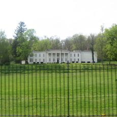
Union County, County administrative division in eastern Indiana, United States.

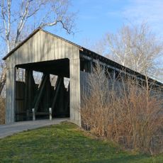
Union County is an administrative division in eastern Indiana with rolling hills and farmland throughout its territory. The East Fork Whitewater River flows through the region and shapes the local landscape.

Union County was established in 1821 by combining territories from Fayette, Franklin, and Wayne counties. The new administrative division emerged during a period of regional reorganization in Indiana.

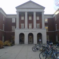
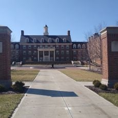
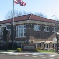
The Union County-College Corner Joint School District functions as an educational institution operating across state boundaries to serve local communities.

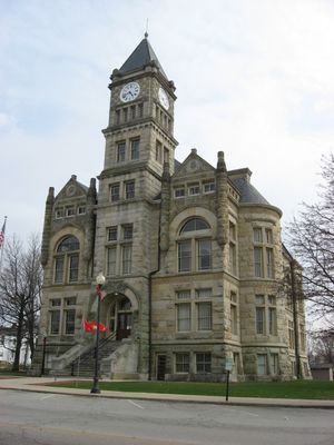
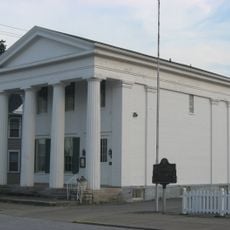
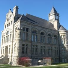
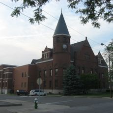
County government services are centered in Liberty, where you can find key offices including the Assessor, Auditor, and Clerk operations. Visitors seeking information about the region can start at these main administrative locations.

The area is home to the Union County-College Corner Joint School District, a partnership that crosses state borders. This school arrangement is the only one of its kind in Indiana and serves communities spanning multiple states.

Location: Indiana

Inception: January 5, 1821

Capital city: Liberty

Part of: Cincinnati metropolitan area

Shares border with: Wayne County, Preble County, Butler County, Franklin County, Fayette County

Website: http://unioncountyin.gov

GPS coordinates: 39.62000,-84.92000

Latest update: December 10, 2025 15:53

Photos
Around this place
Yager Stadium
United States of America

Yager Stadium

19.6 km
Hueston Woods State Park
United States of America

Hueston Woods State Park

15.7 km
Whitewater Memorial State Park
United States of America

Whitewater Memorial State Park

3.9 km
Oxford Female Institute
United States of America

Oxford Female Institute

19.3 km
Elmhurst
United States of America

Elmhurst

19.4 km
King Library
United States of America

King Library

19.9 km
Thomas Ranck Round Barn
United States of America

Thomas Ranck Round Barn

14.9 km
Lottie Moon House
United States of America

Lottie Moon House

19.8 km
Canal House
United States of America

Canal House

18.9 km
Pugh's Mill Covered Bridge
United States of America

Pugh's Mill Covered Bridge

19.2 km
Hall Auditorium
United States of America

Hall Auditorium

19.9 km
Withrow Hall
United States of America

Withrow Hall

19.9 km
Forest Hills Country Club
United States of America

Forest Hills Country Club

20.9 km
Howe Tavern
United States of America

Howe Tavern

10.8 km
Hopewell Associate Reformed Presbyterian Church
United States of America

Hopewell Associate Reformed Presbyterian Church

13.8 km
Henry Maltby House
United States of America

Henry Maltby House

19.7 km
Dr. William S. Alexander House
United States of America

Dr. William S. Alexander House

19.3 km
Elias Kumler House
United States of America

Elias Kumler House

19.7 km
Union County Courthouse
United States of America

Union County Courthouse

1.9 km
Fayette County Courthouse
United States of America

Fayette County Courthouse

19.1 km
Longwood Covered Bridge
United States of America

Longwood Covered Bridge

18.4 km
Liberty Courthouse Square Historic District
United States of America

Liberty Courthouse Square Historic District

1.9 km
Harshman Covered Bridge
United States of America

Harshman Covered Bridge

15.8 km
Austin-Magie Farm and Mill District
United States of America

Austin-Magie Farm and Mill District

19.2 km
Liberty Residential Historic District
United States of America

Liberty Residential Historic District

1.8 km
Oxford Lanes
United States of America

Oxford Lanes

19.5 km
Caroline Scott Harrison - Oxford Female Institute
United States of America

Caroline Scott Harrison - Oxford Female Institute

19.3 km
The Black (Pugh's Mill) Covered Bridge
United States of America

The Black (Pugh's Mill) Covered Bridge

19.2 km
Show the full map
Reviews

Visited this place? Tap the stars to rate it and share your experience / photos with the community! Try now! You can cancel it anytime.

Administrative divisions
« Union County - County administrative division in eastern Indiana, United States » is provided by Around Us (aroundus.com). Images and texts are derived from Wikimedia project under a Creative Commons license. You are allowed to copy, distribute, and modify copies of this page, under the conditions set by the license, as long as this note is clearly visible.

Discover hidden gems everywhere you go!

From secret cafés to breathtaking viewpoints, skip the crowded tourist spots and find places that match your style. Our app makes it easy with voice search, smart filtering, route optimization, and insider tips from travelers worldwide. Download now for the complete mobile experience.

Around Us App Screenshot

A unique approach to discovering new places

Le Figaro

All the places worth exploring

France Info

A tailor-made excursion in just a few clicks

20 Minutes