Baxter State Park

Log in to your account

AroundUs is a community-driven map of interesting places, built by curious explorers like you. It grows with every review, story, and photo you share.
Connect to save your favorite spots, contribute locations, and create personalized routes.
By continuing, you accept our Terms and Conditions and our Privacy Policy
Add to collection
Map
Suggest a change
Share

Baxter State Park, Natural wilderness in Piscataquis County, Maine, United States.
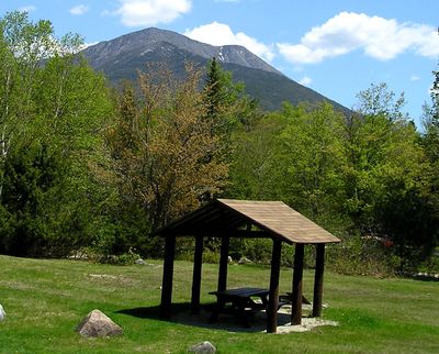
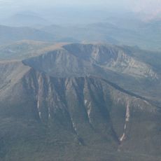
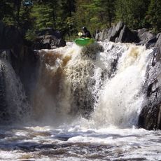
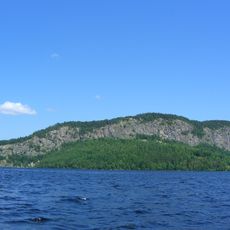
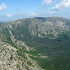
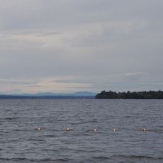
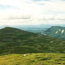
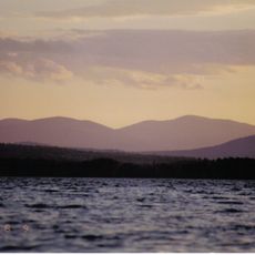
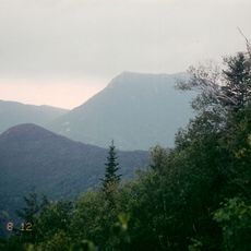
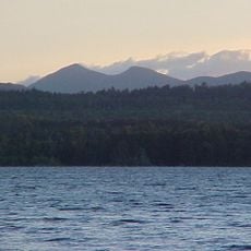
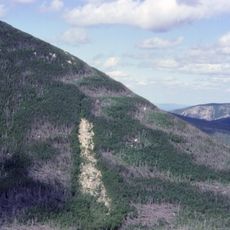
The 209,501-acre Baxter State Park contains Mount Katahdin, standing at 5,267 feet as the highest peak in Maine, with numerous lakes and waterfalls throughout.

Governor Percival P. Baxter established the park on March 3, 1931, and continued donating land parcels until 1962, creating a substantial protected wilderness area.

The park serves as the northern terminus of the Appalachian Trail, marking a significant endpoint for hikers completing the long-distance path through eastern United States.

Visitors need advance reservations for camping, and the park maintains strict regulations prohibiting audio devices and commercial facilities to preserve the natural environment.

The park operates independently from Maine's state park system, funded by an endowment, user fees, and revenue from its Scientific Forest Management Area.

Location: Maine

Inception: March 3, 1931

Shares border with: Katahdin Woods and Waters National Monument

Website: http://baxterstateparkauthority.com

GPS coordinates: 46.03330,-68.93330

Latest update: May 27, 2025 10:00

Nature sites and historic places in Maine

Maine features state parks, lighthouses and historic sites. The region includes waterfalls, lakes, islands and coastal areas. Visitors find old forts, hiking trails and nature preserves. The landscape ranges from mountain areas to sandy beaches. Parks like Baxter and Acadia allow exploration of wilderness.

Around this place
Show the full map
Katahdin
United States of America

Katahdin

14.4 km
Gulf Hagas
United States of America

Gulf Hagas

68.2 km
Mount Kineo
United States of America

Mount Kineo

72.3 km
Katahdin Iron Works
United States of America

Katahdin Iron Works

68.2 km
Eagle Lake Tramway
United States of America

Eagle Lake Tramway

46.8 km
Katahdin
United States of America

Katahdin

82.5 km
Hamlin Peak
United States of America

Hamlin Peak

12.2 km
Lily Bay State Park
United States of America

Lily Bay State Park

70.4 km
North Brother
United States of America

North Brother

9.4 km
White Cap Mountain
United States of America

White Cap Mountain

58.5 km
Doubletop Mountain
United States of America

Doubletop Mountain

14.7 km
William Sewall House
United States of America

William Sewall House

51.4 km
Blackhawk Putnam Tavern
United States of America

Blackhawk Putnam Tavern

84.8 km
Saddleback Mountain
United States of America

Saddleback Mountain

60.4 km
Mount Coe
United States of America

Mount Coe

12.6 km
Aroostook County Courthouse and Jail
United States of America

Aroostook County Courthouse and Jail

85.1 km
Island Falls Opera House
United States of America

Island Falls Opera House

51.3 km
Kineo Cottage Row Historic District
United States of America

Kineo Cottage Row Historic District

72.9 km
Ambajejus Boom House
United States of America

Ambajejus Boom House

33.6 km
William M. Shaw House
United States of America

William M. Shaw House

81.6 km
Unitarian Church of Houlton
United States of America

Unitarian Church of Houlton

85.2 km
Aroostook County Historical and Art Museum
United States of America

Aroostook County Historical and Art Museum

85.2 km
Market Square Historic District
United States of America

Market Square Historic District

85.1 km
First National Bank of Houlton
United States of America

First National Bank of Houlton

84.6 km
Walter P. Mansur House
United States of America

Walter P. Mansur House

85 km
Gordon Fox Ranch
United States of America

Gordon Fox Ranch

82.1 km
Milo Public Library
United States of America

Milo Public Library

85.9 km
Oakfield Grange, No. 414
United States of America

Oakfield Grange, No. 414

60.8 km
Show the full map

Reviews

Visited this place? Tap the stars to rate it and share your experience / photos with the community! Try now! You can cancel it anytime.

« Baxter State Park: Natural wilderness in Piscataquis County, Maine, United States » is provided by Around Us (aroundus.com). Images and texts are derived from Wikimedia project under a Creative Commons license. You are allowed to copy, distribute, and modify copies of this page, under the conditions set by the license, as long as this note is clearly visible.

Discover hidden gems everywhere you go!

From secret cafés to breathtaking viewpoints, skip the crowded tourist spots and find places that match your style. Our app makes it easy with voice search, smart filtering, route optimization, and insider tips from travelers worldwide. Download now for the complete mobile experience.

Around Us App Screenshot

A unique approach to discovering new places

Le Figaro

All the places worth exploring

France Info

A tailor-made excursion in just a few clicks

20 Minutes