Chest opened
+${chestReward.xp} XP
Explorer
NOUVEAU ×${chestReward.collectible.quantity}
tapez pour fermer
Chest locked

Open chests in the app

Around Us is built for your phone — chests unlock when you walk, explore and capture nearby places.

Enable Location

We need your location to show you interesting places around you

Discover nearby places

Find interesting locations and hidden gems around you

Precise directions

Get accurate directions and distances to places

Your location is never shared with other users. It's only used when you tap the location button.

Log in to your account

Start exploring — it's free

Trusted by 72,883 travelers worldwide

Continue with Google
Continue with Apple
or

We will send you a code to connect

By continuing, you accept our Terms and Conditions and our Privacy Policy

Check your inbox

We've sent a pincode in your inbox. Please enter the code below.

Cherry Plain State Park
Discussion Reviews Photo
3.7k Popularity

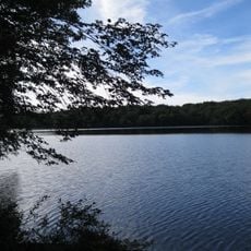
Cherry Plain State Park, State park in Rensselaer County, New York, US.

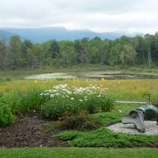
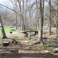
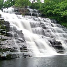
Cherry Plain State Park is a nature area with dense forests and multiple lakes in Rensselaer County. The grounds feature marked trails for walking, designated spots for fishing, and camping areas scattered throughout the property.

The land was acquired by New York State in the 1960s to create a public recreation area. It has since become an important outdoor destination for the surrounding communities.

The park serves as a gathering place for local anglers and families, particularly during warmer months. Visitors come to fish, explore the woods, and spend time together in the natural setting.

The park has separate activity zones with parking areas near each major section for easy access. Visitors should be prepared for changing weather since the wooded areas offer limited shelter from wind and rain.

Black bears roam the northern sections during late summer, feeding on wild berries along the hiking paths. These wildlife encounters remind visitors that the park remains a genuine forest habitat rather than a manicured recreation area.

The community of curious travelers

AroundUs brings together thousands of curated places, local tips, and hidden gems, enriched daily by 60,000 contributors worldwide.

Start exploring
Location
GPS coordinates
42.61900,-73.41200
Latest update
December 12, 2025 07:50
Around this place
Clark Art Institute
United States of America

Clark Art Institute

19 km
Northern boundary of Massachusetts
United States of America

Northern boundary of Massachusetts

18.5 km
Mount Greylock State Reservation
United States of America

Mount Greylock State Reservation

19.4 km
Grafton Lakes State Park
United States of America

Grafton Lakes State Park

17.3 km
Field Farm
United States of America

Field Farm

13.4 km
Pittsfield State Forest
United States of America

Pittsfield State Forest

17.6 km
United States of America

Shaker Museum and Library

18.2 km
United States of America

Mount Lebanon Shaker Village

17.9 km
Hopkins Observatory
United States of America

Hopkins Observatory

20.1 km
Little Red Schoolhouse
United States of America

Little Red Schoolhouse

19.8 km
Barberville Falls
United States of America

Barberville Falls

12.8 km
Craver Farmstead
United States of America

Craver Farmstead

19 km
Gov. Samuel J. Tilden Monument
United States of America

Gov. Samuel J. Tilden Monument

16.2 km
1753 House
United States of America

1753 House

19.6 km
Five Corners Historic District
United States of America

Five Corners Historic District

14.6 km
Dickinson Hill Fire Tower
United States of America

Dickinson Hill Fire Tower

19.5 km
Farnams Village Historic District
United States of America

Farnams Village Historic District

19.8 km
Garfield School
United States of America

Garfield School

19.6 km
Riders Mills Historic District
United States of America

Riders Mills Historic District

19.8 km
Boston Finishing Works
United States of America

Boston Finishing Works

19.9 km
Church Street Historic District
United States of America

Church Street Historic District

19.8 km
St. Luke's Episcopal Church
United States of America

St. Luke's Episcopal Church

15 km
Church of Our Saviour
United States of America

Church of Our Saviour

16.3 km
Pettibone Farm
United States of America

Pettibone Farm

19.8 km
Lebanon Springs Union Free School
United States of America

Lebanon Springs Union Free School

16.3 km
Hancock Town Hall
United States of America

Hancock Town Hall

11.5 km
Albert R. Fox House
United States of America

Albert R. Fox House

10.5 km
Williams College Museum of Art
United States of America

Williams College Museum of Art

20 km
Show the full map
Reviews
Share your experience

No review yet

Discussions
Start a discussion...

No discussion yet

« Cherry Plain State Park - State park in Rensselaer County, New York, US » is provided by Around Us (aroundus.com). Images and texts are derived from Wikimedia project under a Creative Commons license. You are allowed to copy, distribute, and modify copies of this page, under the conditions set by the license, as long as this note is clearly visible.

Discover hidden gems everywhere you go!

From secret cafés to breathtaking viewpoints, skip the crowded tourist spots and find places that match your style. Our app makes it easy with voice search, smart filtering, route optimization, and insider tips from travelers worldwide. Download now for the complete mobile experience.

Around Us App Screenshot

A unique approach to discovering new places

Le Figaro

All the places worth exploring

France Info

A tailor-made excursion in just a few clicks

20 Minutes

Around Us
Travel Guide & Maps
Download

Send to your phone

QR Code
1

Open the camera app on your mobile.

2

Point at the QR code with your camera. A notification will appear.

3

Tap the notification to open the link.