Enable Location

We need your location to show you interesting places around you

Discover nearby places

Find interesting locations and hidden gems around you

Precise directions

Get accurate directions and distances to places

Your location is never shared with other users. It's only used when you tap the location button.

Log in to your account

Start exploring — it's free

Trusted by 69,904 travelers worldwide

Continue with Google
Continue with Apple
or

We will send you a code to connect

By continuing, you accept our Terms and Conditions and our Privacy Policy

Check your inbox

We've sent a pincode in your inbox. Please enter the code below.

Fontaine Ferry Park
Discussion Reviews Photo
8k Popularity

Fontaine Ferry Park, Amusement park in Shawnee neighborhood, Louisville, United States.

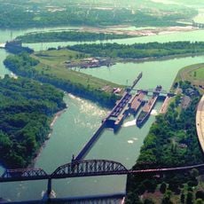
Fontaine Ferry Park was an amusement park on the south bank of the Ohio River in the Shawnee neighborhood of Louisville, Kentucky. The grounds included rides, a swimming pool, and a dance pavilion, all set along the riverfront.

Aaron Fontaine bought the land in 1814 and ran a ferry crossing there for decades. The site was turned into an amusement park in 1905 and stayed open until the late 1960s, when declining attendance and racial tensions led to its closure.

For most of its history, the park was segregated, barring Black visitors from entering. Protests held at the gates in the 1960s became a visible moment in Louisville's civil rights movement.

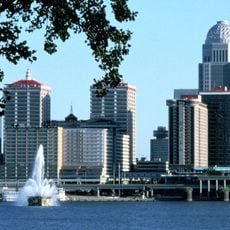
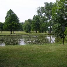
The site is no longer open as a park and the grounds are largely abandoned. It sits in the Shawnee neighborhood, reachable by car from downtown Louisville, but there is little to see on the spot today.

The park's carousel was relocated to Illinois after the closure and can still be ridden there today. It is one of the few physical traces of the site that survived and ended up in active use elsewhere.

The community of curious travelers

AroundUs brings together thousands of curated places, local tips, and hidden gems, enriched daily by 60,000 contributors worldwide.

Start exploring
GPS coordinates
38.26424,-85.82691
Latest update
March 3, 2026 08:20
Around this place
McAlpine Locks and Dam
United States of America

McAlpine Locks and Dam

3.4 km
Sherman Minton Bridge
United States of America

Sherman Minton Bridge

1.6 km
Kentucky & Indiana Terminal Bridge
United States of America

Kentucky & Indiana Terminal Bridge

3 km
Culbertson Mansion
United States of America

Culbertson Mansion

2.8 km
Louisville Falls Fountain
United States of America

Louisville Falls Fountain

3.9 km
Town Clock Church
United States of America

Town Clock Church

2.3 km
Squire Earick House
United States of America

Squire Earick House

2.5 km
United States Marine Hospital of Louisville
United States of America

United States Marine Hospital of Louisville

3.8 km
Scribner House
United States of America

Scribner House

2.2 km
Chickasaw Park
United States of America

Chickasaw Park

2.5 km
Portland Museum
United States of America

Portland Museum

3.6 km
Carnegie Center for Art & History
United States of America

Carnegie Center for Art & History

2.5 km
United States of America

Basil Doerhoefer House

1.6 km
New Albany Downtown Historic District
United States of America

New Albany Downtown Historic District

2.4 km
St. Anthony Roman Catholic Church, Rectory, Convent, and School
United States of America

St. Anthony Roman Catholic Church, Rectory, Convent, and School

3.4 km
Albert S. Brandeis Elementary School
United States of America

Albert S. Brandeis Elementary School

3.6 km
Division Street School
United States of America

Division Street School

3.7 km
Virginia Avenue Colored School
United States of America

Virginia Avenue Colored School

3.1 km
Parkland Evangelical Church
United States of America

Parkland Evangelical Church

3.8 km
Woodbine
United States of America

Woodbine

3.8 km
Montgomery Street School
United States of America

Montgomery Street School

3.4 km
Cedar Bough Place Historic District
United States of America

Cedar Bough Place Historic District

3.5 km
Church of Our Merciful Saviour
United States of America

Church of Our Merciful Saviour

3.4 km
Theodore Roosevelt Elementary School
United States of America

Theodore Roosevelt Elementary School

4.3 km
Shelby Place Historic District
United States of America

Shelby Place Historic District

3.8 km
East Spring Street Historic District
United States of America

East Spring Street Historic District

2.9 km
National Tobacco Works Branch Stemmery
United States of America

National Tobacco Works Branch Stemmery

4.3 km
William Young House
United States of America

William Young House

2 km
Show the full map
Reviews
Share your experience

No review yet

Discussions
Start a discussion...

No discussion yet

« Fontaine Ferry Park - Amusement park in Shawnee neighborhood, Louisville, United States » is provided by Around Us (aroundus.com). Images and texts are derived from Wikimedia project under a Creative Commons license. You are allowed to copy, distribute, and modify copies of this page, under the conditions set by the license, as long as this note is clearly visible.

Discover hidden gems everywhere you go!

From secret cafés to breathtaking viewpoints, skip the crowded tourist spots and find places that match your style. Our app makes it easy with voice search, smart filtering, route optimization, and insider tips from travelers worldwide. Download now for the complete mobile experience.

Around Us App Screenshot

A unique approach to discovering new places

Le Figaro

All the places worth exploring

France Info

A tailor-made excursion in just a few clicks

20 Minutes

Around Us
Travel Guide & Maps
Download

Send to your phone

QR Code
1

Open the camera app on your mobile.

2

Point at the QR code with your camera. A notification will appear.

3

Tap the notification to open the link.