Chest opened
+${chestReward.xp} XP
Explorer
NOUVEAU ×${chestReward.collectible.quantity}
tapez pour fermer
Chest locked

Open chests in the app

Around Us is built for your phone — chests unlock when you walk, explore and capture nearby places.

Enable Location

We need your location to show you interesting places around you

Discover nearby places

Find interesting locations and hidden gems around you

Precise directions

Get accurate directions and distances to places

Your location is never shared with other users. It's only used when you tap the location button.

Log in to your account

Start exploring — it's free

Trusted by 72,959 travelers worldwide

Continue with Google
Continue with Apple
or

We will send you a code to connect

By continuing, you accept our Terms and Conditions and our Privacy Policy

Check your inbox

We've sent a pincode in your inbox. Please enter the code below.

Discussion Reviews Photo
21.1k Popularity

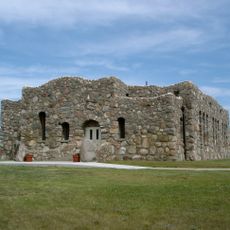
Fort Berthold Reservation, Indigenous reservation in western North Dakota, United States.

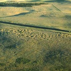
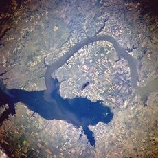
Fort Berthold Reservation is located across multiple counties in western North Dakota and is divided by the Missouri River and Lake Sakakawea. The landscape combines river valleys with open land that serves the communities living here.

The reservation began with an agreement made in 1851 that initially set aside much larger lands. The boundaries were later reduced, which shaped what you see today.

The Mandan, Hidatsa, and Arikara people live here and shape daily life through their traditions and community bonds. You can experience this in conversations with residents and in how people maintain their cultural practices.

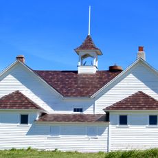
The administrative center is located near New Town and serves as an orientation point for visitors. The land is spread across a large area, so planning ahead helps when exploring.

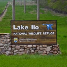
A wildlife refuge sits within the reservation boundaries and protects natural habitats and animal populations. This blend of conservation and community land use is something visitors often overlook.

The community of curious travelers

AroundUs brings together thousands of curated places, local tips, and hidden gems, enriched daily by 60,000 contributors worldwide.

Start exploring
Location
Inception
1870
Capital city
New Town
Operator
Mandan, Hidatsa, and Arikara Nation
GPS coordinates
47.74310,-102.27700
Latest update
December 23, 2025 21:04
Around this place
United States of America

Fort Berthold

43.2 km
Four Bears Bridge
United States of America

Four Bears Bridge

33.9 km
United States of America

Fort Stevenson

66.4 km
Lake Ilo National Wildlife Refuge
United States of America

Lake Ilo National Wildlife Refuge

54.8 km
United States of America

Verendrye National Monument

33.3 km
United States of America

Little Missouri State Park

39.8 km
United States of America

Hiddenwood National Wildlife Refuge

37.7 km
Crow Flies High State Recreation Area
United States of America

Crow Flies High State Recreation Area

33.4 km
Lynch Quarry Site
United States of America

Lynch Quarry Site

50.6 km
United States of America

Shell Lake National Wildlife Refuge

50.8 km
United States of America

Independence Congregational Church

9.2 km
United States of America

Beulah School

65 km
United States of America

Lost Bridge

39.8 km
United States of America

Fort Stevenson State Park Arboretum

66 km
Wabek Consolidated School
United States of America

Wabek Consolidated School

34.5 km
United States of America

Indian Hills State Recreation Area and Resort

20.7 km
Van Hook State Wildlife Management Area
United States of America

Van Hook State Wildlife Management Area

24.1 km
Paul Broste Rock Museum
United States of America

Paul Broste Rock Museum

26.6 km
United States of America

Clarks Creek Public Use Area

36 km
United States of America

McLean National Wildlife Refuge

25.1 km
United States of America

Le Paul Slough

53.9 km
United States of America

Lake Ilo

53.3 km
Beulah Water Park
United States of America

Beulah Water Park

63.6 km
United States of America

Hiddenwood Lake

37.4 km
United States of America

Antelope Creek State Wildlife Management Area

46.2 km
United States of America

Medicine Hole Golf Course

53.1 km
United States of America

Statue, Work of art

49.1 km
United States of America

Statue, Work of art

49.1 km
Show the full map
Reviews
Share your experience

No review yet

Discussions
Start a discussion...

No discussion yet

« Fort Berthold Reservation - Indigenous reservation in western North Dakota, United States » is provided by Around Us (aroundus.com). Images and texts are derived from Wikimedia project under a Creative Commons license. You are allowed to copy, distribute, and modify copies of this page, under the conditions set by the license, as long as this note is clearly visible.

Discover hidden gems everywhere you go!

From secret cafés to breathtaking viewpoints, skip the crowded tourist spots and find places that match your style. Our app makes it easy with voice search, smart filtering, route optimization, and insider tips from travelers worldwide. Download now for the complete mobile experience.

Around Us App Screenshot

A unique approach to discovering new places

Le Figaro

All the places worth exploring

France Info

A tailor-made excursion in just a few clicks

20 Minutes

Around Us
Travel Guide & Maps
Download

Send to your phone

QR Code
1

Open the camera app on your mobile.

2

Point at the QR code with your camera. A notification will appear.

3

Tap the notification to open the link.