Enable Location

We need your location to show you interesting places around you

Discover nearby places

Find interesting locations and hidden gems around you

Precise directions

Get accurate directions and distances to places

Your location is never shared with other users. It's only used when you tap the location button.

Frying Pan Meetinghouse

Log in to your account

Start exploring — it's free

Trusted by 62,396 travelers worldwide

Continue with Google
Continue with Apple
or

We will send you a code to connect

By continuing, you accept our Terms and Conditions and our Privacy Policy

Check your inbox

We've sent a pincode in your inbox. Please enter the code below.

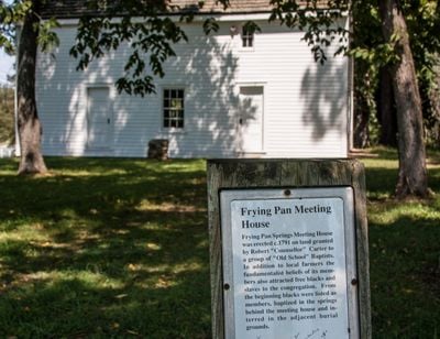
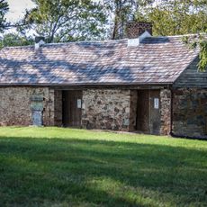
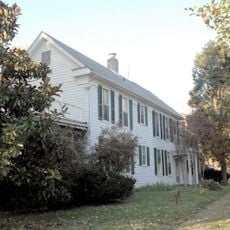
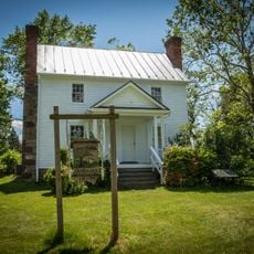
Frying Pan Meetinghouse, church building in Virginia, United States of America

Frying Pan Meetinghouse is a wooden church building constructed in 1791 located near Floris on Centreville Road in Virginia. The structure retains its original simple design with plain wooden walls and sits amid open fields beside a cemetery containing early gravestones.

The building was established in 1791 after Robert Carter III granted two acres of land with a natural spring to the Baptist congregation. During the Civil War the church suffered damage from passing troops on both sides but was repaired afterward and remains a witness to early struggles for religious freedom in Virginia.

The meetinghouse served as a gathering place for Baptists who sought religious freedom and built community through shared worship. Today the simple interior reflects how early believers organized their faith and came together for both spiritual practice and local life.

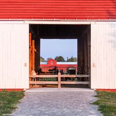
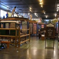
The site is easily accessible on foot and situated in a quiet rural area within Frying Pan Farm Park where visitors can explore the original building and adjacent cemetery. Wear comfortable shoes and allow time to walk around the grounds and examine the older graves at a leisurely pace.

In 1984 the last church trustee transferred the building to the local park authority to preserve it for future visitors. This handover rescued the structure from neglect and transformed it into a public space where people can walk through early community history and religious struggle.

The community of curious travelers

AroundUs brings together thousands of curated places, local tips, and hidden gems, enriched daily by 60,000 contributors worldwide.

Start exploring
Location
GPS coordinates
38.94000,-77.41330
Latest update
February 9, 2026 07:42
Around this place
Enola Gay
United States of America

Enola Gay

4.2 km
Steven F. Udvar-Hazy Center
United States of America

Steven F. Udvar-Hazy Center

4.2 km
CIA University
United States of America

CIA University

2.7 km
A. Smith Bowman Distillery
United States of America

A. Smith Bowman Distillery

5.7 km
Meadowlark Botanical Gardens
United States of America

Meadowlark Botanical Gardens

11.5 km
Ox Hill Battlefield Park
United States of America

Ox Hill Battlefield Park

9.2 km
Lake Fairfax Park
United States of America

Lake Fairfax Park

8.7 km
Ellanor C. Lawrence Park
United States of America

Ellanor C. Lawrence Park

9.1 km
Colvin Run Mill
United States of America

Colvin Run Mill

10.8 km
National Weather Service Baltimore/Washington
United States of America

National Weather Service Baltimore/Washington

7.5 km
Arcola Elementary School
United States of America

Arcola Elementary School

10.7 km
Dranesville Tavern
United States of America

Dranesville Tavern

8.8 km
Lake Anne Village Center Historic District
United States of America

Lake Anne Village Center Historic District

7 km
Broad Run Bridge and Tollhouse
United States of America

Broad Run Bridge and Tollhouse

12 km
Donald D. Engen Observation Tower
United States of America

Donald D. Engen Observation Tower

4.1 km
Arcola Slave Quarters
United States of America

Arcola Slave Quarters

10 km
Merrybrook
United States of America

Merrybrook

1.8 km
Herndon Historic District
United States of America

Herndon Historic District

4 km
Vestal's Gap Road and Lanesville Historic District
United States of America

Vestal's Gap Road and Lanesville Historic District

8.7 km
Bloomfield
United States of America

Bloomfield

9.1 km
Floris Historic District
United States of America

Floris Historic District

545 m
Loudoun Heritage Farm Museum
United States of America

Loudoun Heritage Farm Museum

8.6 km
Children's Science Center Lab
United States of America

Children's Science Center Lab

9.7 km
Ray Muth Sr. Memorial Park
United States of America

Ray Muth Sr. Memorial Park

11.3 km
Cascades Library
United States of America

Cascades Library

10.6 km
Centreville Regional Library
United States of America

Centreville Regional Library

11.7 km
Oakton Community Library
United States of America

Oakton Community Library

11.5 km
Reston Regional Library
United States of America

Reston Regional Library

5.5 km
Show the full map
« Frying Pan Meetinghouse - church building in Virginia, United States of America » is provided by Around Us (aroundus.com). Images and texts are derived from Wikimedia project under a Creative Commons license. You are allowed to copy, distribute, and modify copies of this page, under the conditions set by the license, as long as this note is clearly visible.

Discover hidden gems everywhere you go!

From secret cafés to breathtaking viewpoints, skip the crowded tourist spots and find places that match your style. Our app makes it easy with voice search, smart filtering, route optimization, and insider tips from travelers worldwide. Download now for the complete mobile experience.

Around Us App Screenshot

A unique approach to discovering new places

Le Figaro

All the places worth exploring

France Info

A tailor-made excursion in just a few clicks

20 Minutes

Around Us
Travel Guide & Maps
Download

Send to your phone

QR Code
1

Open the camera app on your mobile.

2

Point at the QR code with your camera. A notification will appear.

3

Tap the notification to open the link.