Enable Location

We need your location to show you interesting places around you

Discover nearby places

Find interesting locations and hidden gems around you

Precise directions

Get accurate directions and distances to places

Your location is never shared with other users. It's only used when you tap the location button.

Vestal's Gap Road and Lanesville Historic District

Log in to your account

Start exploring — it's free

Trusted by 61,566 travelers worldwide

Continue with Google
Continue with Apple
or

We will send you a code to connect

By continuing, you accept our Terms and Conditions and our Privacy Policy

Check your inbox

We've sent a pincode in your inbox. Please enter the code below.

Vestal's Gap Road and Lanesville Historic District

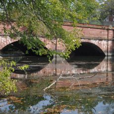
Vestal's Gap Road and Lanesville Historic District, Historic district in Sterling, Virginia, US.

Description

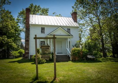
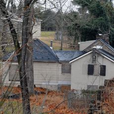
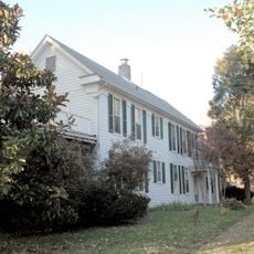
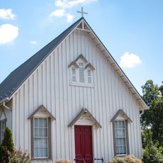
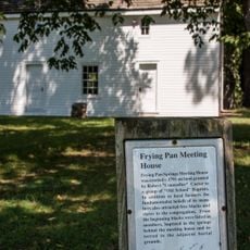
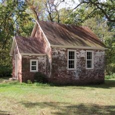
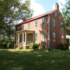
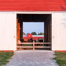
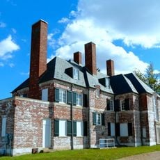
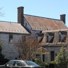
Vestal's Gap Road and Lanesville Historic District is a protected historic area in Virginia that preserves an old road and a two-story frame house built around 1807. The Lanesville house stands on a solid stone foundation within a park and is accompanied by informative signs that help visitors understand the historical features.

History

The area played an important role in 1814 when the road was used to transport documents while British forces approached Washington. This connection to a critical moment in early American history makes this site significant.

Culture

The Lanesville house displays construction methods typical of the Early Republic, with its stone foundation and wooden framing showing how craftspeople of that era built their homes. Visitors can observe the practical design choices that shaped daily life in early Virginia.

Practical

The site is located within a public park with marked pathways and signs that allow visitors to explore both historical elements on their own. The best time to visit is during good weather, when the outdoor areas and the building complex are fully accessible.

Did you know?

High-ranking visitors like President John Adams attempted to use the road in 1825 but found it in such poor condition that they had to choose a different route. This shows how important the road once was but also how quickly historical paths could fall into disrepair.

Location
GPS coordinates
39.01750,-77.40310
Latest update
December 14, 2025 18:03

AroundUs brings together thousands of curated places, local tips, and hidden gems, enriched daily by 60,000 contributors worldwide. Discover all places nearby (Virginia).

Around this place
Janelia Research Campus
United States of America

Janelia Research Campus

8 km
A. Smith Bowman Distillery
United States of America

A. Smith Bowman Distillery

8.1 km
Trump National Golf Club
United States of America

Trump National Golf Club

6.3 km
Seneca Quarry
United States of America

Seneca Quarry

7.9 km
Lake Fairfax Park
United States of America

Lake Fairfax Park

9.4 km
United States of America

Selden Island

7.7 km
Reston Station
United States of America

Reston Station

9.5 km
McKee-Beshers Wildlife Management Area
United States of America

McKee-Beshers Wildlife Management Area

6.7 km
National Weather Service Baltimore/Washington
United States of America

National Weather Service Baltimore/Washington

8.5 km
Seneca Aqueduct
United States of America

Seneca Aqueduct

7.8 km
Lock 23
United States of America

Lock 23

8.5 km
Dranesville Tavern
United States of America

Dranesville Tavern

3.8 km
Lake Anne Village Center Historic District
United States of America

Lake Anne Village Center Historic District

7.6 km
Broad Run Bridge and Tollhouse
United States of America

Broad Run Bridge and Tollhouse

4.2 km
Merrybrook
United States of America

Merrybrook

6.9 km
Herndon Historic District
United States of America

Herndon Historic District

5.7 km
Ashburn Presbyterian Church
United States of America

Ashburn Presbyterian Church

7.5 km
Frying Pan Meetinghouse
United States of America

Frying Pan Meetinghouse

8.7 km
Seneca Historic District
United States of America

Seneca Historic District

9.5 km
Bloomfield
United States of America

Bloomfield

3.9 km
Floris Historic District
United States of America

Floris Historic District

8.8 km
Loudoun Heritage Farm Museum
United States of America

Loudoun Heritage Farm Museum

116 m
Janelia
United States of America

Janelia

8 km
Ray Muth Sr. Memorial Park
United States of America

Ray Muth Sr. Memorial Park

5.3 km
Mount Nebo
United States of America

Mount Nebo

9.3 km
Cascades Library
United States of America

Cascades Library

2 km
Ashburn Library
United States of America

Ashburn Library

9.2 km
Reston Regional Library
United States of America

Reston Regional Library

7.4 km
Show the full map
« Vestal's Gap Road and Lanesville Historic District - Historic district in Sterling, Virginia, US » is provided by Around Us (aroundus.com). Images and texts are derived from Wikimedia project under a Creative Commons license. You are allowed to copy, distribute, and modify copies of this page, under the conditions set by the license, as long as this note is clearly visible.

Discover hidden gems everywhere you go!

From secret cafés to breathtaking viewpoints, skip the crowded tourist spots and find places that match your style. Our app makes it easy with voice search, smart filtering, route optimization, and insider tips from travelers worldwide. Download now for the complete mobile experience.

Around Us App Screenshot

A unique approach to discovering new places

Le Figaro

All the places worth exploring

France Info

A tailor-made excursion in just a few clicks

20 Minutes

Around Us
Travel Guide & Maps
Download

Send to your phone

QR Code
1

Open the camera app on your mobile.

2

Point at the QR code with your camera. A notification will appear.

3

Tap the notification to open the link.