Enable Location

We need your location to show you interesting places around you

Discover nearby places

Find interesting locations and hidden gems around you

Precise directions

Get accurate directions and distances to places

Your location is never shared with other users. It's only used when you tap the location button.

Hartshorne Woods Park

Log in to your account

Start exploring — it's free

Trusted by 63,118 travelers worldwide

Continue with Google
Continue with Apple
or

We will send you a code to connect

By continuing, you accept our Terms and Conditions and our Privacy Policy

Check your inbox

We've sent a pincode in your inbox. Please enter the code below.

Hartshorne Woods Park
Discussion Reviews 1 Photos
4.8k Popularity

Hartshorne Woods Park, County park in Monmouth County, United States.

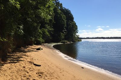
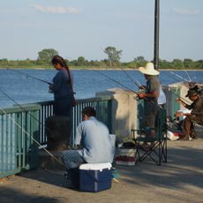
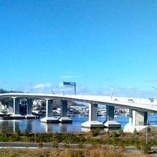
Hartshorne Woods Park is a county forest covering over 800 acres along the Atlantic Coast with views overlooking the Navesink River. The grounds feature marked trails suitable for hiking and biking, with multiple entry points distributed across the landscape.

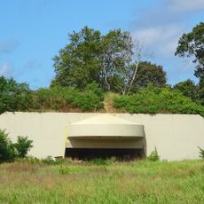
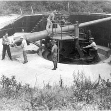
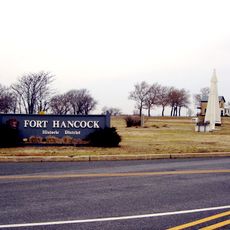
Military defense installations were built on these grounds during World War II to protect New York Harbor and surrounding coastal areas. These fortifications demonstrate the strategic importance this coastal region held for national defense.

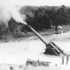
Battery Lewis displays a naval gun from the Battleship New Jersey, reflecting the region's role in coastal defense during wartime. Visitors can see the scale of this weapon and understand how this location served military protection.

The park is accessible through three main entry points and offers miles of marked routes for outdoor activities. Wearing appropriate footwear and bringing a map is recommended since the terrain includes elevated sections and can be uneven.

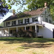
The land was originally acquired by Richard Hartshorne, an English Quaker who received a large grant in 1669 and kept portions in his family for nearly 3 centuries. This long family ownership before it became public land adds a human story to the forest today.

The community of curious travelers

AroundUs brings together thousands of curated places, local tips, and hidden gems, enriched daily by 60,000 contributors worldwide.

Start exploring
Location
Inception
1974
GPS coordinates
40.38970,-73.98630
Latest update
December 10, 2025 20:03
Around this place
Gunnison Beach
United States of America

Gunnison Beach

7.9 km
Fort Hancock
United States of America

Fort Hancock

8.4 km
Sandy Hook Light
United States of America

Sandy Hook Light

8.1 km
Navesink Twin Lights
United States of America

Navesink Twin Lights

737 m
Gateway National Recreation Area
United States of America

Gateway National Recreation Area

7.2 km
Two River Theater
United States of America

Two River Theater

8.7 km
Highlands Air Force Station
United States of America

Highlands Air Force Station

672 m
Long Branch Pier
United States of America

Long Branch Pier

9.7 km
Parker Homestead
United States of America

Parker Homestead

7.9 km
Battery Gunnison
United States of America

Battery Gunnison

7.9 km
Seabright Lawn Tennis and Cricket Club
United States of America

Seabright Lawn Tennis and Cricket Club

2.6 km
Water Witch Club Casino
United States of America

Water Witch Club Casino

1.3 km
Highlands Army Air Defense Site
United States of America

Highlands Army Air Defense Site

8.4 km
T. Thomas Fortune House
United States of America

T. Thomas Fortune House

9.2 km
Fisk Chapel
United States of America

Fisk Chapel

5.7 km
Conover Beacon
United States of America

Conover Beacon

6.8 km
Fort Hancock and the Sandy Hook Proving Ground Historic District
United States of America

Fort Hancock and the Sandy Hook Proving Ground Historic District

6.2 km
St. George's-by-the-River Episcopal Church
United States of America

St. George's-by-the-River Episcopal Church

3 km
Christ Church , Shrewsbury
United States of America

Christ Church , Shrewsbury

9.7 km
Water Witch Club Historic District
United States of America

Water Witch Club Historic District

1.5 km
Fort Hancock, U.S. Life Saving Station
United States of America

Fort Hancock, U.S. Life Saving Station

4.1 km
Battery Kingman
United States of America

Battery Kingman

5.4 km
First Presbyterian Church of Rumson
United States of America

First Presbyterian Church of Rumson

2.5 km
Highlands–Sea Bright Bridge
United States of America

Highlands–Sea Bright Bridge

933 m
North Long Branch School-Primary No. 3
United States of America

North Long Branch School-Primary No. 3

7.7 km
Count Basie Theatre
United States of America

Count Basie Theatre

8.4 km
Navesink south lighthouse
United States of America

Navesink south lighthouse

715 m
Navesink north lighthouse
United States of America

Navesink north lighthouse

715 m
Show the full map
Reviews
Share your experience

No review yet

Discussions
Start a discussion...

No discussion yet

« Hartshorne Woods Park - County park in Monmouth County, United States » is provided by Around Us (aroundus.com). Images and texts are derived from Wikimedia project under a Creative Commons license. You are allowed to copy, distribute, and modify copies of this page, under the conditions set by the license, as long as this note is clearly visible.

Discover hidden gems everywhere you go!

From secret cafés to breathtaking viewpoints, skip the crowded tourist spots and find places that match your style. Our app makes it easy with voice search, smart filtering, route optimization, and insider tips from travelers worldwide. Download now for the complete mobile experience.

Around Us App Screenshot

A unique approach to discovering new places

Le Figaro

All the places worth exploring

France Info

A tailor-made excursion in just a few clicks

20 Minutes

Around Us
Travel Guide & Maps
Download

Send to your phone

QR Code
1

Open the camera app on your mobile.

2

Point at the QR code with your camera. A notification will appear.

3

Tap the notification to open the link.