Enable Location

We need your location to show you interesting places around you

Discover nearby places

Find interesting locations and hidden gems around you

Precise directions

Get accurate directions and distances to places

Your location is never shared with other users. It's only used when you tap the location button.

Gateway National Recreation Area

Log in to your account

Start exploring — it's free

Trusted by 63,730 travelers worldwide

Continue with Google
Continue with Apple
or

We will send you a code to connect

By continuing, you accept our Terms and Conditions and our Privacy Policy

Check your inbox

We've sent a pincode in your inbox. Please enter the code below.

Discussion Reviews 1 Photos
6.5k Popularity

Gateway National Recreation Area, National Recreation Area in New York City and New Jersey, United States

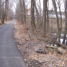
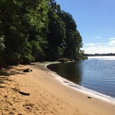
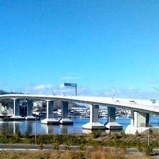
Gateway National Recreation Area is a large protected area with beaches, marshlands, and habitats along the New York coast and northern New Jersey. The land includes several distinct sections with forests, wetlands, and open shorelines that together create a varied landscape.

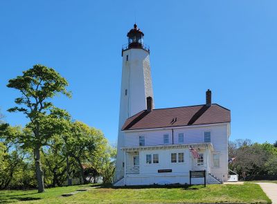
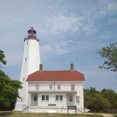
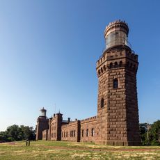
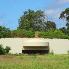
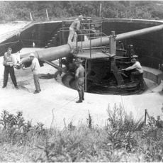
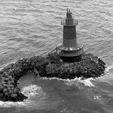
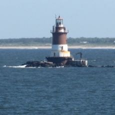
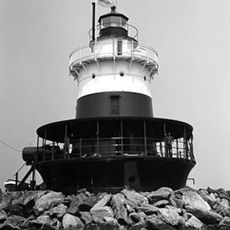
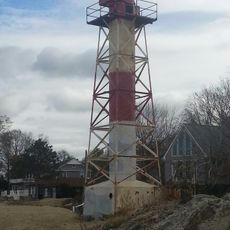
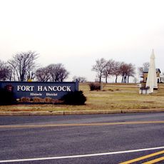
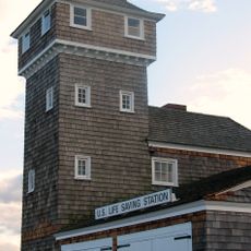
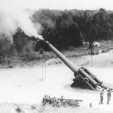
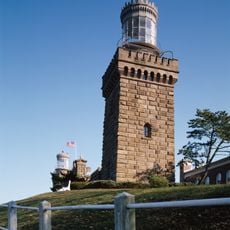
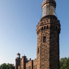
The area was established in 1972 as the first urban recreation area in the US National Park System. It preserves old military fortifications and holds one of the nation's oldest still-operating lighthouses.

Jamaica Bay is a protected habitat where birds breed and spend winter, with visitors able to watch this wildlife from dedicated observation points. The location has become a center for studying coastal ecosystems and attracts people who want to research nature or simply spot rare species.

The area is open year-round and provides multiple visitor centers, parking areas, and camping options. When visiting, keep in mind that different sections have varying conditions and some trails can be flooded during high tide or bad weather.

Floyd Bennett Field houses Hangar B, where volunteers work on restoring historic aircraft and display a collection of vintage planes to the public. This project preserves an often-overlooked piece of aviation history within an urban park.

The community of curious travelers

AroundUs brings together thousands of curated places, local tips, and hidden gems, enriched daily by 60,000 contributors worldwide.

Start exploring
Location
Location
Location
Location
Inception
October 27, 1972
Address
26 Hudson Rd, Highlands, NJ 07732, USA
Opening Hours
Dimanche: 06:00 - 21:00
GPS coordinates
40.45400,-73.99700
Latest update
February 8, 2026 09:32
Around this place
Gunnison Beach
United States of America

Gunnison Beach

680 m
Fort Hancock
United States of America

Fort Hancock

1.2 km
Sandy Hook Light
United States of America

Sandy Hook Light

951 m
Navesink Twin Lights
United States of America

Navesink Twin Lights

6.5 km
Henry Hudson Trail
United States of America

Henry Hudson Trail

9.8 km
Highlands Air Force Station
United States of America

Highlands Air Force Station

7 km
Hartshorne Woods Park
United States of America

Hartshorne Woods Park

7.2 km
Seabrook-Wilson House
United States of America

Seabrook-Wilson House

8.3 km
Battery Gunnison
United States of America

Battery Gunnison

680 m
West Bank Light
United States of America

West Bank Light

10.1 km
Romer Shoal Light
United States of America

Romer Shoal Light

6.7 km
Old Orchard Shoal Light
United States of America

Old Orchard Shoal Light

10.8 km
Seabright Lawn Tennis and Cricket Club
United States of America

Seabright Lawn Tennis and Cricket Club

9.8 km
Water Witch Club Casino
United States of America

Water Witch Club Casino

6 km
Highlands Army Air Defense Site
United States of America

Highlands Army Air Defense Site

10 km
Fisk Chapel
United States of America

Fisk Chapel

11 km
Conover Beacon
United States of America

Conover Beacon

6.2 km
Fort Hancock and the Sandy Hook Proving Ground Historic District
United States of America

Fort Hancock and the Sandy Hook Proving Ground Historic District

1 km
St. George's-by-the-River Episcopal Church
United States of America

St. George's-by-the-River Episcopal Church

10.2 km
Water Witch Club Historic District
United States of America

Water Witch Club Historic District

5.9 km
Fort Hancock, U.S. Life Saving Station
United States of America

Fort Hancock, U.S. Life Saving Station

3.2 km
Battery Kingman
United States of America

Battery Kingman

1.8 km
Uhlerstown Historic District
United States of America

Uhlerstown Historic District

10.5 km
First Presbyterian Church of Rumson
United States of America

First Presbyterian Church of Rumson

8.7 km
Highlands–Sea Bright Bridge
United States of America

Highlands–Sea Bright Bridge

6.6 km
Navesink south lighthouse
United States of America

Navesink south lighthouse

6.5 km
Navesink north lighthouse
United States of America

Navesink north lighthouse

6.5 km
Victory Park
United States of America

Victory Park

8.7 km
Show the full map
Reviews
Share your experience

No review yet

Discussions
Start a discussion...

No discussion yet

« Gateway National Recreation Area - National Recreation Area in New York City and New Jersey, United States » is provided by Around Us (aroundus.com). Images and texts are derived from Wikimedia project under a Creative Commons license. You are allowed to copy, distribute, and modify copies of this page, under the conditions set by the license, as long as this note is clearly visible.

Discover hidden gems everywhere you go!

From secret cafés to breathtaking viewpoints, skip the crowded tourist spots and find places that match your style. Our app makes it easy with voice search, smart filtering, route optimization, and insider tips from travelers worldwide. Download now for the complete mobile experience.

Around Us App Screenshot

A unique approach to discovering new places

Le Figaro

All the places worth exploring

France Info

A tailor-made excursion in just a few clicks

20 Minutes

Around Us
Travel Guide & Maps
Download

Send to your phone

QR Code
1

Open the camera app on your mobile.

2

Point at the QR code with your camera. A notification will appear.

3

Tap the notification to open the link.