Enable Location

We need your location to show you interesting places around you

Discover nearby places

Find interesting locations and hidden gems around you

Precise directions

Get accurate directions and distances to places

Your location is never shared with other users. It's only used when you tap the location button.

Fort Hancock

Log in to your account

Join the adventure

Create your free account and start exploring

Save your favorite places
Create custom travel routes
Rate and review places
Access the full interactive map
Continue with Google
Continue with Apple
Continue with email
By continuing, you accept our Terms and Conditions and our Privacy Policy
Create an account

Fort Hancock

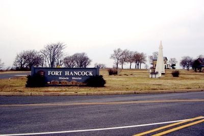
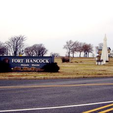
Fort Hancock, Military fort in Sandy Hook, United States

Description

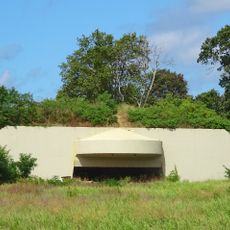
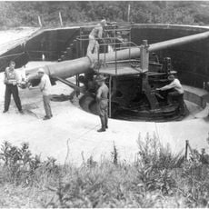
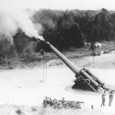
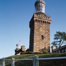
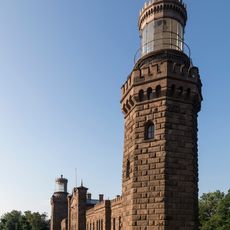
Fort Hancock is a former coastal defense installation at the northern tip of the Sandy Hook peninsula in New Jersey. The complex includes concrete gun batteries, underground passages, and brick buildings spread across an open stretch of land.

History

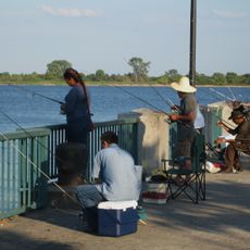
The base was established in 1895 to protect New York Harbor from potential attacks by sea. During World War II up to 7,000 soldiers were stationed here before the facility closed in 1974.

Culture

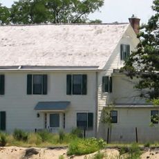
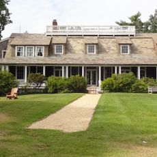
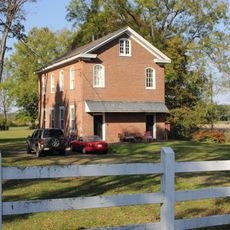
The name honors General Winfield Scott Hancock, a senior officer in the American Civil War. Today the empty barracks and officers' houses along the streets preserve the layout of a military settlement that you can walk through.

Practical

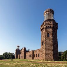
Rangers lead tours of Battery Potter and the Mortar Battery during summer, with daily visits available between 9 AM and 5 PM. Many buildings remain closed and you walk across open terrain, so sturdy shoes and weather protection are recommended.

Did you know?

The underground tunnel complex, originally built to store ammunition, later served as a classified command post for the defense of New York City. In the deepest chambers you can still see ventilation systems and control panels from the Cold War era.

i
i
Part of
Fort Hancock and the Sandy Hook Proving Ground Historic District
i
GPS coordinates
40.46390,-74.00280
i
Latest update
December 5, 2025 22:30

AroundUs brings together thousands of curated places, local tips, and hidden gems, enriched daily by 60,000 contributors worldwide. Discover all places nearby (Middletown Township).

Around this place
Sandy Hook Light
United States of America

Sandy Hook Light

259 m
Navesink Twin Lights
United States of America

Navesink Twin Lights

7.7 km
Henry Hudson Trail
United States of America

Henry Hudson Trail

9.7 km
Gateway National Recreation Area
United States of America

Gateway National Recreation Area

1.2 km
Highlands Air Force Station
United States of America

Highlands Air Force Station

8.1 km
Hartshorne Woods Park
United States of America

Hartshorne Woods Park

8.4 km
Seabrook-Wilson House
United States of America

Seabrook-Wilson House

8.1 km
Battery Gunnison
United States of America

Battery Gunnison

755 m
West Bank Light
United States of America

West Bank Light

8.9 km
Romer Shoal Light
United States of America

Romer Shoal Light

5.5 km
Old Orchard Shoal Light
United States of America

Old Orchard Shoal Light

9.7 km
Water Witch Club Casino
United States of America

Water Witch Club Casino

7.1 km
Conover Beacon
United States of America

Conover Beacon

6.5 km
Fort Hancock and the Sandy Hook Proving Ground Historic District
United States of America

Fort Hancock and the Sandy Hook Proving Ground Historic District

2.2 km
Water Witch Club Historic District
United States of America

Water Witch Club Historic District

7.1 km
Fort Hancock, U.S. Life Saving Station
United States of America

Fort Hancock, U.S. Life Saving Station

4.4 km
Battery Kingman
United States of America

Battery Kingman

3 km
Uhlerstown Historic District
United States of America

Uhlerstown Historic District

9.3 km
First Presbyterian Church of Rumson
United States of America

First Presbyterian Church of Rumson

9.8 km
Highlands–Sea Bright Bridge
United States of America

Highlands–Sea Bright Bridge

7.8 km
Beach C
United States of America

Beach C

5.6 km
North Beach
United States of America

North Beach

898 m
Beach E
United States of America

Beach E

4.3 km
Ideal Beach
United States of America

Ideal Beach

9.1 km
Navesink south lighthouse
United States of America

Navesink south lighthouse

7.7 km
Navesink north lighthouse
United States of America

Navesink north lighthouse

7.7 km
Victory Park
United States of America

Victory Park

9.8 km
FIshing Beach
United States of America

FIshing Beach

3.3 km
Show the full map
Reviews

Visited this place? Tap the stars to rate it and share your experience / photos with the community! Try now! You can cancel it anytime.

« Fort Hancock - Military fort in Sandy Hook, United States » is provided by Around Us (aroundus.com). Images and texts are derived from Wikimedia project under a Creative Commons license. You are allowed to copy, distribute, and modify copies of this page, under the conditions set by the license, as long as this note is clearly visible.

Discover hidden gems everywhere you go!

From secret cafés to breathtaking viewpoints, skip the crowded tourist spots and find places that match your style. Our app makes it easy with voice search, smart filtering, route optimization, and insider tips from travelers worldwide. Download now for the complete mobile experience.

Around Us App Screenshot

A unique approach to discovering new places

Le Figaro

All the places worth exploring

France Info

A tailor-made excursion in just a few clicks

20 Minutes