Sandy Hook Light

Log in to your account

AroundUs is a community-driven map of interesting places, built by curious explorers like you. It grows with every review, story, and photo you share.
Connect to save your favorite spots, contribute locations, and create personalized routes.
Continue with Google
Continue with Apple
Continue with X
Continue with Facebook
Continue with email
By continuing, you accept our Terms and Conditions and our Privacy Policy
Create an account
Add to collection
Map
Suggest a change
Share

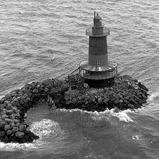
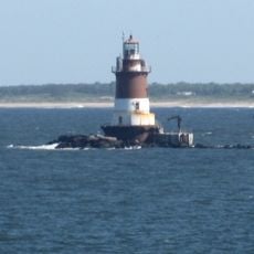
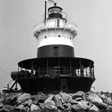
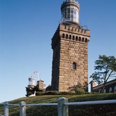
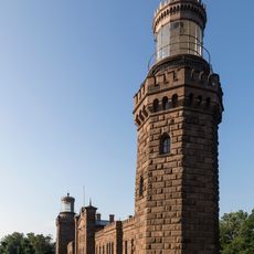
Sandy Hook Light, Lighthouse in Middletown Township, US

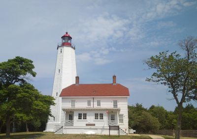
Sandy Hook Light is an octagonal limestone tower located on the New Jersey coast that rises 26 meters above the ground. Its white exterior and stone foundation create a simple but solid structure built to withstand harsh coastal weather over many decades.

The lighthouse was built in 1764 using an innovative lottery system to fund its construction, making it a crucial aid for maritime safety. This period marked a turning point in harbor navigation as shipping traffic to and from New York intensified during the colonial era.

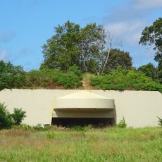
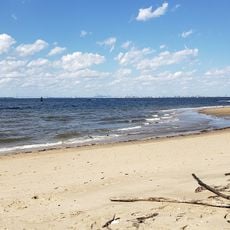
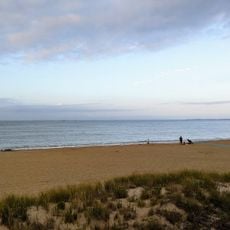
This lighthouse represents the maritime heritage of the New Jersey coast and how shipping shaped early settlement patterns in the region. Walking around it today, you can sense how central this tower was to the daily operations of the harbor and the survival of coastal communities.

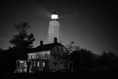
You can climb the interior stairs to reach the observation deck and enjoy views of the harbor and surrounding coastline. Guided tours led by National Park Service rangers are available regularly and provide detailed information about the structure and its role in local history.

This is the oldest continuously operating lighthouse in the United States, still functioning for over 250 years without losing its purpose. The fact that it continues to guide ships today demonstrates how well the original 18th-century builders understood what they were constructing.

Location: Middletown Township

Inception: June 11, 1764

Architects: Isaac Conro

Height: 26 m

GPS coordinates: 40.46167,-74.00194

Latest update: December 8, 2025 13:42

Photos
Around this place
Fort Hancock
United States of America

Fort Hancock

259 m
Navesink Twin Lights
United States of America

Navesink Twin Lights

7.4 km
Henry Hudson Trail
United States of America

Henry Hudson Trail

9.7 km
Gateway National Recreation Area
United States of America

Gateway National Recreation Area

951 m
Highlands Air Force Station
United States of America

Highlands Air Force Station

7.9 km
Hartshorne Woods Park
United States of America

Hartshorne Woods Park

8.1 km
Seabrook-Wilson House
United States of America

Seabrook-Wilson House

8.1 km
Battery Gunnison
United States of America

Battery Gunnison

576 m
West Bank Light
United States of America

West Bank Light

9.2 km
Romer Shoal Light
United States of America

Romer Shoal Light

5.8 km
Old Orchard Shoal Light
United States of America

Old Orchard Shoal Light

9.9 km
Water Witch Club Casino
United States of America

Water Witch Club Casino

6.9 km
Conover Beacon
United States of America

Conover Beacon

6.4 km
Fort Hancock and the Sandy Hook Proving Ground Historic District
United States of America

Fort Hancock and the Sandy Hook Proving Ground Historic District

2 km
Water Witch Club Historic District
United States of America

Water Witch Club Historic District

6.8 km
Fort Hancock, U.S. Life Saving Station
United States of America

Fort Hancock, U.S. Life Saving Station

4.2 km
Battery Kingman
United States of America

Battery Kingman

2.8 km
Uhlerstown Historic District
United States of America

Uhlerstown Historic District

9.6 km
First Presbyterian Church of Rumson
United States of America

First Presbyterian Church of Rumson

9.5 km
Highlands–Sea Bright Bridge
United States of America

Highlands–Sea Bright Bridge

7.5 km
Beach C
United States of America

Beach C

5.4 km
North Beach
United States of America

North Beach

1.1 km
Beach E
United States of America

Beach E

4 km
Ideal Beach
United States of America

Ideal Beach

9.1 km
Navesink south lighthouse
United States of America

Navesink south lighthouse

7.4 km
Navesink north lighthouse
United States of America

Navesink north lighthouse

7.4 km
Victory Park
United States of America

Victory Park

9.5 km
FIshing Beach
United States of America

FIshing Beach

3 km
Show the full map
Reviews

Visited this place? Tap the stars to rate it and share your experience / photos with the community! Try now! You can cancel it anytime.

« Sandy Hook Light - Lighthouse in Middletown Township, US » is provided by Around Us (aroundus.com). Images and texts are derived from Wikimedia project under a Creative Commons license. You are allowed to copy, distribute, and modify copies of this page, under the conditions set by the license, as long as this note is clearly visible.

Discover hidden gems everywhere you go!

From secret cafés to breathtaking viewpoints, skip the crowded tourist spots and find places that match your style. Our app makes it easy with voice search, smart filtering, route optimization, and insider tips from travelers worldwide. Download now for the complete mobile experience.

Around Us App Screenshot

A unique approach to discovering new places

Le Figaro

All the places worth exploring

France Info

A tailor-made excursion in just a few clicks

20 Minutes