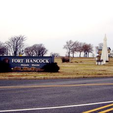
Highlands Air Force Station, Military base and historic district in Middletown Township, United States
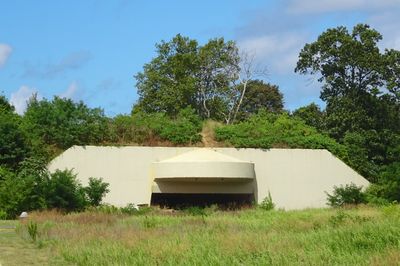
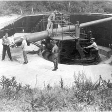
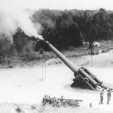
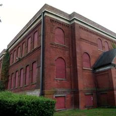
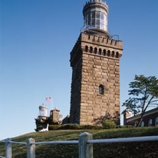
Highlands Air Force Station is a former military installation on a coastal ridge in Middletown Township, New Jersey, built to monitor the airspace along the eastern seaboard. The site included radar equipment, observation posts, and fortified battery positions, many of which are still visible on the grounds.
The station was established by the US Air Force in 1948 as part of a defense network along the eastern coast. It operated for nearly two decades before being decommissioned in 1966, after which the land was gradually opened to the public.
The name refers to the elevated coastal terrain that sets this area apart from the flat land nearby. Visitors walking through the park today still come across concrete bunkers and reinforced structures that show how the site was once used.
The grounds are accessible today through Hartshorne Woods Park, a public recreation area managed by the county. Footpaths connect the different sections of the former base, so the site is easy to explore on foot at your own pace.
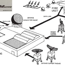
In 1958 the station received one of the first long-range radar systems of its kind in the country, the General Electric AN/FPS-7. This system was powerful enough to detect objects far out over the Atlantic Ocean.
The community of curious travelers
AroundUs brings together thousands of curated places, local tips, and hidden gems, enriched daily by 60,000 contributors worldwide.