Chest opened
+${chestReward.xp} XP
Explorer
NOUVEAU ×${chestReward.collectible.quantity}
tapez pour fermer
Chest locked

Open chests in the app

Around Us is built for your phone — chests unlock when you walk, explore and capture nearby places.

Enable Location

We need your location to show you interesting places around you

Discover nearby places

Find interesting locations and hidden gems around you

Precise directions

Get accurate directions and distances to places

Your location is never shared with other users. It's only used when you tap the location button.

Log in to your account

Start exploring — it's free

Trusted by 72,887 travelers worldwide

Continue with Google
Continue with Apple
or

We will send you a code to connect

By continuing, you accept our Terms and Conditions and our Privacy Policy

Check your inbox

We've sent a pincode in your inbox. Please enter the code below.

Hendrick Island
Discussion Reviews Photo
1.7k Popularity

Hendrick Island, River island in Solebury Township, Pennsylvania, US.

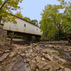
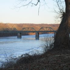
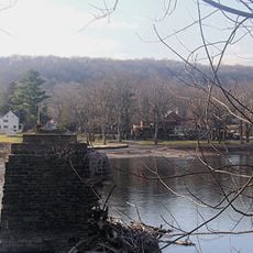
Hendrick Island is a large river island within the Delaware River, covered in deciduous forest with rocky shorelines along its eastern and northern edges. The landscape includes wetland areas near the water and elevated woodland in its interior.

The Lenape people lived in this area for centuries, leaving behind archaeological traces of their presence. Today the island remains protected as part of a natural reserve system that honors its past.

Heritage Conservancy maintains this protected natural area within Delaware Canal State Park, offering educational kayak trips for environmental exploration.

Access to the island is by boat only, with launching areas available at nearby riverfront locations. Weather and water conditions on the river can change quickly, so visitors should plan accordingly.

The center of the island rises noticeably above river level, creating two contrasting natural zones with different habitats. This elevation change supports a mix of wetland and forest wildlife throughout the landscape.

The community of curious travelers

AroundUs brings together thousands of curated places, local tips, and hidden gems, enriched daily by 60,000 contributors worldwide.

Start exploring
Location
GPS coordinates
40.40750,-74.99444
Latest update
December 21, 2025 16:05
Around this place
Bucks County Playhouse
United States of America

Bucks County Playhouse

6.3 km
New Hope – Lambertville Bridge
United States of America

New Hope – Lambertville Bridge

6.1 km
Lumberville – Raven Rock Bridge
United States of America

Lumberville – Raven Rock Bridge

3.6 km
Bulls Island Recreation Area
United States of America

Bulls Island Recreation Area

3.4 km
Green Sergeant's Covered Bridge
United States of America

Green Sergeant's Covered Bridge

4.7 km
Centre Bridge–Stockton Bridge
United States of America

Centre Bridge–Stockton Bridge

1.4 km
Cintra
United States of America

Cintra

5.7 km
Lambertville House
United States of America

Lambertville House

6.2 km
Point Pleasant-Byram Bridge
United States of America

Point Pleasant-Byram Bridge

5.9 km
James W. Marshall House
United States of America

James W. Marshall House

6.3 km
Bridge in Tinicum Township
United States of America

Bridge in Tinicum Township

6.3 km
Lambertville Historic District
United States of America

Lambertville Historic District

6.4 km
Covered Bridge Historic District
United States of America

Covered Bridge Historic District

5 km
Carversville Historic District
United States of America

Carversville Historic District

6 km
Phillips Mill Historic District
United States of America

Phillips Mill Historic District

3.5 km
Cuttalossa Valley Historic District
United States of America

Cuttalossa Valley Historic District

2.9 km
Center Bridge Historic District
United States of America

Center Bridge Historic District

1.4 km
Joshua Ely House
United States of America

Joshua Ely House

6.4 km
Bridge in Solebury Township
United States of America

Bridge in Solebury Township

6.4 km
Springdale Historic District
United States of America

Springdale Historic District

5.7 km
Rhoads Homestead
United States of America

Rhoads Homestead

5.6 km
Raven Rock Historic District
United States of America

Raven Rock Historic District

3.4 km
Point Pleasant Historic District
United States of America

Point Pleasant Historic District

6.3 km
Lumberville Historic District
United States of America

Lumberville Historic District

3.6 km
District No. 98 Schoolhouse
United States of America

District No. 98 Schoolhouse

1.6 km
Upper Aquetong Valley Historic District
United States of America

Upper Aquetong Valley Historic District

5.1 km
New Hope – Lambertville Toll Bridge
United States of America

New Hope – Lambertville Toll Bridge

4.6 km
Isaiah Paxson Farm
United States of America

Isaiah Paxson Farm

586 m
Show the full map
Reviews
Share your experience

No review yet

Discussions
Start a discussion...

No discussion yet

« Hendrick Island - River island in Solebury Township, Pennsylvania, US » is provided by Around Us (aroundus.com). Images and texts are derived from Wikimedia project under a Creative Commons license. You are allowed to copy, distribute, and modify copies of this page, under the conditions set by the license, as long as this note is clearly visible.

Discover hidden gems everywhere you go!

From secret cafés to breathtaking viewpoints, skip the crowded tourist spots and find places that match your style. Our app makes it easy with voice search, smart filtering, route optimization, and insider tips from travelers worldwide. Download now for the complete mobile experience.

Around Us App Screenshot

A unique approach to discovering new places

Le Figaro

All the places worth exploring

France Info

A tailor-made excursion in just a few clicks

20 Minutes

Around Us
Travel Guide & Maps
Download

Send to your phone

QR Code
1

Open the camera app on your mobile.

2

Point at the QR code with your camera. A notification will appear.

3

Tap the notification to open the link.